| Area |
South Fork |
| Topic |
Tour: Aerial and Ground Photos of Timber Harvest Lower Gualala SF |
 Click on image to enlarge (155K).
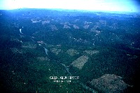
This photo is looking north along the lower South Fork Gualala River below the Wheatfield Fork with many recent clear cuts depicted. The river is following the San Andreas Fault, which continues north along the Little North Fork Gualala in the distance at left. Lower Buckeye and Rockpile Creek watersheds can be seen as these tribs join the SF Gualala from the east (right). Photos courtesy of Russian River Residents Against Unsafe Logging.
 Click on image to enlarge (154K).
This photo is looking south along the lower South Fork Gualala River below the Wheatfield Fork with clear cuts at right in the riparian zone. Although the riparian leave strip may act as a filter for sediment from upslope, the reduction of coniferous overstory has the potential to increase ambient air temperatures at this site. Warmer air temperatures over a stream promote stream warming. The river is following the San Andreas Fault. Photos courtesy of Russian River Residents Against Unsafe Logging.
 Click on image to enlarge (91K).
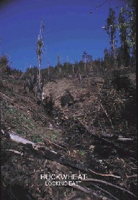
This is a ground photo of a timber harvest after site preparation on one of the units in the "Buckwheat" timber harvest along the lower South Fork Gualala. The intensity of the burn during site prep appears to have removed vegetation from the Class III watercourse which runs toward you in the center of the picture. Photos courtesy of Russian River Residents Against Unsafe Logging.
 Click on image to enlarge (128K).
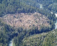
The photo above shows a clear cut along the South Fork Gualala with a minimal riparian buffer. Photo provided courtesy of the Russian River Residents Against Unsafe Logging.

 Click on image to enlarge (155K).
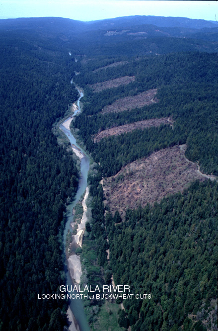 Click on image to enlarge (154K).
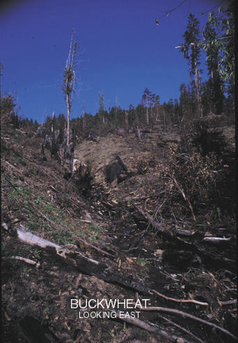 Click on image to enlarge (91K).
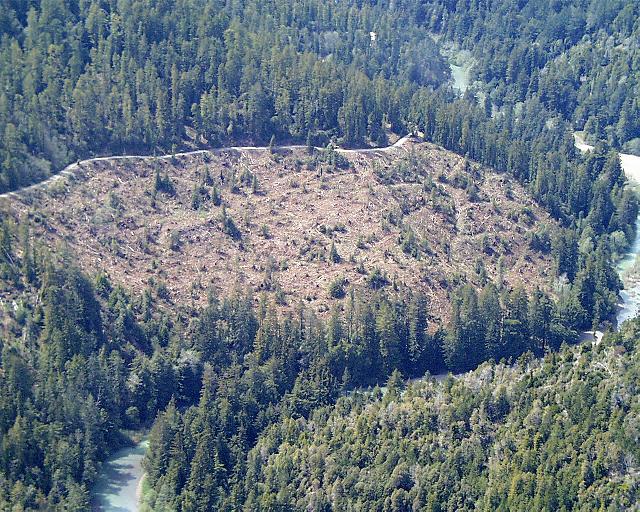 Click on image to enlarge (128K).