| Area |
Wheatfield |
| Topic |
Tour: CDFG Tombs Creek #1 CDFG Photos 2001 |
 Click on image to enlarge (74K). Click here to display a larger version (478K).
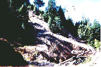
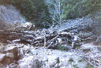
Landslide along Tombs Creek in reach of stream which had no surface flow when surveyed in September 2001. Photo provided courtesy of the California Department of Fish and Game North Coast Watershed Assessment Program.
TMB_HU.0196
Erosion and log jam in Dry area
Photo # 20
HU #0196
09.27.01
Dry [7.0]
Stabilize old skid road
LDA 12ft tall; 45ft long; 10ft wide
 Click on image to enlarge (73K). Click here to display a larger version (448K).
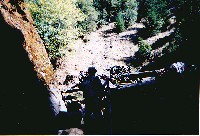
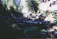
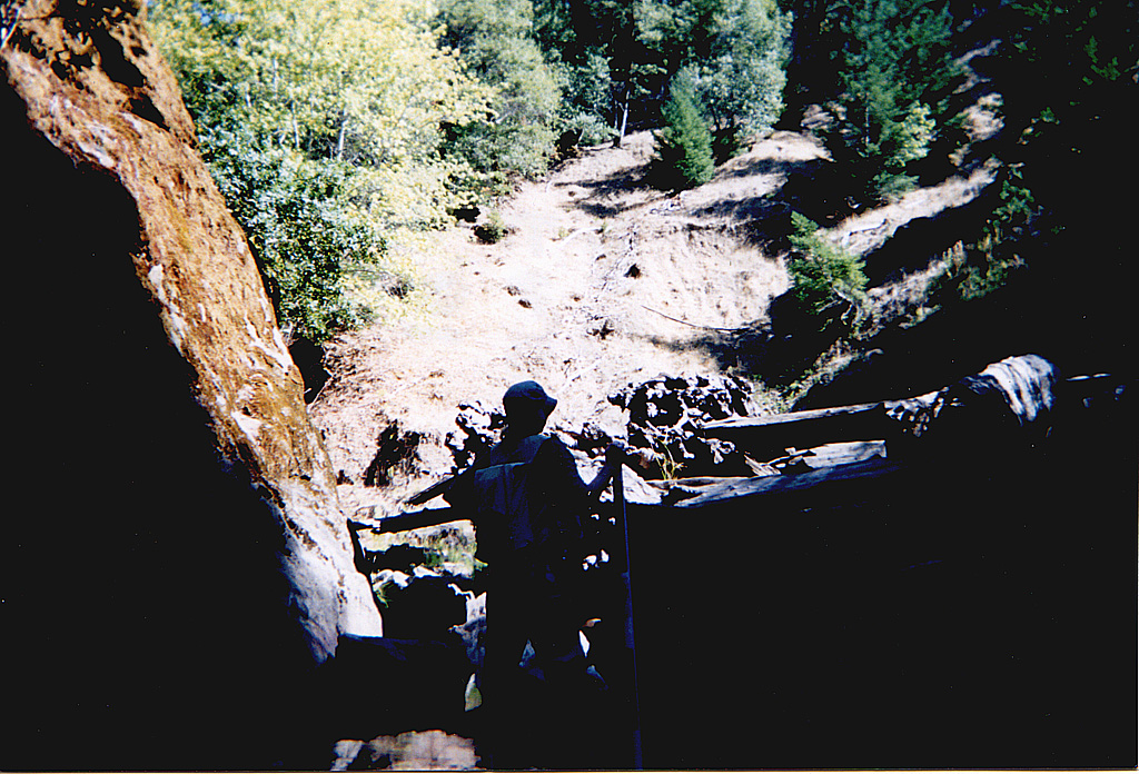
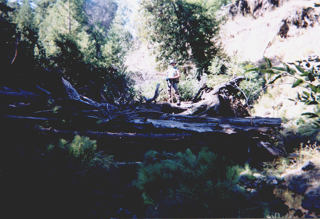
California Department of Fish and Game surveyor climbs through log jam and observes landslide adjacent to Tombs Creek during surveys in September 2001. Photo provided courtesy of the California Department of Fish and Game North Coast Watershed Assessment Program.
TMB_HU.0199 Log jam/erosion with Kathy
Photo #25
HU #0199
09.27.01
70oF H2O
step run [3.4]
Erosion from landslide
 Click on image to enlarge (60K). Click here to display a larger version (414K).
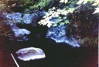
Mid-channel pool on Haupt Creek photographed during survey in September 2001. Bedrock likely made the pool tail crest unusable for salmonids resulting in an embeddedness rating of 5 or unusable. Photo provided courtesy of the California Department of Fish and Game North Coast Watershed Assessment Program.
TMB_HU.0231 4.2 pool
Photo #24
HU #0231
09.28.01
58oF H2O
Mid-channel pool [4,2]
Embeddedness=5
Substrate=F
Shelter value=2
SH YOY; 1+; 2+ present
 Click on image to enlarge (73K). Click here to display a larger version (482K).
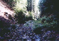
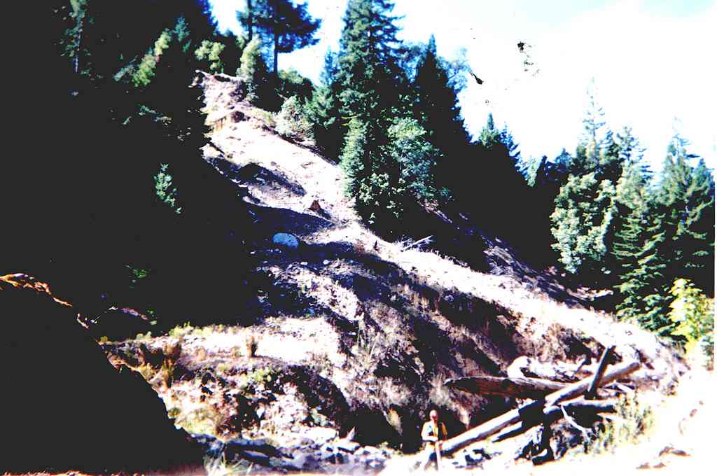
Step run in Tombs Creek with cobble substrate during low flow conditions in September 2001. Note old streamside landslide. Photo provided courtesy of the California Department of Fish and Game North Coast Watershed Assessment Program.
TMB_HU.0238 Example of B4 (i34?)
Photo #23
HU #0238, 09.28.01
58oF H2O, step run [3.4]
SH1+ present in pools above and below, YOY & 2+ present in pool below
 Click on image to enlarge (91K). Click here to display a larger version (676K).
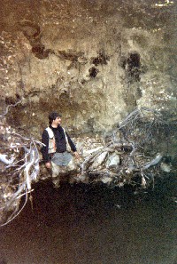
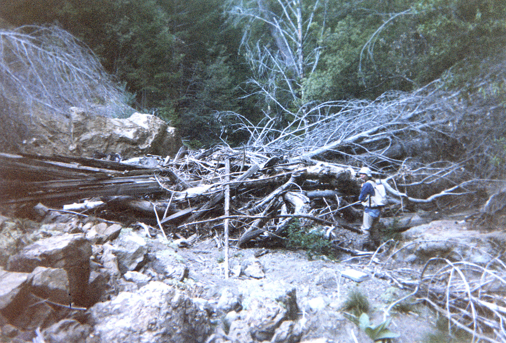
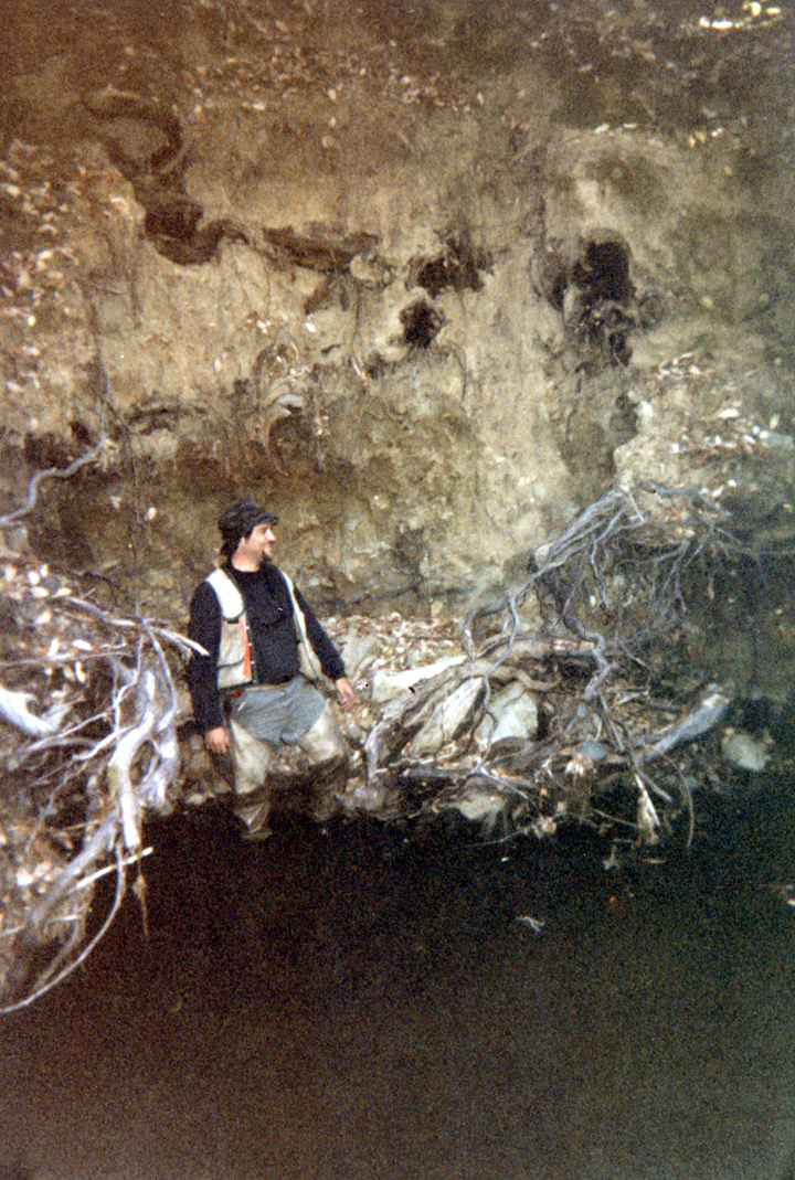
Landslide adjacent to dry reach of Tombs Creek with California Department of Fish and Game surveyor pictured at right in photo taken on 10/2/2001. Photo provided courtesy of the California Department of Fish and Game North Coast Watershed Assessment Program.
TMB_HU.0287 Erosion, Dry landslide/ Kathy
Photo #
HU #0287
10.02.01
Dry [7.0]
60oF H2O
5 ft. tall, 18 ft. long
LDA
 Click on image to enlarge (105K). Click here to display a larger version (663K).
Mid-channel pool on Tombs Creek with extensive cover provided by large woody debris. Picture taken on 10/2/2001. Photo courtesy of the California Department of Fish and Game North Coast Watershed Assessment Program. CDFG notes:
TMB_HU.317A 4.2 pool with two log jams in background
Photo #
HU #317A
10.02.01
63oF H2O
Mid channel pool [4.2]
SH-YOY, 1+, 2+ 3+ present
LDA crosses stream
16ft. tall; 50ft. wide; 40ft. long
Embeddedness=2
Substrate=F
Shelter value=3
 Click on image to enlarge (64K). Click here to display a larger version (413K).
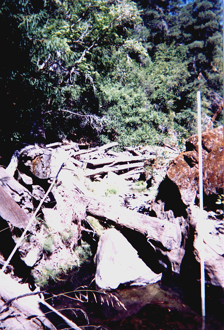
Log jam spanning Tombs Creek and providing good cover. CDFG surveyor pictured on jam in photo taken 10/2/2001. Photo courtesy of the California Department of Fish and Game North Coast Watershed Assessment Program.
TMB_HU.0317B Allen and log jam
Photo #14
HU #0317B
10.02.01
63oF H2O
SH YOY, 1+, 2+ 3+ present
SDA crosses stream
16ft tall; 50ft side; 40 ft. long
 Click on image to enlarge (77K). Click here to display a larger version (534K).
CDFG surveyor shown at the base of an eroding bank along Tombs Creek during October 2, 2001 survey. Photo courtesy of the California Department of Fish and Game North Coast Watershed Assessment Program.
TMB_HU0350
Erosion and Allen, Tombs Creek 4.2
Photo #13
HU #0350
10.03.01
58oF H2O mid channel pool
SH YOY, 1+, 2+ present
Erosion left bank
14ft tall; 15ft wide; 10ft deep
Embeddedness=1
Substrate=C
Shelter value=3

 Click on image to enlarge (74K). Click here to display a larger version (478K).
 Click on image to enlarge (73K). Click here to display a larger version (448K).
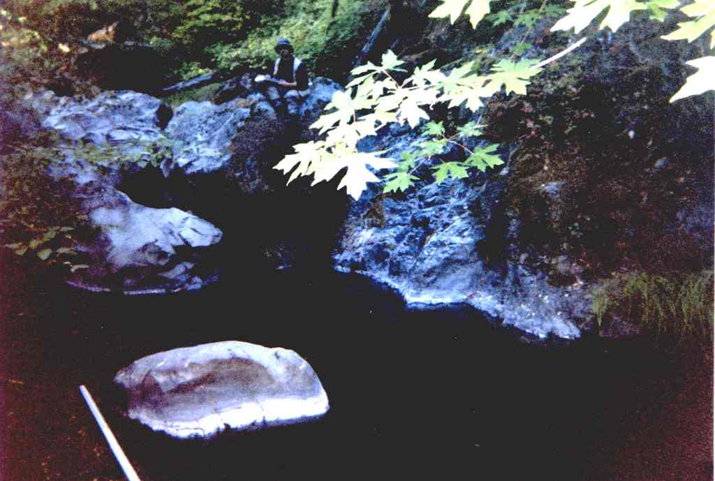 Click on image to enlarge (60K). Click here to display a larger version (414K).
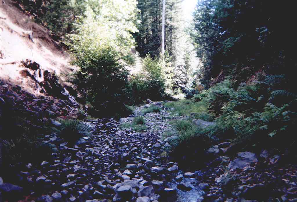 Click on image to enlarge (73K). Click here to display a larger version (482K).
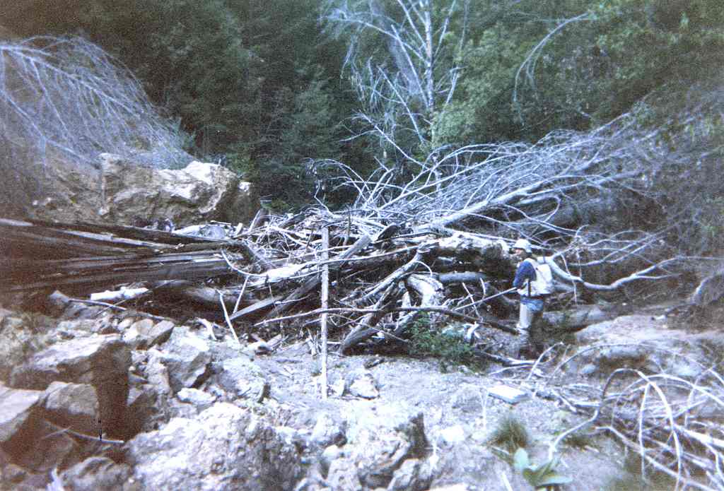 Click on image to enlarge (91K). Click here to display a larger version (676K).
 Click on image to enlarge (105K). Click here to display a larger version (663K).
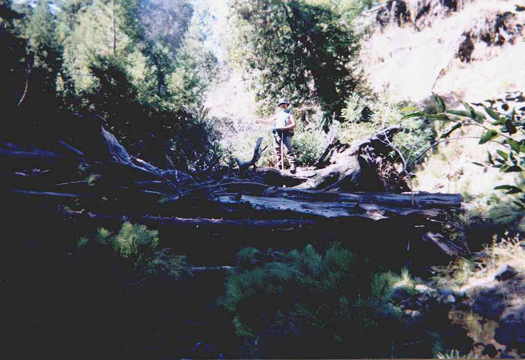 Click on image to enlarge (64K). Click here to display a larger version (413K).
 Click on image to enlarge (77K). Click here to display a larger version (534K).
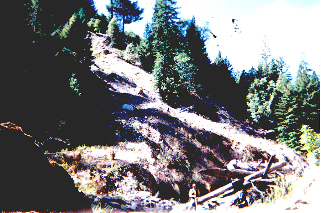