| Area |
Wheatfield |
| Topic |
Tour: CDFG Wheatfield Fork #1 CDFG Photos 2001 |
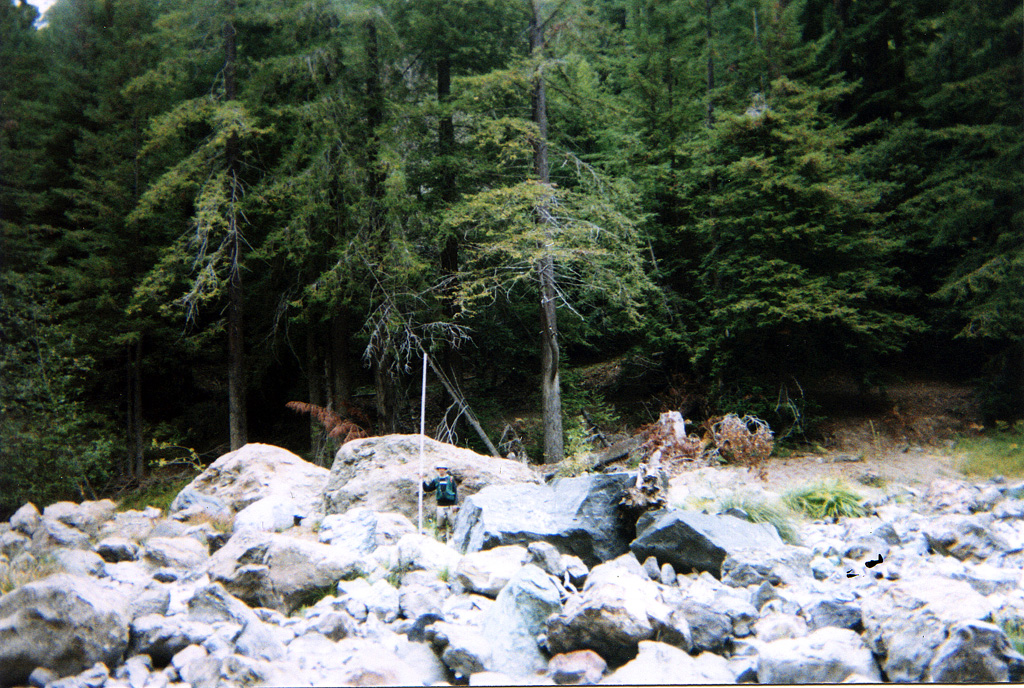
 Click on image to enlarge (84K). Click here to display a larger version (571K).
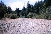
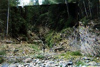
Photograph of the Wheatfield Fork Gualala River lacking surface flow just upstream of its convergence with the South Fork taken on September 27, 2001. Photo provided courtesy of the California Department of Fish and Game North Coast Watershed Assessment Program.
WF_HU.0001
Photo #23
HU #0001
09.27.01
Dry [7.0]
Start of survey, out of the influence of mainstem.
 Click on image to enlarge (76K). Click here to display a larger version (488K).
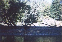
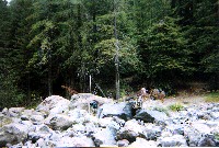
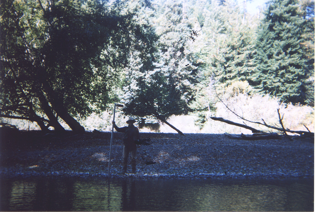
This photo shows the edge of a pool along the Wheatfield Fork Gualala River taken during a September 27, 2001 survey. The gravel terrace next to the stream was approximately five feet high. Photo provided courtesy of the California Department of Fish and Game North Coast Watershed Assessment Program.
WF_HU.0050A
09.27.01
61oF H2O
Lateral scour pool, root wad enhanced [5.3]
Embeddedness=1
Substrate=C
Shelter value=2
93% of channel width
5ft high gravel wedge.
 Click on image to enlarge (60K). Click here to display a larger version (416K).
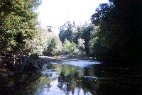
This photo shows a lateral scour pool enhanced by a rootwad along the Wheatfield Fork Gualala River taken during a September 27, 2001 survey. Photo provided courtesy of theCalifornia Department of Fish and Game North Coast Watershed Assessment Program.
WF_HU.0050B
09.27.01
61oF H2O
Lateral scour pool, root wad enhanced [5.3]
Embeddedness=1
Substrate=C
Shelter value=2
93% of channel width
5ft high gravel wedge.
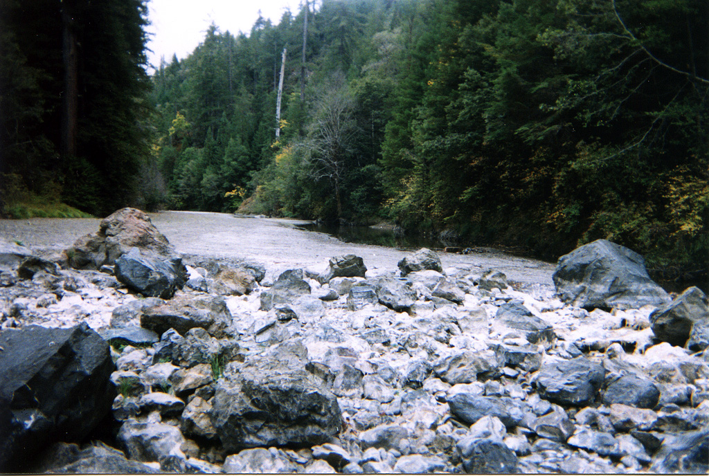
 Click on image to enlarge (104K). Click here to display a larger version (806K).
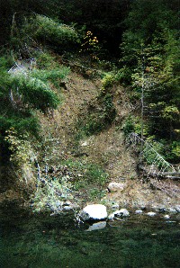
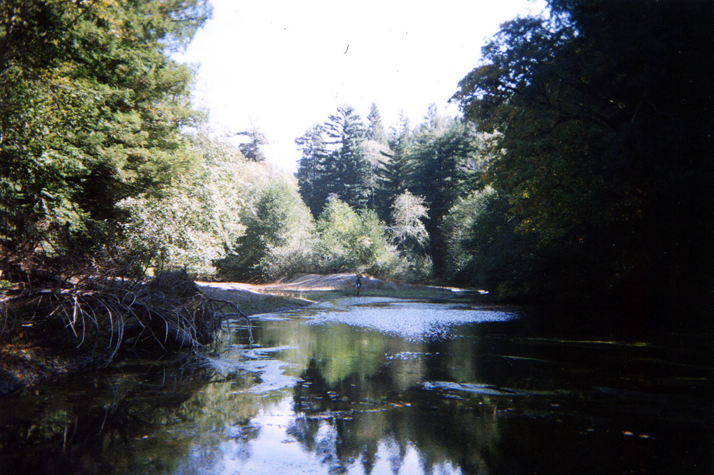
This photo shows the edge of a mid-channel pool along the Wheatfield Fork Gualala River taken during a September 27, 2001 survey. Note streamside landslide. Photo provided courtesy of the California Department of Fish and Game North Coast Watershed Assessment Program.
WF_HU.0245
Photo #
HU #0245
10.04.01
64oF H2O
Mid-channel pool [4.2]
Embeddedness=2
Substrate=C
Shelter value=2
Landslide left bank 20ft wide X 60ft high
 Click on image to enlarge (84K). Click here to display a larger version (555K).
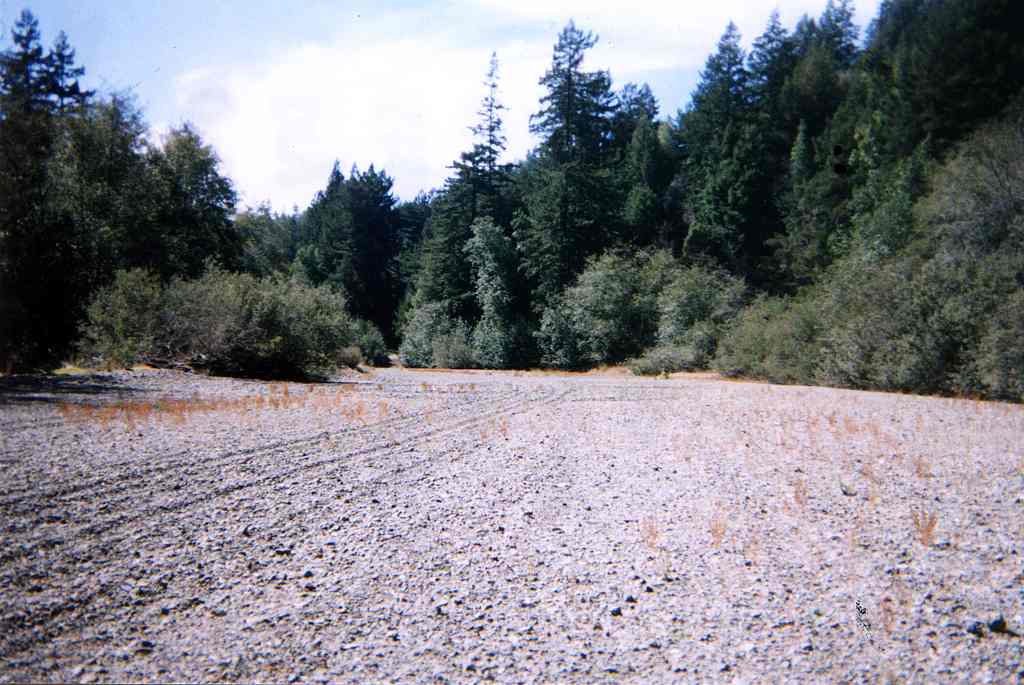
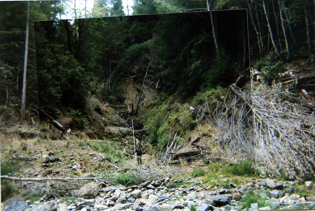
The photo above shows a tributary channel to the Wheatfield Fork Gualala River, which runs dry in the foreground of the photo. The shape of the channel and debris piled at the mouth of the stream indicate that it has been the pathway of a debris torrent. Photo provided courtesy of the California Department of Fish and Game North Coast Watershed Assessment Program.
WF_HU.0246A
Photo #16
HU #0246A
10.04.01
64oF H2O
Dry [7]
Boulder field dimensions:
100ft wide X 150ft long
This unit has a left bank tributary. It has loaded the river with boulders and large cobble.
 Click on image to enlarge (75K). Click here to display a larger version (509K).
Boulder field in a section of the Wheatfield Fork Gualala River which lacked surface flow during the CDFG survey conducted on October 4, 2001. Photo provided courtesy of the California Department of Fish and Game North Coast Watershed Assessment Program.
WF_HU.0246B
Photo #
HU #0246B
10.04.01
64oF H2O
Dry [7]
Boulder field dimensions:
100ft wide X 150ft long
This unit has a left bank tributary. It has loaded the river with boulders and large cobble.
 Click on image to enlarge (74K). Click here to display a larger version (492K).
Photo looking upstream on the Wheatfield Fork Gualala River on October 4, 2001. The river slips sub-surface under rubble and boulders contributed from a landslide at this location (same location as previous two pictures). Photo provided courtesy of the California Department of Fish and Game North Coast Watershed Assessment Program.
WF_HU.0246C
Photo #
HU #0246C
10.04.01
64oF H2O
Dry [7]
Boulder field dimensions:
100ft wide X 150ft long
This unit has a left bank tributary. It has loaded the river with boulders and large cobble.
 Click on image to enlarge (38K). Click here to display a larger version (375K).
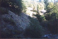
Eroding gravel bank above mid-channel pool along the Wheatfield Fork Gualala River. Photo courtesy of the California Department of Fish and Game North Coast Watershed Assessment Program.
WF_HU.0396
Photo #
HU #0396
10.10.01
58.2oF H2O
Mid-channel pool [4.2]
Embeddedness=3
Substrate=C
Shelter value=3
Unstable right bank composed of gravel.

 Click on image to enlarge (84K). Click here to display a larger version (571K).
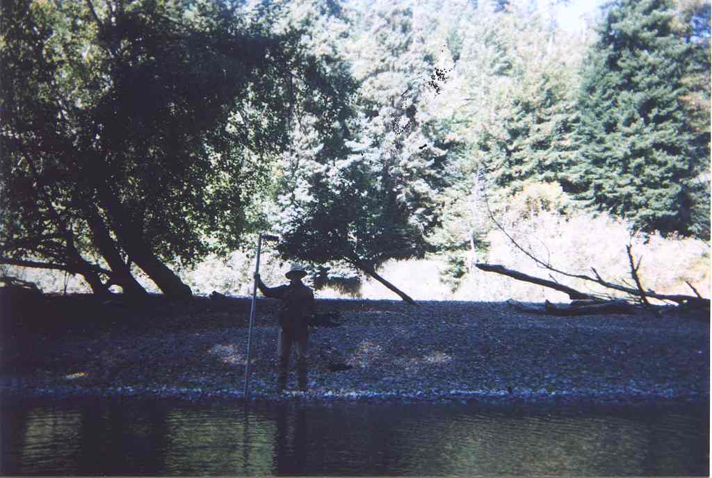 Click on image to enlarge (76K). Click here to display a larger version (488K).
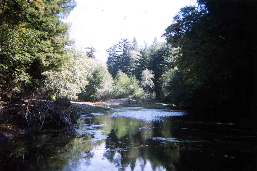 Click on image to enlarge (60K). Click here to display a larger version (416K).
 Click on image to enlarge (104K). Click here to display a larger version (806K).
 Click on image to enlarge (84K). Click here to display a larger version (555K).
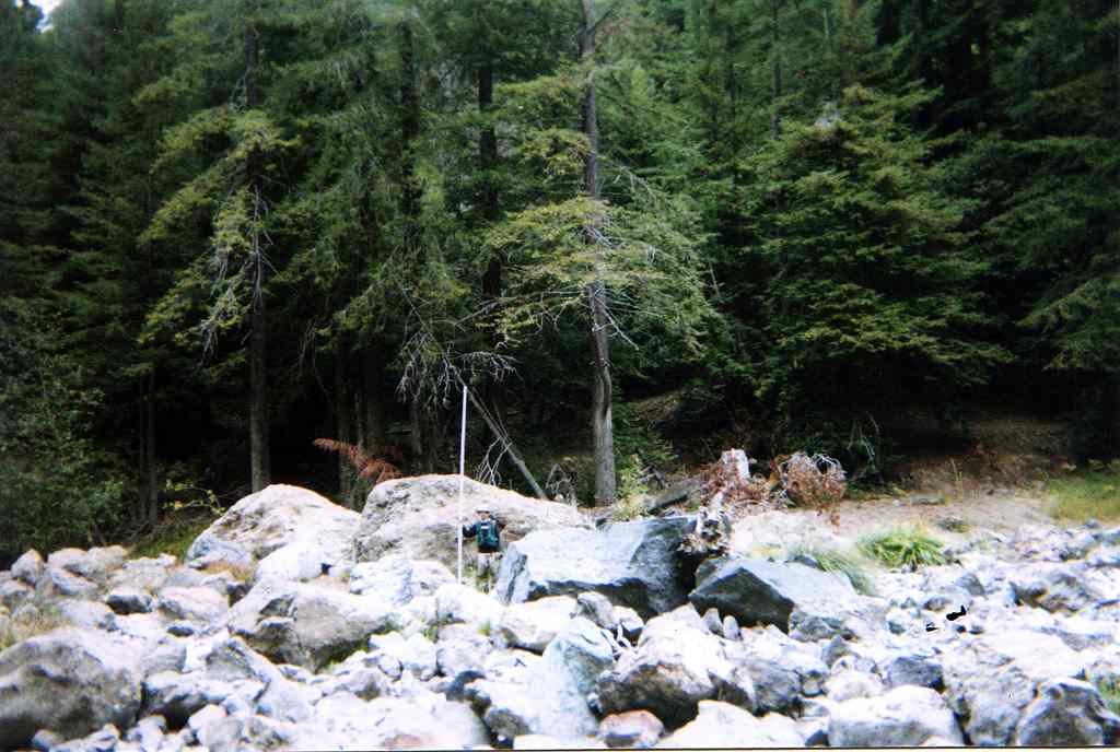 Click on image to enlarge (75K). Click here to display a larger version (509K).
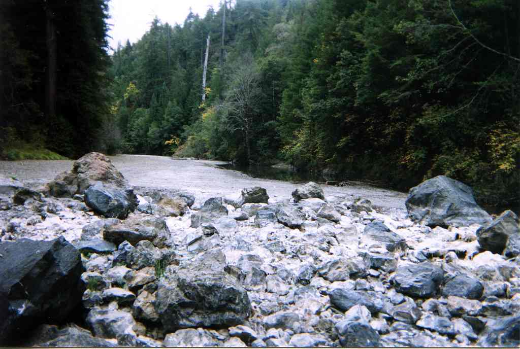 Click on image to enlarge (74K). Click here to display a larger version (492K).
 Click on image to enlarge (38K). Click here to display a larger version (375K).
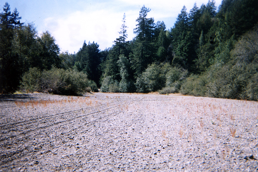