| Area |
Wheatfield |
| Topic |
Tour: CDFG Wheatfield Fork #2 CDFG Photos 2001 |
 Click on image to enlarge (62K). Click here to display a larger version (470K).
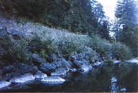
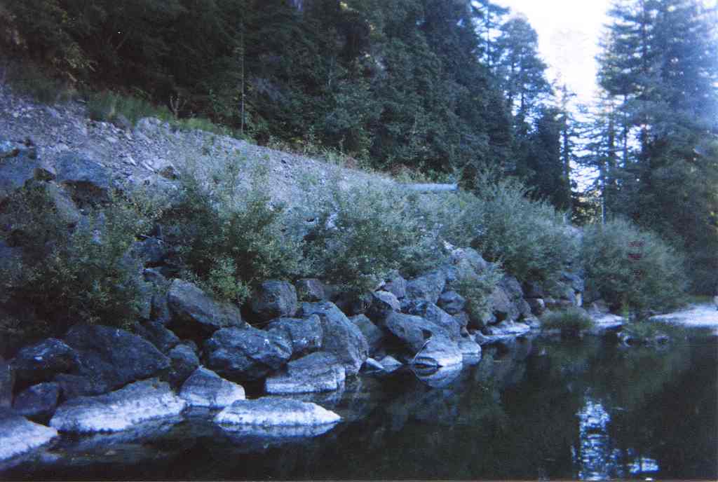
Photograph of a mid-channel pool on the Wheatfield Fork Gualala River just downstream of Annapolis Road in fall 2001. Riprap along Skaggs Springs-Stewarts Point Road confines the channel and provides cover. Note willows sprouting from soil deposits between boulders. Photo provided courtesy of the California Department of Fish and Game North Coast Watershed Assessment Program.
WF_HU.0408
Photo #11
HU #0408
10.10.01
63.8oF H2O
Mid-channel pool [4.2]
Embeddedness=5
Substrate=B
Shelter value=2
Left bank composed of riprap; 50% of length to preserve Skaggs Springs Road. Annapolis Road meets Skaggs Springs at the head of this unit.
 Click on image to enlarge (76K). Click here to display a larger version (519K).
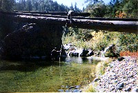
This photo shows a mid-channel pool on the Wheatfield Fork Gualala River taken during an October 10, 2001 survey. Photo provided courtesy of the California Department of Fish and Game North Coast Watershed Assessment Program. CDFG notes:
WF_HU.0415
Photo #10
HU #0415
10.10.01
61.8oF H2O
Mid-channel pool [4.2]
Embeddedness=3
Substrate=C
Shelter value=1
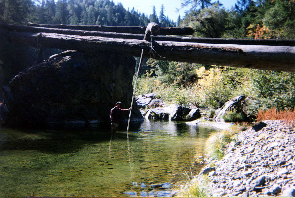
 Click on image to enlarge (102K). Click here to display a larger version (695K).
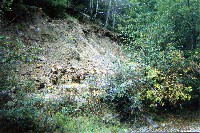
This photo shows a bank failure adjacent to a run along the Wheatfield Fork Gualala River taken during an October 2001 survey. Photo provided courtesy of the California Department of Fish and Game North Coast Watershed Assessment Program.
WF_HU.504
Photo #8
HU #504
10.11.01
63.7oF H2O
Run [3.3]
Shelter value=1
Landslide 40ft high X 105ft long
Right bank
 Click on image to enlarge (90K). Click here to display a larger version (594K).
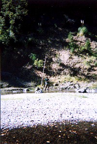
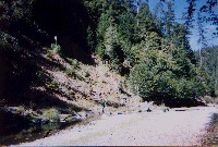
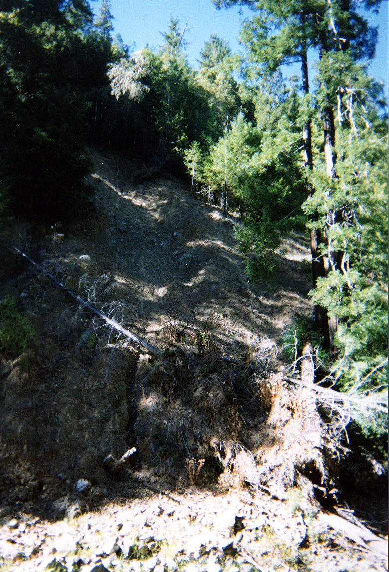
This photo shows the edge of an old landslide along the Wheatfield Fork Gualala River taken during an October 2001 survey. Photo provided courtesy of the California Department of Fish and Game North Coast Watershed Assessment Program.
WF_HU.0574A
Photo #5
HU #0574A
63.5oF H2O
Mid-channel pool [4.2]
Embeddedness=3
Substrate=C
Shelter value=1
Landslide left bank 126ft high X160ft wide
 Click on image to enlarge (69K). Click here to display a larger version (438K).
Same locations as Picture 4 but from a different angle. Photo provided courtesy of the California Department of Fish and Game North Coast Watershed Assessment Program.
WF_HU.0574B
Photo #
HU #0574
63.5oF H2O
Mid-channel pool [4.2]
Embeddedness=3
Substrate=C
Shelter value=1
Landslide left bank 126ft high X160ft wide
 Click on image to enlarge (72K). Click here to display a larger version (501K).
Unknown location on Wheatfield Fork Gualala River with a beautiful, bedrock-formed pool. Photo provided courtesy of the California Department of Fish and Game North Coast Watershed Assessment Program.
 Click on image to enlarge (101K). Click here to display a larger version (714K).
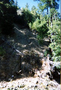
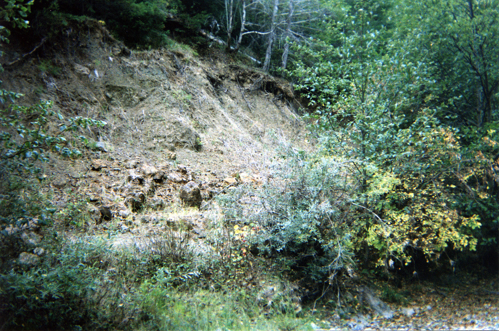
Streamside landslide contributing sediment to the Wheatfield Fork Gualala River. Photo provided courtesy of the California Department of Fish and Game North Coast Watershed Assessment Program.
WF_HU.562
Photo #7
HU #562
10.12.01
62.8oF H2O
Lateral scour pool, bedrock formed. [5.4]
Embeddedness=5
Substrate=B
Shelter value=1
Landslide left bank, 180ft high X 140ft long.
 Click on image to enlarge (42K). Click here to display a larger version (368K).
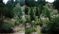
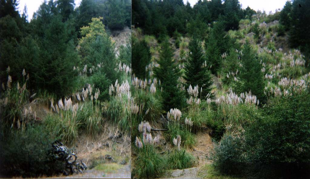
Hillslope of riparian zone of the Wheatfield Fork Gualala River has a pattern of vegetation reflecting a large landslide within the last twenty years. Invasive, non-native pampas grass provides much of slope cover. Photo provided courtesy of the California Department of Fish and Game North Coast Watershed Assessment Program.
WF_HU.234
Photo #20?
HU #234
10.04.01
63.8oF H2O
Mid-channel pool [3.4]
Embeddedness=5
Substrate=B
Shelter value=0
Landslide: 340ft high X 170ft wide

 Click on image to enlarge (62K). Click here to display a larger version (470K).
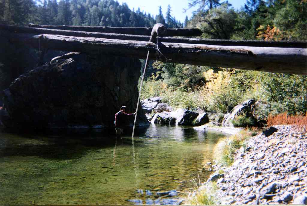 Click on image to enlarge (76K). Click here to display a larger version (519K).
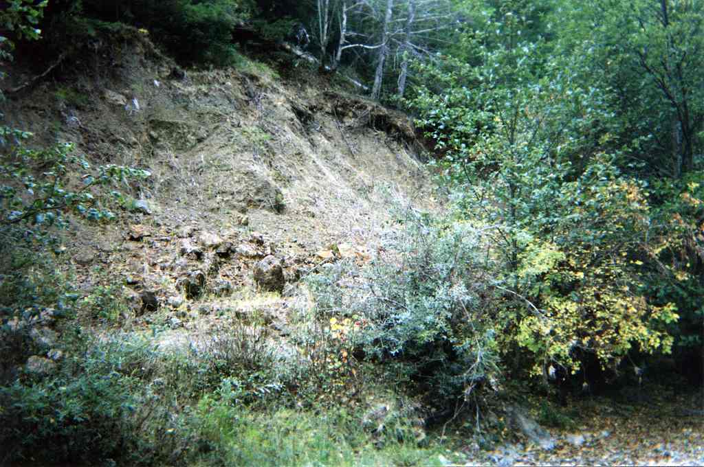 Click on image to enlarge (102K). Click here to display a larger version (695K).
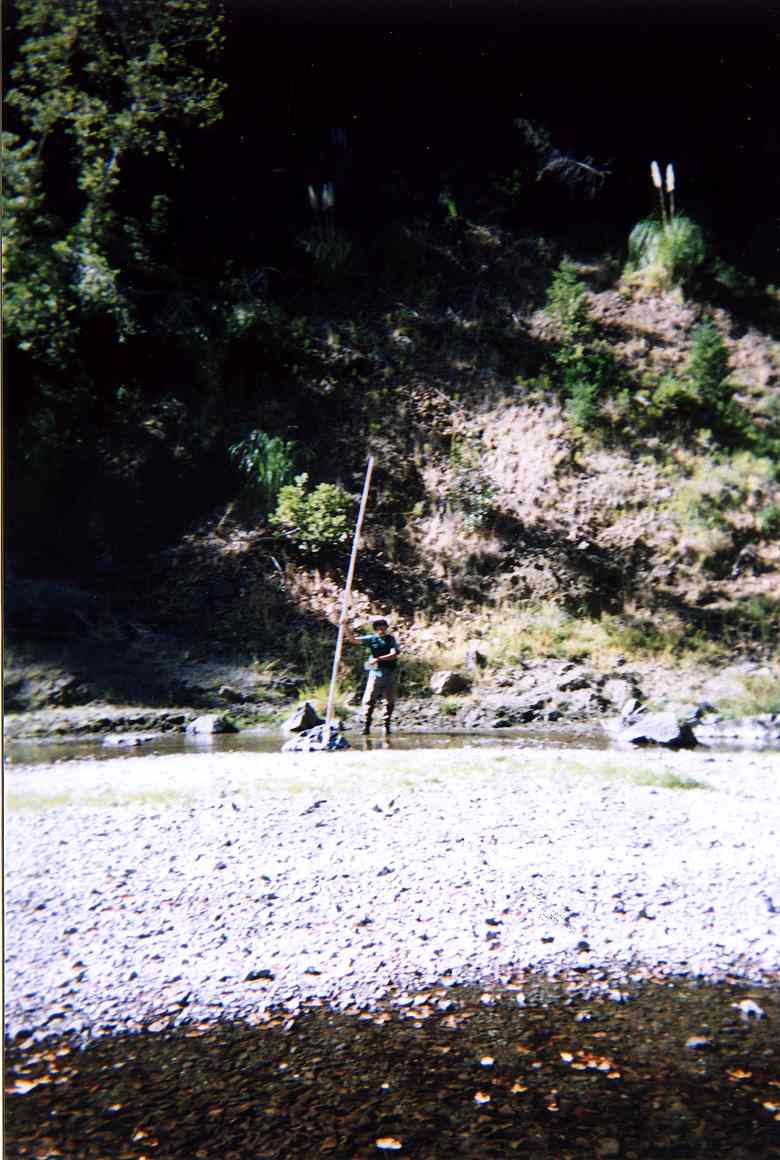 Click on image to enlarge (90K). Click here to display a larger version (594K).
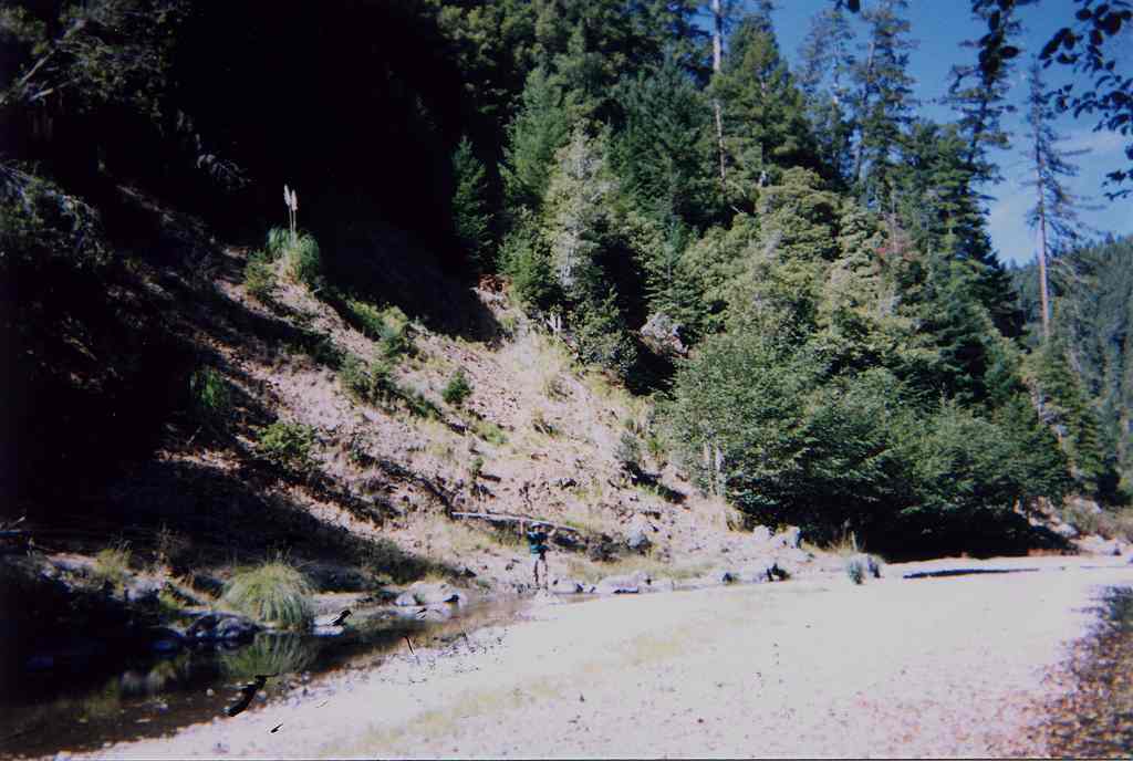 Click on image to enlarge (69K). Click here to display a larger version (438K).
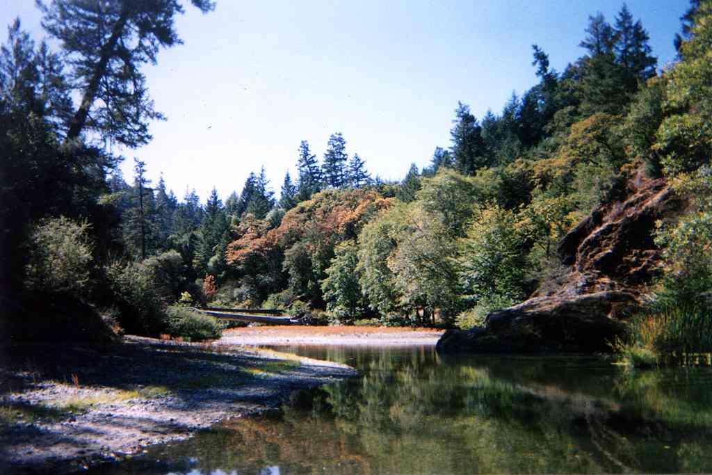 Click on image to enlarge (72K). Click here to display a larger version (501K).
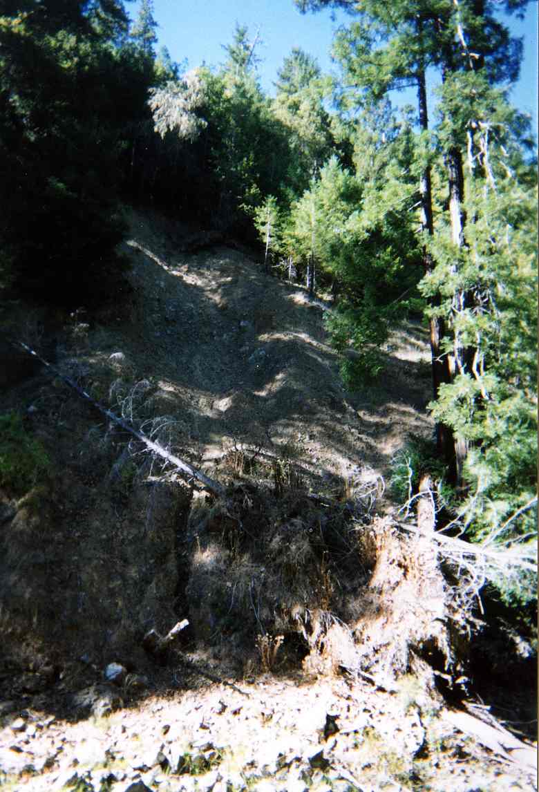 Click on image to enlarge (101K). Click here to display a larger version (714K).
 Click on image to enlarge (42K). Click here to display a larger version (368K).
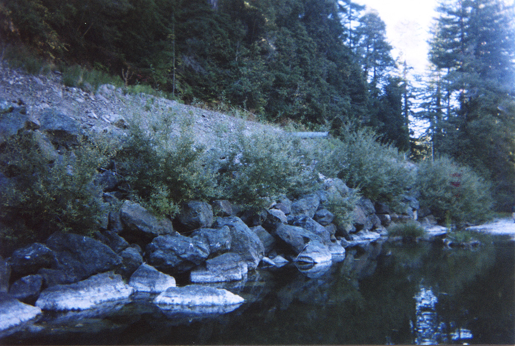