| Area |
Wheatfield |
| Topic |
Tour: Fuller Creek TMDL Picts |
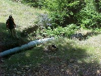 Click on image to enlarge (108K).
Stream crossing failure on the South Fork Fuller Creek. Photo taken in 2001 by North Coast Regional Water Quality Personnel as part of the TSD for the Gualala TMDL and provided by Bryan McFadin.
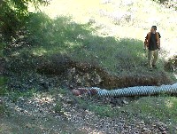 Click on image to enlarge (90K).
Another angle on same stream crossing failure as Picture #1 on the South Fork Fuller Creek. Photo taken in 2001 by North Coast Regional Water Quality Personnel as part of the TSD for the Gualala TMDL and provided by Bryan McFadin.
 Click on image to enlarge (30K). Click here to display a larger version (252K).
Looking down culvert at same South Fork Fuller Creek location. Photo taken in 2001 by North Coast Regional Water Quality Personnel as part of the TSD for the Gualala TMDL and provided by Bryan McFadin.

 Click on image to enlarge (108K).
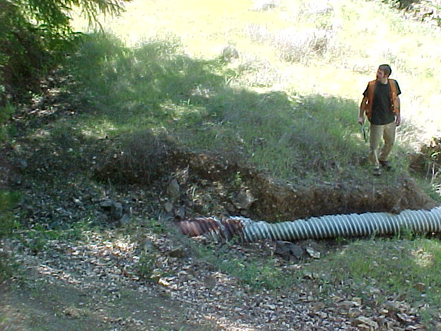 Click on image to enlarge (90K).
 Click on image to enlarge (30K). Click here to display a larger version (252K).
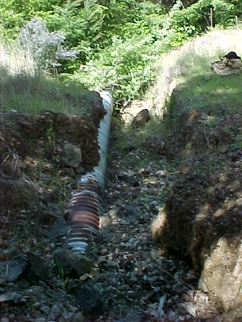