| Area |
Wheatfield |
| Topic |
Tour: Aerial Pictures Post WW II Logging, Wheatfield Fork |
 Click on image to enlarge (150K). Click here to display a larger version (747K).
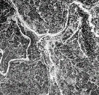
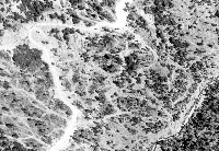
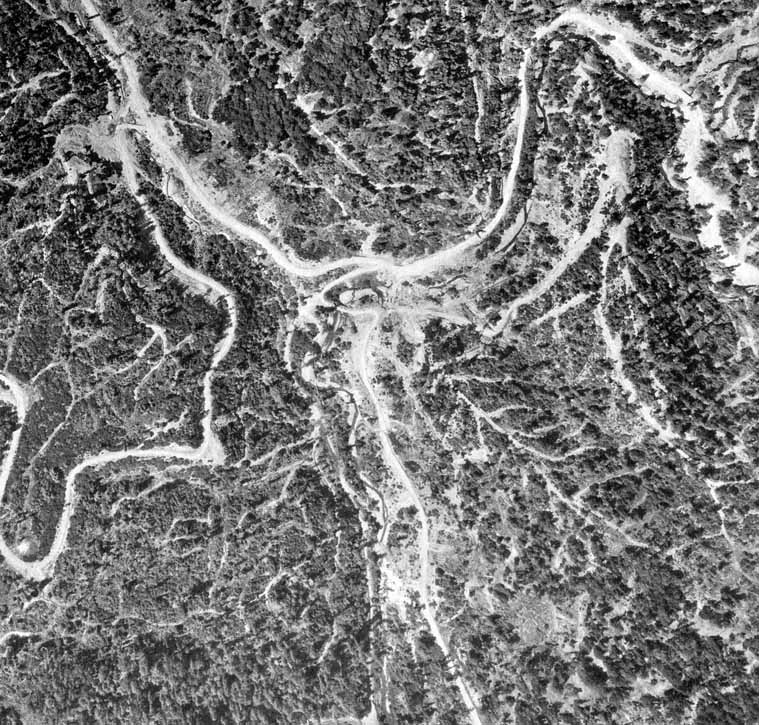
This is an aerial photo of the North Fork and mainstem Fuller Creek convergence taken in June 1965 showing intensive logging activity and associated roads and skid trails. Photo provided by California Department of Transportation. Scanned by Don Morse, California Department of Forestry (FRAP), North Coast Watershed Assessment Program.
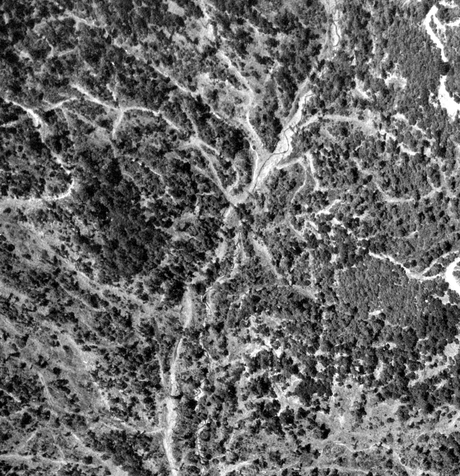
 Click on image to enlarge (37K). Click here to display a larger version (190K).
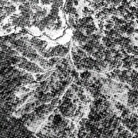
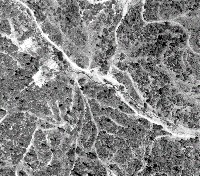
This is an aerial photo of the North Fork Wheatfield Fork Gualala River taken in June 1965 showing intensive logging activity and associated roads and skid trails. Note that the stream channel at upper left is wide and shallow after sediment contributions. Photo provided by California Department of Transportation. Scanned by Don Morse, California Department of Forestry (FRAP), North Coast Watershed Assessment Program.
 Click on image to enlarge (111K). Click here to display a larger version (639K).
Failed landing at upper left in photo formed a debris torrent which came downhill (across the photo) and blew out a road crossing. Photo provided by California Department of Transportation. Scanned by Don Morse, California Department of Forestry (FRAP), North Coast Watershed Assessment Program.
 Click on image to enlarge (119K). Click here to display a larger version (828K).
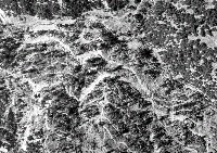
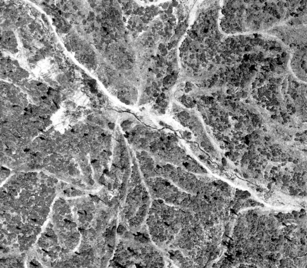
Skid and tractor trails appear as a dendric network on the hillslopes and the stream channel is wide and shallow as a result of numerous debris torrents from the 1964 flood. Photo provided by California Department of Transportation. Scanned by Don Morse, California Department of Forestry (FRAP), North Coast Watershed Assessment Program.
 Click on image to enlarge (145K). Click here to display a larger version (878K).
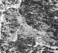
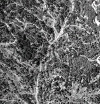
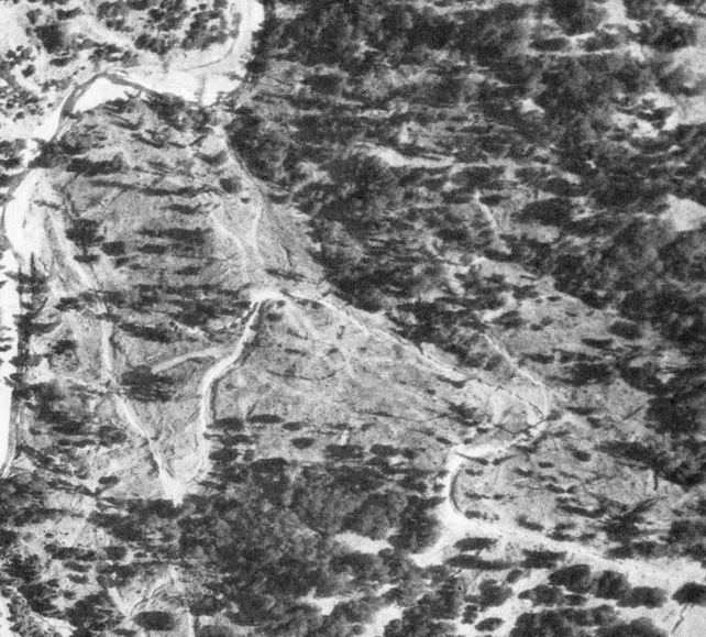
Large hillslope failure at left created a debris torrent which can be seen washing out other road fills on its way to the Wheatfield tributary depicted. Photo provided by California Department of Transportation. Scanned by Don Morse, California Department of Forestry (FRAP), North Coast Watershed Assessment Program.
 Click on image to enlarge (90K). Click here to display a larger version (349K).
The aerial photo above was taken in 1965 and shows a stream diversion where road crossings change the course of a stream, shunting it to a place on the hillside which was unarmored and greatly increasing soil loss. Provided courtesy of Don Morse, California Department of Forestry (FRAP), North Coast Watershed Assessment Program.
 Click on image to enlarge (161K). Click here to display a larger version (763K).
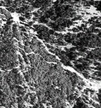
More post WWII bad news logging. Provided by Don Morse, CDF FRAP.
 Click on image to enlarge (150K). Click here to display a larger version (960K).
And more really bad Post WWII logging. Photo scanned and provided by Don Morse, CDF, FRAP.

 Click on image to enlarge (150K). Click here to display a larger version (747K).
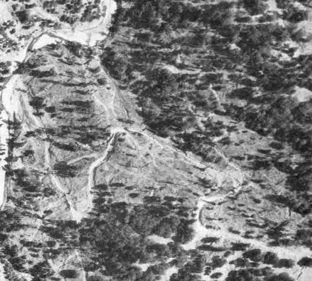 Click on image to enlarge (37K). Click here to display a larger version (190K).
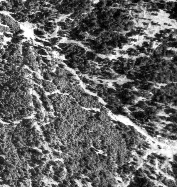 Click on image to enlarge (111K). Click here to display a larger version (639K).
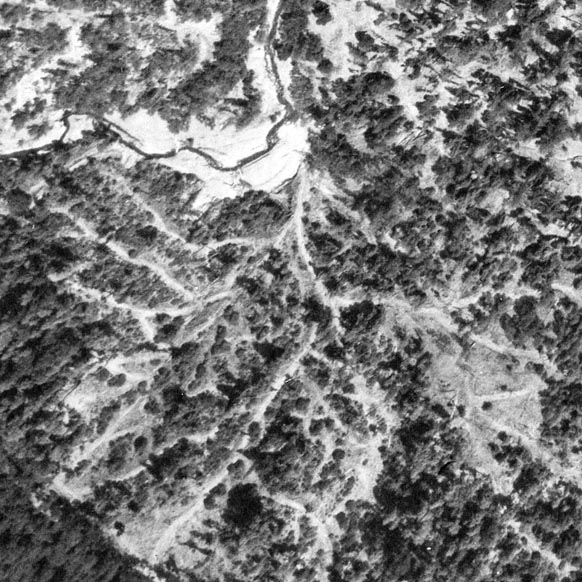 Click on image to enlarge (119K). Click here to display a larger version (828K).
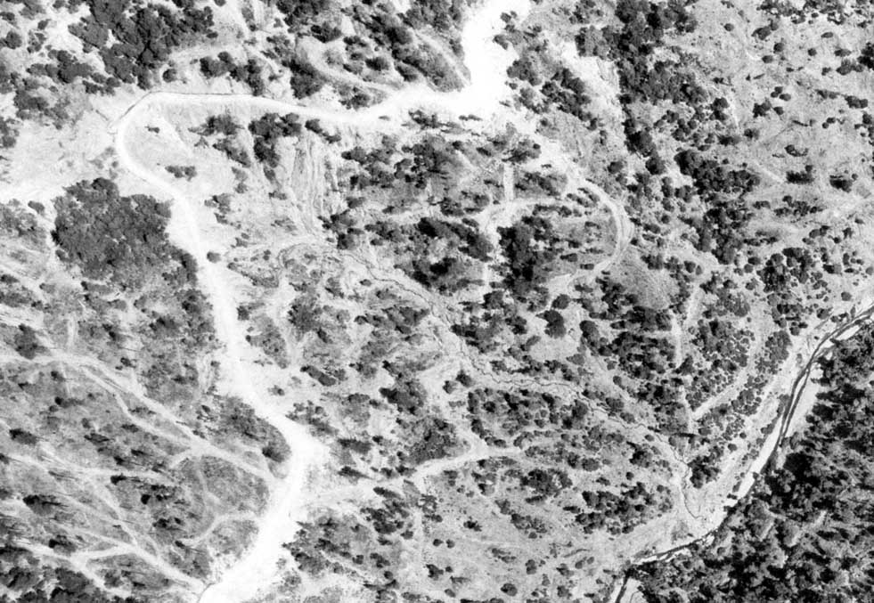 Click on image to enlarge (145K). Click here to display a larger version (878K).
 Click on image to enlarge (90K). Click here to display a larger version (349K).
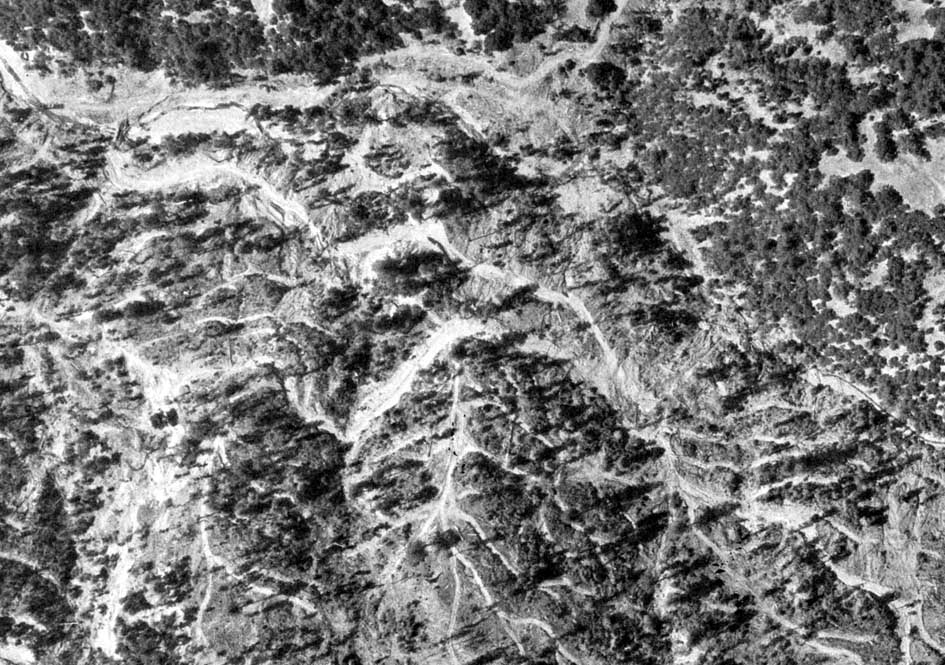 Click on image to enlarge (161K). Click here to display a larger version (763K).
 Click on image to enlarge (150K). Click here to display a larger version (960K).