
| Area | Lower Klamath/Basin-wide |
| Topic | Map: 1B. Sub-basins, Klamath Basin |
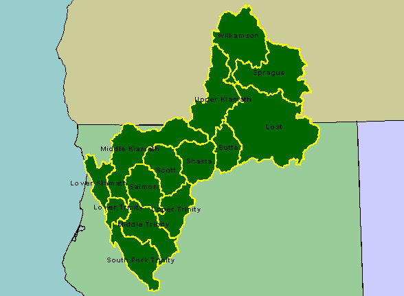
| This is a map of the sub-basins in the KRIS Klamath. All sub-basins shown in this map above Iron Gate Dam (Upper Klamath, Butte, Lost, Sprague, and Williamson) are combined into one sub-basin in KRIS. Scale = 1:3,239,527 . | |||
 |
 |
||
To view metadata about a map layer, click on a link in the table below.
| Name of Layer in Map Legend | Metadata File Name |
|---|---|
| Trinity Subbasins (w/labels) | subbasins_trin.shp.txt |
| Klamath Subbasins (w/ labels) | tfsubwsd.shp.txt |
| California | Unavailable |
| Oregon | oregon_bdry.shp.txt |
| Nevada | nevada_bdry.shp.txt |
| Pacific Ocean | Unavailable |
| www.krisweb.com |