| Area |
Lower Klamath/Basin-wide |
| Topic |
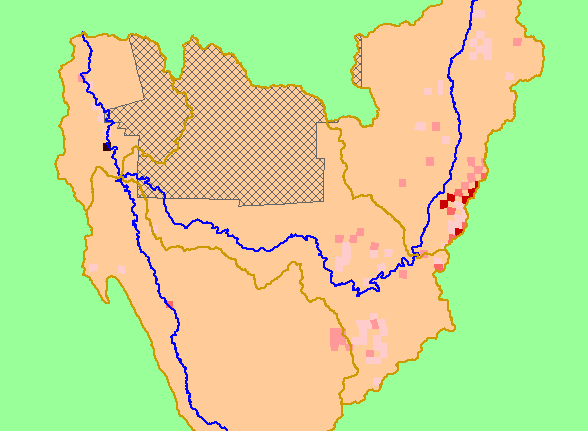
Pesticides: Klamath/Trinity Basin-wide Amount Applied by Crop 2001 |
|
This map shows the amount of registered pesticides applied in the Russian basin during the year 2001. This database does not
include residential pesticide use. Pesticide use is reported to the nearest square mile (section), so no location information is
available for areas that do not have Public Land Survey sections (grey area on map). Data are from the California Pesticide Use
Reporting Database, which was assembled by the California Department of Pesticide Regulation. See Info Links for more
information.
|
|
|
 |
 |
To view metadata about a map layer, click on a link in the table below.
