|
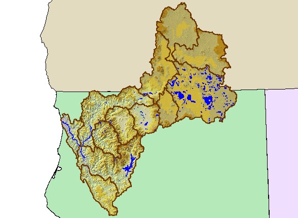
This map is a Digital Elevation Model (DEM) showing the topography of the landscape in the Klamath basin, displayed with
sub-basin boundaries. The basin spans over 10,000 square miles of northern California and southeast Oregon. Although the
eastern portion of the Klamath Basin is in the Cascade Province, it is much less mountainous than the western portion of the basin.
The Klamath Mountain geologic province extends from the Shasta Basin west and includes the Marble Mountains, the Siskiyous,
Trinity Alps and Yolla Bolla Mountains. A small portion of the Klamath watershed in Modoc County is considered to be in the
Great Basin. Data were provided by Humboldt State University and Klamath National Forest.
|
|