|
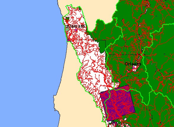
This is a map of the 1:24,000 scale roads, public land ownership, and cities in the Lower Klamath sub-basin, displayed with KRIS
sub-basins. Six Rivers National Forest is shown in green and part the Hoopa Reservation is shown as purple. Most of the Lower
Klamath Basin is in private timberland ownership. The USFS ownership is largely in upper Blue Creek which is a Key Watershed
under the Northwest Forest Plan. Data were provided by Humboldt State University and Klamath National Forest. Click the
check box next to a layer to toggle it on/off. Other available layers include streams. Scale = 1:716,795 .
|
|