
| Area | Lower Klamath/Basin-wide |
| Topic | Tour: Yurok Reservation Ah Pah Creek Erosion Inventory 1997 |
Yurok Tribal member surveys blown out stream crossing in the mainstem Ah Pah Creek watershed, documented during erosion source assessment in fall 1997. Use Pan function or click Fit to see whole image. Press F1 for help in use of Picture tools.
Road fill adjacent to this culvert has been washed away by previous floods, probably because the culvert inlet was plugged. Yurok Tribal technician estimates sediment potential and the amount of past erosion. Sub-basin area is mainstem Ah Pah Creek. Photo taken September 1997. Photo courtesy of Yurok Tribe Watershed Restoration Division.
Corrugated plastic pipe lacking downspout has caused an erosion problem on road fill, causing a head cut. Mainstem Ah Pah Creek sub-basin watershed assessment. Fall 1997. Photo courtesy of Yurok Tribe Watershed Restoration Division.
Failed road crossing with the old culvert shown. The culvert appears to be undersized. A great deal of sediment has been unleashed into the creek from the old fill material. Ah Pah mainstem sub-basin. Fall 1997. Photo courtesy of Yurok Tribe Watershed Restoration Division.
This drainage structure is a ditch relief pipe for the Highway 101 bypass. Note gully forming below the leaking band separation. Photo courtesy of Yurok Tribe Watershed Restoration Division.
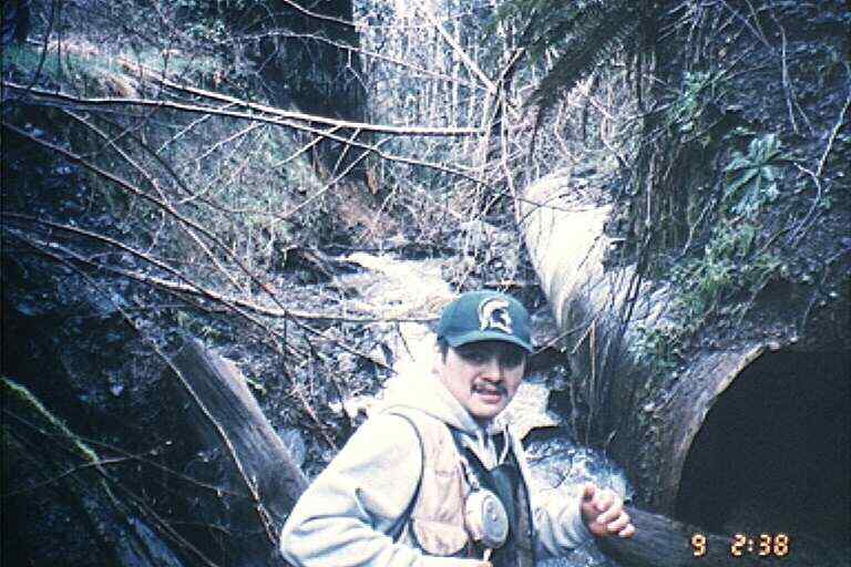
Yurok surveyor investigating a plugged culvert inlet along the upper mainstem of Ah Pah Creek. Photo courtesy of Yurok Tribe Watershed Restoration Division.
Potential road fill failure at the mainstem of Ah Pah Creek, below the Highway 101 bypass. This large rotational slump may have been triggered by ditch relief from the Highway 101 bypass. Unstable fill may also be involved. The site is immediately over a stream crossing for Ah Pah Creek.
Gully erosion in road fill from the Highway 101 bypass. The bypass is just out of the photo. Water has been concentrated by flow off the freeway. Note the failing sediment retention fence and possibly a gabion structure underneath. Headwaters of Ah Pah Creek. Photo courtesy of Yurok Tribe Watershed Restoration Division.
 Click on image to enlarge (62K).
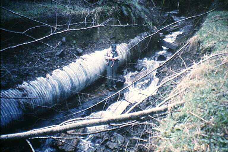 Click on image to enlarge (59K).
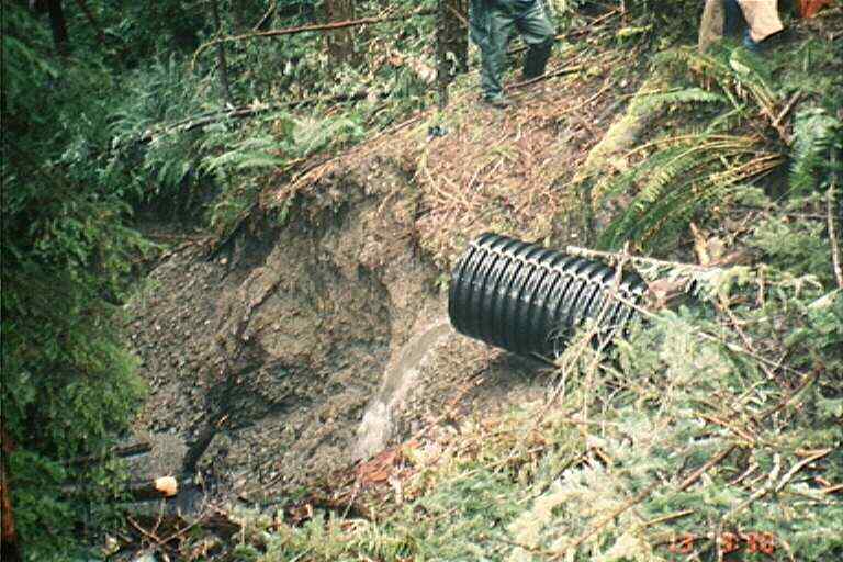 Click on image to enlarge (66K).
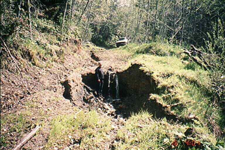 Click on image to enlarge (79K).
 Click on image to enlarge (28K).
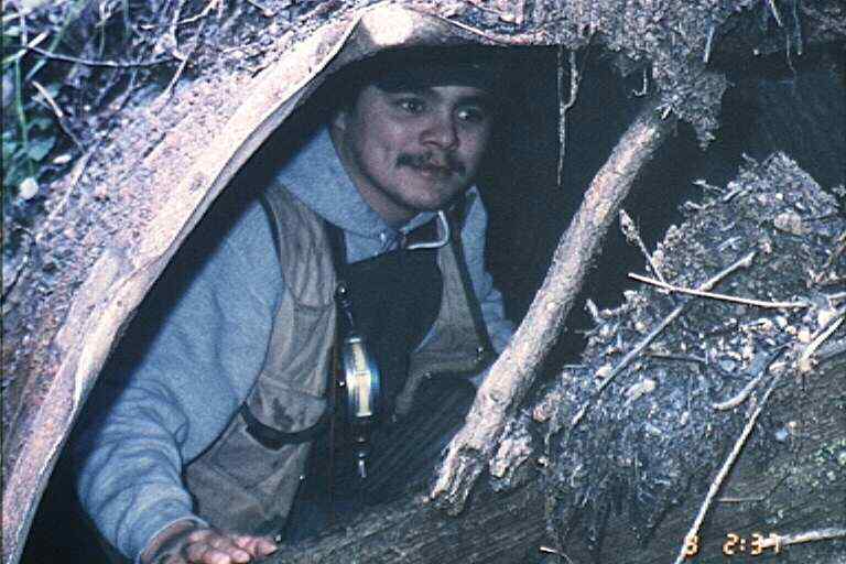 Click on image to enlarge (53K).
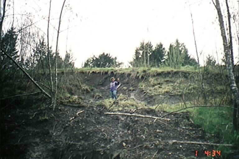 Click on image to enlarge (40K).
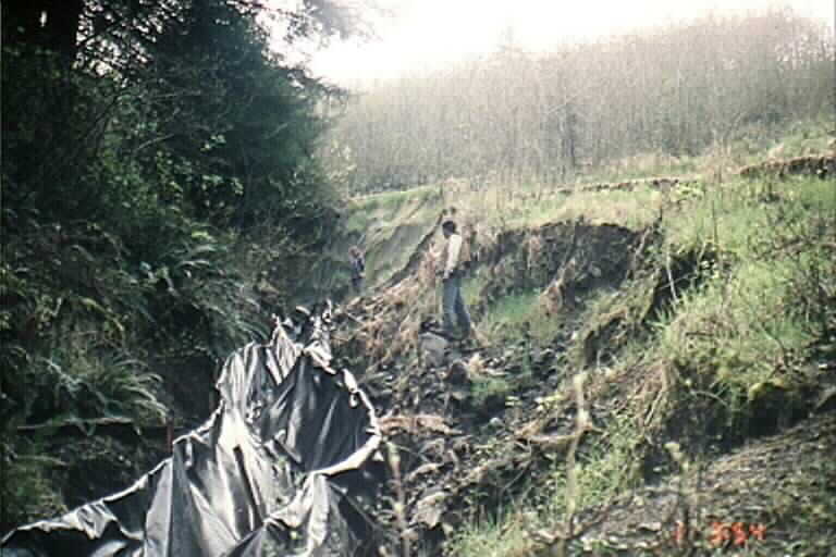 Click on image to enlarge (49K).
To learn more about this topic click Info Links
To view additional information (data source, aquisition date etc.) about this page, click Metadata
| www.krisweb.com |