
| Area | Lower Klamath/Basin-wide |
| Topic | VegType: Blue Creek Lower vs Upper 1994 |
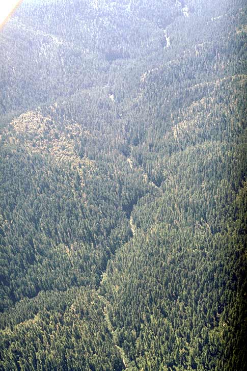
Upper Blue Creek on Six Rivers National Forest is considered a Key Watershed under the Northwest Forest Plan and is largely in late seral stage conditions. The small crease seen in the landscape is the stream course. Tall trees shield the stream from direct sun and encroach closely on the stream channel. The riparian area also helps to maintain cool air temperatures over the stream. Use Pan function or click Fit to see whole image. Press F1 for help in use of Picture tools.
Inner gorge of lower Blue Creek on private, industrial timber lands with fresh clearcuts in October 1990. Many large conifers in stream side locations appear to have been logged, which will retard recruitment of large wood to the stream.
Note early seral stage conditions in foreground as a result of recent, clearcut logging in the lower Blue Creek watershed. Dense skid trails in clearcut area in lower photo can increase surface erosion and sediment contributions to streams. Small diameter trees and shrubs are visible elsewhere in the photo where the forest is in early recovery from prior logging. The wide flood plain of lower Blue Creek is symptomatic of cumulative watershed effects with timber harvest and erosion causing the streambed to fill in and widen. October 1990.
 Click on image to enlarge (75K).
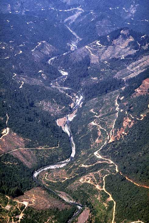 Click on image to enlarge (76K).
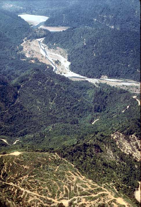 Click on image to enlarge (72K).
To learn more about this topic click Info Links
To view additional information (data source, aquisition date etc.) about this page, click Metadata
| www.krisweb.com |