
| Area | Lower Klamath/Basin-wide |
| Topic | Tour: Lower Klamath Oblique Aerial Photos |
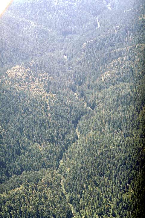
Upper Blue Creek on Six Rivers National Forest is considered a Key Watershed under the Northwest Forest Plan and is largely in late seral stage conditions. The small crease seen in the landscape is the stream course. Tall trees shield the stream from direct sun and encroach closely on the stream channel. The riparian area also helps to maintain cool air temperatures over the stream. Use Pan function or click Fit to see whole image. Press F1 for help in use of Picture tools.
Inner gorge of lower Blue Creek on private, industrial timber lands with fresh clearcuts in October 1990. Many large conifers in stream side locations appear to have been logged which will retard recruitment of large wood to the stream. Use Pan function or click Fit to see whole image. Press F1 for help in use of Picture tools.
Note early seral stage conditions in foreground as a result of recent, clearcut logging in the lower Blue Creek watershed. The wide flood plain of lower Blue Creek is symptomatic of cumulative watershed effects with timber harvest and erosion causing the streambed to fill in and widen. Photo taken October 1990. Use Pan function or click Fit to see whole image. Press F1 for help in use of Picture tools.
Early seral stage conditions in upper Hunter Creek after extensive logging. Small landslides apparently triggered by sidecasting of fill during road construction are also in evidence. Photo taken in October 1990. Use Pan function or click Fit to see whole image. Press F1 for help in use of Picture tools.
Panorama of the Terwer Creek watershed photographed in 1990. Although within Yurok Tribe ancestral territories, the land is owned by large, industrial timber interests. Parts of the holdings in this watershed were transferred from U.S. Forest Service to private ownership as part of the Redwood National Park formation in the 1970's. Use Pan function or click Fit to see whole image. Press F1 for help in use of Picture tools.
Aerial photo of the upper Turwer Creek watershed showing extensive logging and road networks. An intense fire burned the upper Terwer and Hunter Creek watersheds in 1988, and part of the area may have been burned and subsequently salvage logged. Photo taken in October 1990. Use Pan function or click Fit to see whole image. Press F1 for help in use of Picture tools.
Upper Terwer Creek, an area affected by the 1988 fire, after salvage logging in October 1990. Notice the aggraded streambed. Use Pan function or click Fit to see whole image. Press F1 for help in use of Picture tools.
Lower Terwer Creek running underground in late fall 1990. High sediment yield related to watershed disturbance has caused a large accretion of sediment, and the stream runs underground in late summer and fall. Use Pan function or click Fit to see whole image. Press F1 for help in use of Picture tools.
 Click on image to enlarge (75K).
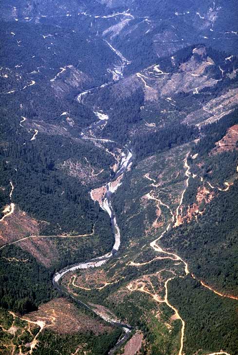 Click on image to enlarge (76K).
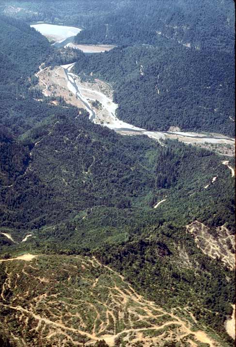 Click on image to enlarge (72K).
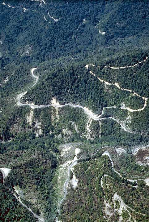 Click on image to enlarge (86K).
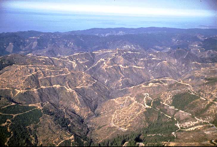 Click on image to enlarge (57K).
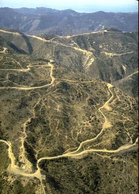 Click on image to enlarge (61K).
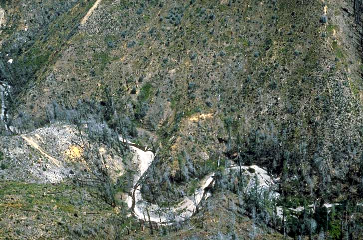 Click on image to enlarge (83K).
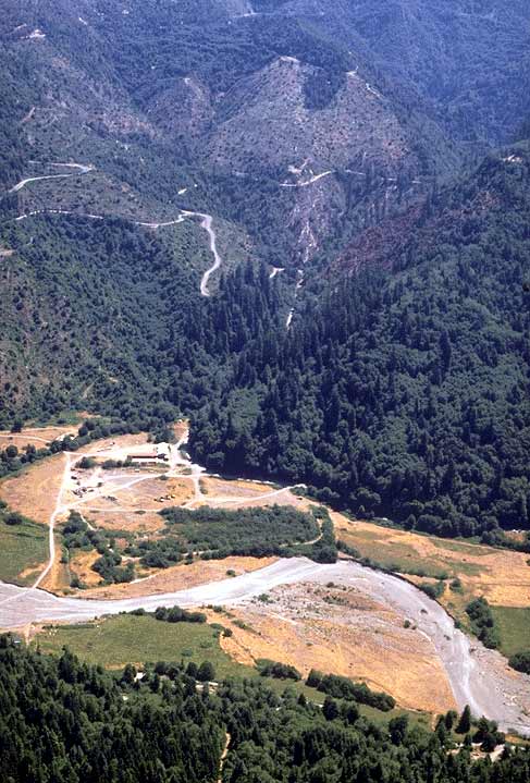 Click on image to enlarge (69K).
To learn more about this topic click Info Links
To view additional information (data source, aquisition date etc.) about this page, click Metadata
| www.krisweb.com |