
| Area | Lower Trinity/Basin-wide |
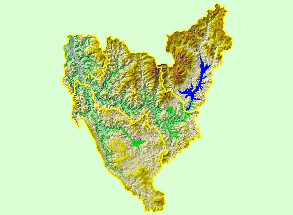
| Topic | Map: 1B. Elevation, Trinity Basin |
| This map is a Digital Elevation Model (DEM) showing the topography of the landscape in the Trinity basin, displayed with sub-basin boundaries. Data were contributed by the U.S. Geological Survey. | |||
 |
 |
||
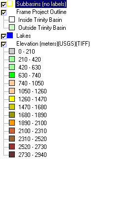
To view metadata about a map layer, click on a link in the table below.
| Name of Layer in Map Legend | Metadata File Name |
|---|---|
| Subbasins (no labels) | subbasins_trin.shp.txt |
| Frame Project Outline | Unavailable |
| Lakes | tc_lakes.shp.txt |
| Elevation (meters)(USGS)(TIFF) | elev30.tif.txt |
| Topographic Map (1:24k scale) | trinity.sid.txt |
| Slope of Elevation (TIFF) | slope1.tif.txt |
| www.krisweb.com |