
| Area | Lower Trinity/Basin-wide |
| Topic | Tour: Lower Trinity Basin Map Tour |
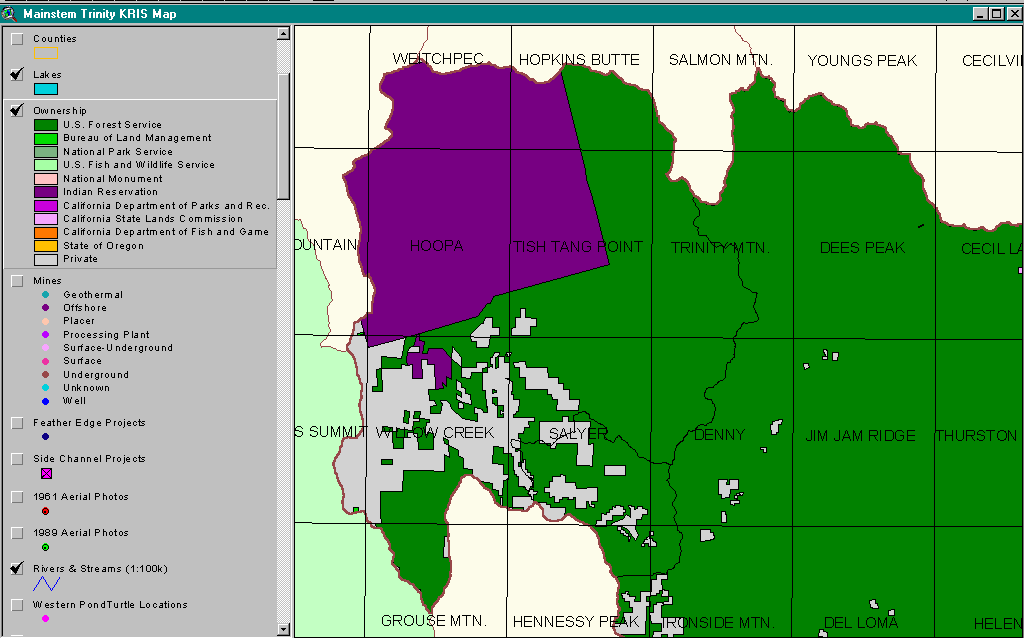
The map image above comes from the KRIS Trinity Map and the program ArcView and shows ownership of the Lower Trinity Basin. The Hoopa Indian Reservation extends downstream to the Klamath and part of the "Hoopa Square" is not showing because it extends slightly into the Lower and Middle Klamath Basins. It has also been augmented further by a land acquisition from Six Rivers National Forest in upper Tish Tang Creek, which also does not show on the map. National Forest lands in the west (left) are in Six Rivers National Forest while those in the east are in the Shasta Trinity National Forest. Private lands are clustered around the towns of Willow Creek, Salyer and Hawkins Bar as well as in the uplands of the Willow Creek watershed. The Trinity Alps Wilderness covers much of the public land to the east.
The map image above shows an elevation map for the Lower Trinity Basin with the Trinity River Valley highlighted in light blues because of its relatively low elevation (<450 meters = 1430 feet). Horse Linto, Tish Tang and Mill Creeks all have their headwaters in the Trinity Alps in the east with elevations rising to over 1980 meters (6,400 feet). The ridge to the west (left) is lower in elevation with only Horse Mountain rising to over 1400 meters (4500 feet). Image taken from the KRIS Trinity Map project in the program ArcView.
This map shows the Lower Trinity Basin with vegetation types and timber size classes highlighted. These signatures were derived from 1994 Landsat imagery by Dr. Larry Fox and the Humboldt State University Spatial Analysis Lab. They were modified from 38 classes to ten classes for use in KRIS. The gravel bar of the Trinity River in flat reaches near Willow Creek and Hoopa shows as the red-brown bare rock and soil. Mature forests in the Trinity Alps Wilderness in upper Horse Linto Creek and in the New River to the East show as medium to very large trees. Much of the uplands in the Hoopa Valley register as early seral conditions with shrub-small tree (<6 ") and small trees showing as the dominant signature but with some patches of very large trees interspersed. Areas disturbed by recent logging may be more prone to landslides and sediment yield which may in turn negatively effect fish habitat. Map from the Lower Trinity KRIS Map ArcView project.
This map shows the Lower Trinity Basin with vegetation types of 38 classes derived from 1994 Landsat imagery. The classification is according to the California Wildlife Habitat Relationships (WHR) system and was analyzed by Dr. Larry Fox at Humboldt State University. From the KRIS Map LOwer Trinity ArcView project.
The map image above is taken from the KRIS Trinity Map ArcView project and shows mining claims. Mining claims are most intensely clustered in the New River drainage. If all claims were activated in response to an increasing price of gold, there is a potential for adverse cumulative effects to fisheries and water quality. The 1872 Mining Act still allows claims to be filed anywhere on public lands so the number of claims could also expand substantially.
The Six Rivers National Forest has extensively monitored streams on the Lower Trinity Ranger District which covers much of the Lower trinity Basin. Shown at left is a map of locations of their temperature probes where water temperatures have been monitored annually since 1997. Map from the Lower Trinity KRIS Map ArcView project. Gauge locations are 4021, 4022 and 4024 in Horse Linto Creek, 4023 in Cedar Creek, 4019 and 4020 in Campbell Creek, 4031 in Sharber-Peckham Creek and 4025, 4026 and 4027 in Willow Creek.
 Click on image to enlarge (33K).
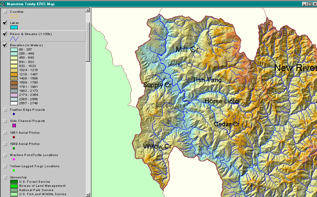 Click on image to enlarge (255K).
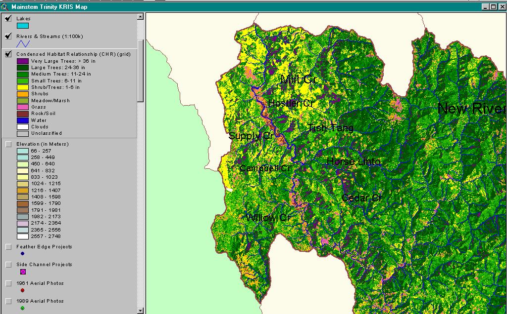 Click on image to enlarge (119K).
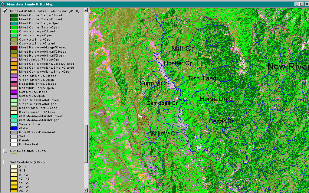 Click on image to enlarge (191K).
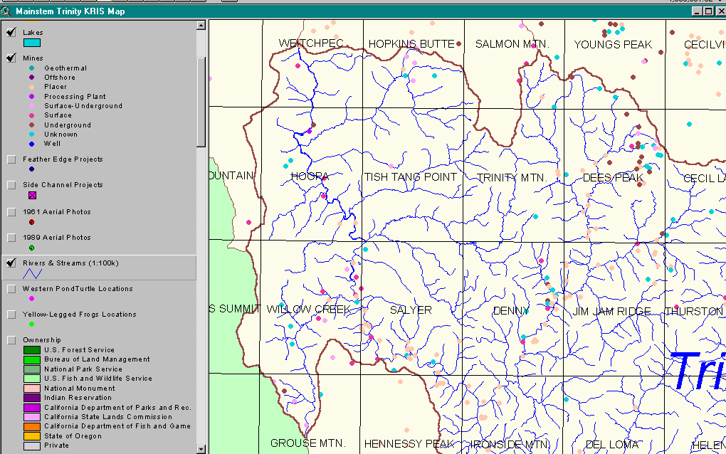 Click on image to enlarge (43K).
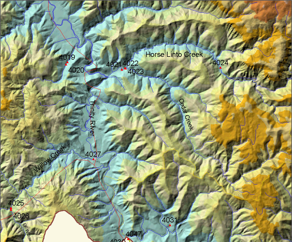 Click on image to enlarge (314K).
To learn more about this topic click Info Links
| www.krisweb.com |