
| Area | Lower Trinity/Basin-wide |
| Topic | Tour: Post January 1997 Storm Photos of Tributary Mouths |
This photo Mill Creek just upstream of the Highway 96 Bridge. High flows during the January 1997 storm caused large amounts of sediment transport but the alder riparian zone in this reach was not scoured. The terrace at left provided flood relief. Flood debris at right, which is mostly small wood, still partially obstructs the channel. Photo by Pat Higgins. January 1997.
This photo was taken in mid-January 1997 and shows excavation at the mouth of Mill Creek downstream of the Highway 97 Bridge. The terrace at the mouth of Mill Creek after the January 1997 flood was approximately 300 feet wide. This indicates that the storm precipitated elevated sediment levels. Photo by Pat Higgins.
This photo was taken from the new Highway 96 Bridge over Hostler Creek and shows the old highway bridge and the flood terrace from the January 1997 storm. This shot indicates massive aggradation and indicates major changes in watershed processes. The old highway bridge likely had substantial elevation above the stream bed one first constructed. It is likely that this "foot print" indicates severe cumulative watershed effects. Photo by Pat Higgins. January 1997.
This photo shows the mouth of Horse Linto Creek during the fall of 1997. Note the height of gravel terraces which indicate the height of transport in the January 1997 event. Note also that silty terraces shown in the January 1974 photo (Picture #5) now are vegetated with hardwoods. This indicates that flood damage in 1997 was no where near the impacts of the 1974 event. Photo by Pat Higgins.
This photo of the mouth of Horse Linto Creek above the Hoopa Indian Reservation was taken during high flows on January 17,1974. This was a very large regional storm event. Note the large deposit of sediment just up stream of the mouth of Horse Linto Creek. Photo courtesy of Russ Smith, Bureau of Reclamation.
 Click on image to enlarge (73K).
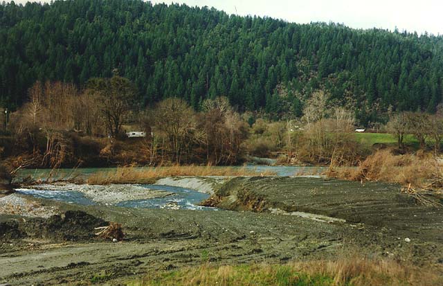 Click on image to enlarge (64K).
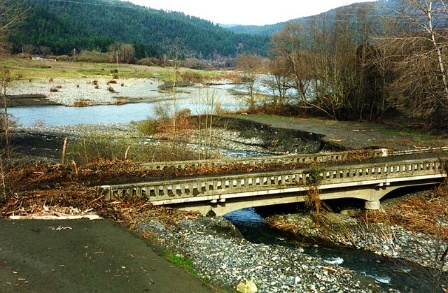 Click on image to enlarge (89K).
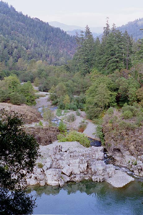 Click on image to enlarge (91K).
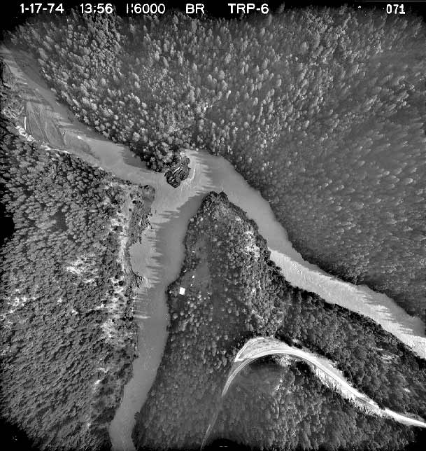 Click on image to enlarge (75K).
To learn more about this topic click Info Links
To view additional information (data source, aquisition date etc.) about this page, click Metadata
| www.krisweb.com |