| Area |
Middle Klamath |
| Topic |
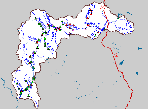
Map: Mid Klamath Water Quality Monitoring Sites (hotlinked) |
|
This is a map of the temperature monitoring sites in the Middle Klamath. Temperature monitoring sites shown in red are hotlinked
to charts. To view a chart, click on a red triangle. The Temperature Monitoring sites 2002 include all of the sites monitored by the
Karuk Tribe and the US Forest Service. The 2003 Monitoring Sites are only Karuk Tribe sites, some of which were not
monitored in previous years.
|
|
|
 |
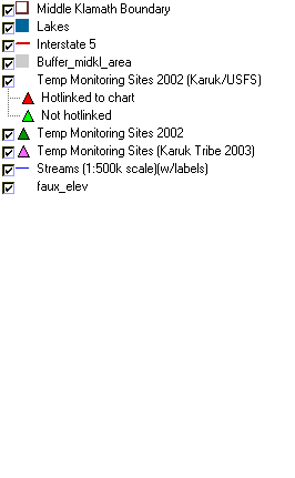 |
To view metadata about a map layer, click on a link in the table below.
