
| Area | Middle Klamath |
| Topic | Map: Mid Klamath West Marble Region Fire Perimeters |
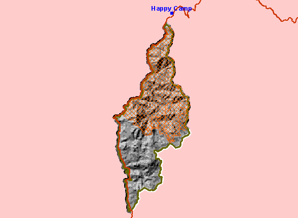
| This is a map of fire perimeters in the West Marble region. | |||
 |
 |
||
To view metadata about a map layer, click on a link in the table below.
| Name of Layer in Map Legend | Metadata File Name |
|---|---|
| Cities | kb_cities.shp.txt |
| Highway 96 | hwy_96.shp.txt |
| 200K_West_Marble_Buffer | 200k_west_marble_buffer.shp.txt |
| KNF Fires after 1950 | knf_mkfire.shp.txt |
| West Marble Area Boundary | west_marble.shp.txt |
| Elevation (in Meters) | mk_elev.tif.txt |
| Grey Hillshade | mk_hlshd.tif.txt |
| www.krisweb.com |