
| Area | Mainstem Klamath |
| Topic | Tour: Yurok Tribe Fisheries Staff at Work |
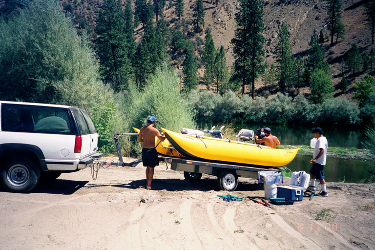
A Yurok crew getting ready for a day of Flow study related data collection at the Brown Bear site. Cross sections, total station measurements, substrate sampling, water temperature data and biosampling for habitat suitability are carried out to provide data to the Klamath River Flow Study being conducted by Dr. Thomas Hardy of Utah State University. Photo courtesy of Yurok Tribal Fisheries Program, Water Management and Rights Protection Division, Weitchpec, CA.
This photo shows the Yurok Tribe Fisheries Department staff setting up for cross section and flow measurement of the Klamath River just above Weitchpec. The data they collect will feed the PHABSIM model. The river's substrate in various cells will also be noted as part of the flow study. See Pictures #3 and #4 for more shots of the same activity. Photo courtesy of Yurok Tribal Fisheries Program, Water Management and Rights Protection Division, Weitchpec, CA.
Tim Hardin, Yurok Tribal fish biologist, holds position while Greg Bates, also with the Yurok Tribe, measures the water velocity and depth for river discharge. Photo courtesy of Yurok Tribal Fisheries Program, Water Management and Rights Protection Division, Weitchpec, CA.
Jeremiah Jackson holds the boat steady with the outboard while Greg Bates continues to take measurements. Photo courtesy of Yurok Tribal Fisheries Program, Water Management and Rights Protection Division, Weitchpec, CA.
This photo shows a team made up of U.S. Fish and Wildlife staff and a Hoopa Tribe fisheries biologist participating in the cooperative flow study by doing substrate mapping at Rogers Creek on the mainstem Klamath River. This is the same location as the total station mapping being carried out by the Yurok Tribe. Photo courtesy of Yurok Tribal Fisheries Program, Water Management and Rights Protection Division, Weitchpec, CA.
This photo shows the Klamath River at the Tree of Heaven total station monitoring site. This edge habitat was noted to be extremely productive for Chinook salmon juveniles early in the season but productivity dropped as flows decreased and the river warmed. Photo courtesy of Yurok Tribal Fisheries Program, Water Management and Rights Protection Division, Weitchpec, CA.
 Click on image to enlarge (156K).
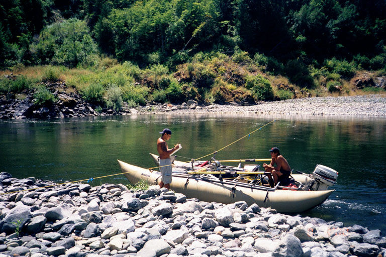 Click on image to enlarge (167K).
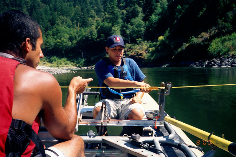 Click on image to enlarge (120K).
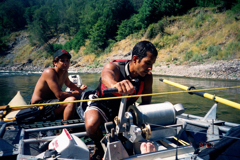 Click on image to enlarge (148K).
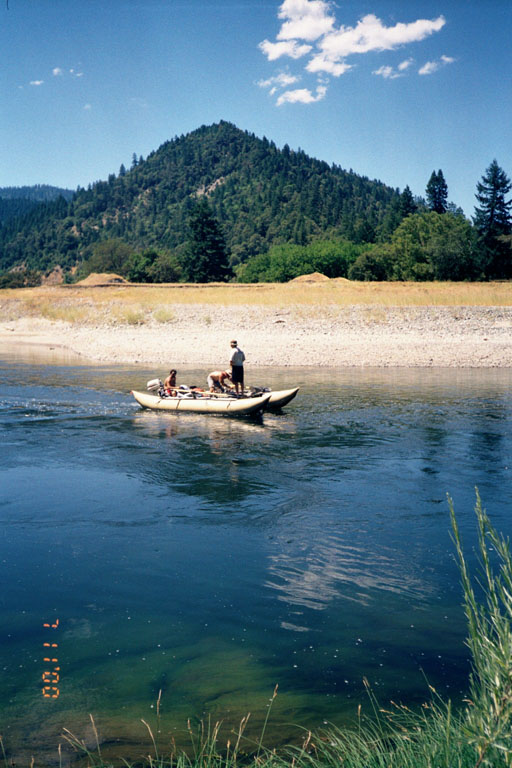 Click on image to enlarge (111K).
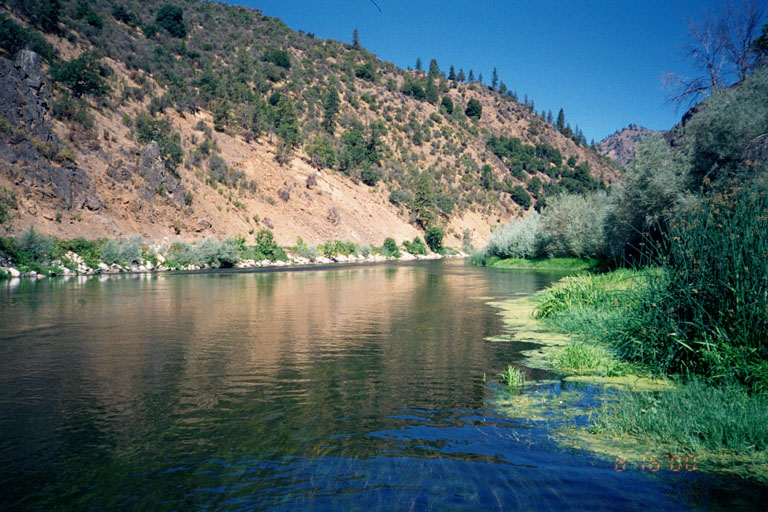 Click on image to enlarge (145K).
To learn more about this topic click Info Links
To view additional information (data source, aquisition date etc.) about this page, click Metadata
| www.krisweb.com |