
| Area | Mainstem Klamath |
| Topic | Tour: OSU Forward Looking Infrared Radar Results #1 |
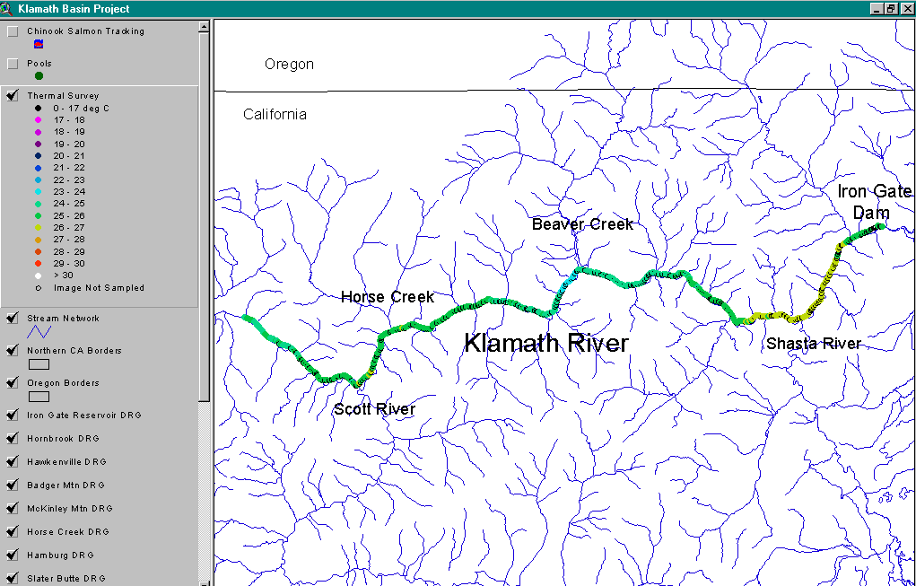
This map shows the thermal signatures for the entire reach surveyed by the Oregon State University Forward Looking Infrared Radar (FLIR) study of the Klamath River which was conducted in July 1996. OSU supplied the ArcView project, and full information about their study is available by clicking on Info Links. The temperature regime of the Klamath shows a pattern of increase from just below Iron Gate Dam to below the mouth of the Shasta River. Temperatures moderate from about Humbug Creek to below Beaver Creek. The Klamath warms from Horse Creek to the mouth of the Scott but the Scott River cools the Klamath again. See the rest of this slide Tour and the next for specific location images from the upper limit of the survey area, the mouth of the Shasta, the mouth of Beaver and Horse creeks and the mouth of the Scott River.
This USGS topographic map image shows the mouth of the Scott River as it meets the Klamath River. Image from Oregon State University ArcView FLIR project. See Pictures #3 and #4 for corresponding video and FLIR images for this location. Click on Info Links for more information.
Mouth of the Scott River image in normal video color taken as part of the OSU FLIR study. See Picture #4 for the FLIR image of the same location. Click on Info Links for more information.
This is a thermal Forward Looking Infrared Radar Image (FLIR) showing the confluence of the Klamath River (flowing from the top to bottom of the image) and the Scott River (flowing in from the right). The Klamath River is between 26 - 27 degrees C before the confluence with the Scott River. The Scott River surface temperatures appear to range from 23-24.9 C and the river's volume seems sufficient to moderate the temperature of the mainstem Klamath. Image from Oregon State University ArcView FLIR project. Click on Info Links for more information.
This USGS topographic map image shows the mouth of the Shasta River as it meets the Klamath River. Image from Oregon State University ArcView FLIR project. See Pictures #7 and #8 for corresponding video and FLIR images for this location. Click on Info Links for more information.
Mouth of the Shasta River in aerial video image with real color. See Picture #7 for FLIR of same location. For more information on the Oregon State University FLIR study, click on Info Links.
Thermal Forward Looking Infrared Radar Image (FLIR) showing the confluence of the Klamath River (flowing from the top of the image to the bottom of the image) and the Shasta River (flowing right to left in the image). The Shasta River is approximately 29 degrees C and a warm water plume is observed in the Klamath River below. The rock outcropping on the right side of the image shows temperature differences due to variations in sun exposure angles. Image from Oregon State University ArcView FLIR project. Click on Info Links for more information.
USGS topographic map image shows the mouth of Beaver Creek as it meets the Klamath River. Image from Oregon State University ArcView FLIR project. Click on Info Links for more information. See the first Picture in the next Topic (click forward arrow at upper right) for a video image of this area and see Picture #2 of the next series for a FLIR Image.
 Click on image to enlarge (36K).
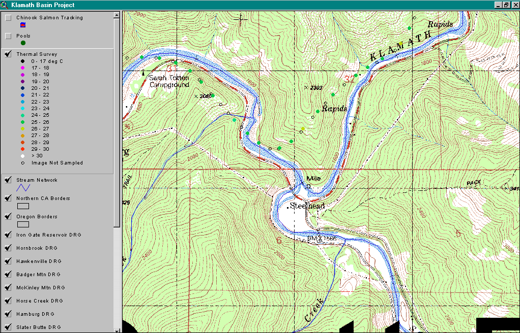 Click on image to enlarge (104K).
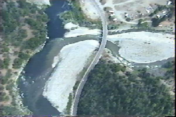 Click on image to enlarge (92K).
 Click on image to enlarge (80K).
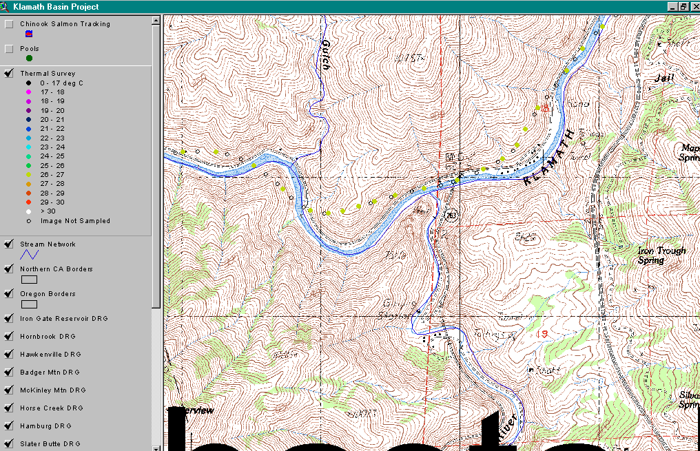 Click on image to enlarge (111K).
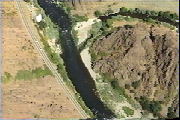 Click on image to enlarge (103K).
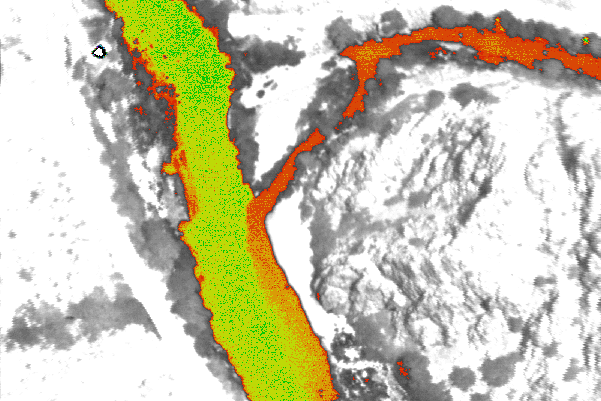 Click on image to enlarge (114K).
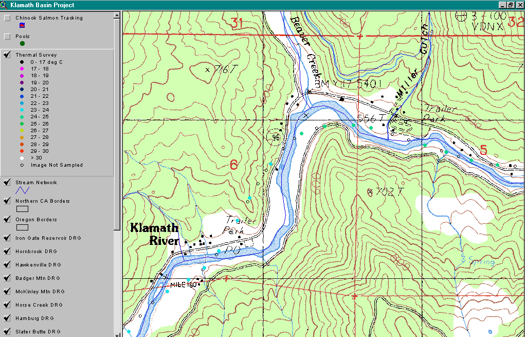 Click on image to enlarge (79K).
To learn more about this topic click Info Links
To view additional information (data source, aquisition date etc.) about this page, click Metadata
| www.krisweb.com |