
| Area | Mainstem Klamath |
| Topic | Tour: OSU Forward Looking Infrared Radar Results #2 |
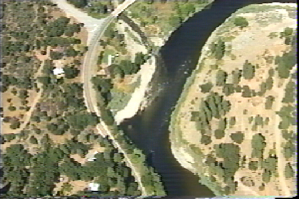
The image above is a true color aerial video image of the convergence of Beaver Creek and the Klamath River taken from the Oregon State University Forward Looking Infrared Radar (FLIR) ArcView project. See Picture #2 for the matching FLIR image. Click Info Links for more information.
A thermal Forward Looking Infrared Radar (FLIR) image showing the confluence of the Klamath River with Beaver Creek. Beaver Creak is approximately 2 - 3 degrees C cooler then the river. Surface temperatures of Beaver Creek range from 20-23 C while the Klamath from 23-26 C. The mouth of Beaver Creek is a thermal refugia that is used by cold water fish species during the summer months. For more information on the Oregon State University FLIR study, click on Info Links.
This is a USGS topographic map image taken from the Oregon State University FLIR ArcView project. The image shows the Klamath River just downstream of Iron Gate Dam in the vicinity of Klamathon. This was the upper extent of the OSU FLIR study. See Pictures #4 and #5 for corresponding video and FLIR images for this area. Click on Info Links for more information.
This true color aerial video image is part of the OSU FLIR study and captured for use in KRIS from the OSU ArcView project. It shows the Klamath River above the Ager-Beswick Road at Klamathon at the upper limit of the FLIR survey. See Picture #5 for the FLIR image of the same location. Click on Info Links for more information.
A thermal Forward Looking Infrared Radar Image (FLIR) showing the Klamath River at the upper limit of the OSU survey. Thermal images indicate surface temperatures of 25-26.9 C with warmer water on the margins. Click on Info Links for more information.
This is a USGS topographic map image of the convergence of Horse Creek and the Klamath River taken from the Oregon State University Forward Looking Infrared Radar (FLIR) ArcView project. See Picture #7 for video close up and Picture #8 for FLIR image. Click Info Links for more information.
This is a true color aerial video image of the convergence of Horse Creek and the Klamath River taken from the Oregon State University Forward Looking Infrared Radar (FLIR) ArcView project. Click Info Links for more information.
A thermal Forward Looking Infrared Radar Image (FLIR) showing the confluence of the Klamath River (flowing from the top of the image to the bottom of the image) and Horse Creek (flowing left to right in the image). Horse Creek is showing surface temperatures of approximately 20-23 degrees C with a thermal plume extending into the Klamath of 22-23 degree C water. The Klamath River itself shows surface temperatures of 25-26.9 C with warmer water on the margins. Image from Oregon State University ArcView FLIR project. Click on Info Links for more information.
 Click on image to enlarge (110K).
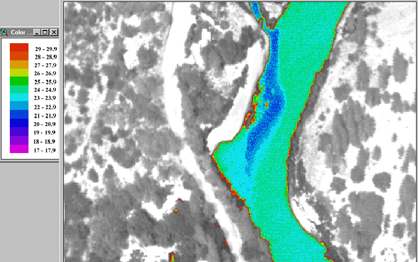 Click on image to enlarge (132K).
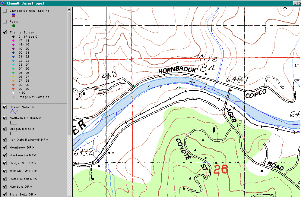 Click on image to enlarge (54K).
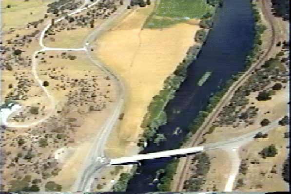 Click on image to enlarge (33K).
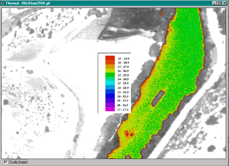 Click on image to enlarge (92K).
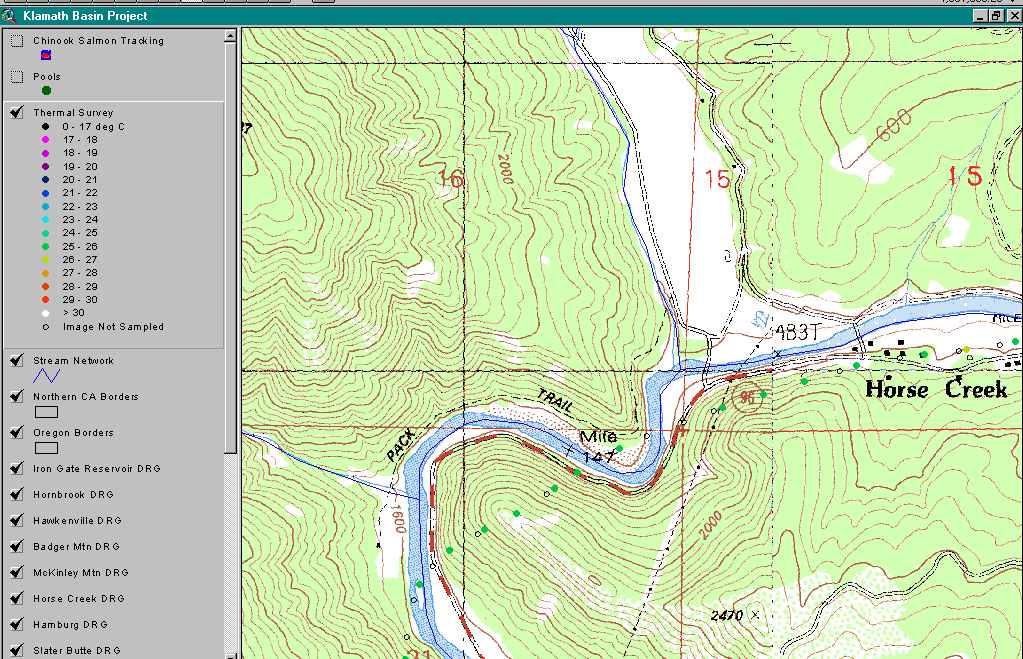 Click on image to enlarge (83K).
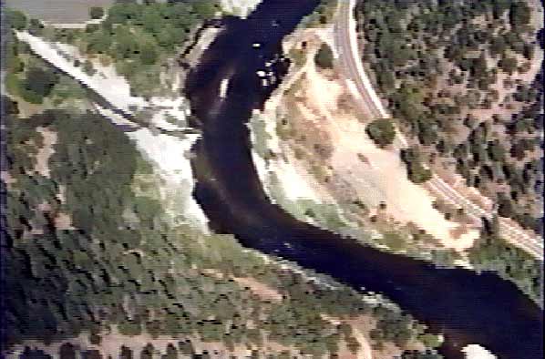 Click on image to enlarge (38K).
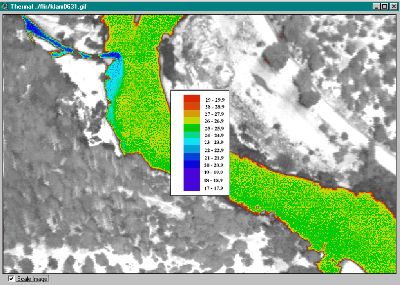 Click on image to enlarge (128K).
To learn more about this topic click Info Links
To view additional information (data source, aquisition date etc.) about this page, click Metadata
| www.krisweb.com |