
| Area | Mainstem Trinity |
| Topic | Tour: Maps of Changes in Riparian Zone 1960-1989 |
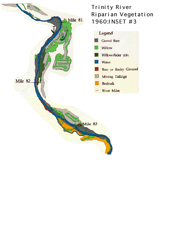
Note the wide area of vegetation marked by the active flood plain of the river in 1960. Dramatic changes can be noted with post dam conditions by clicking on picture #2 above. Compare river widths and vegetation and cover types around river mile 81 and 83 markers. The working electronic map can be found in KRIS Map as an ArcView coverage derived from work by Randy Wilson and others at the USFS' Redwood Sciences Lab in Arcata. Wilson's paper is in the KRIS Bibliography in the Trinity section and can also be accessed through Info Links tab.
After Trinity Dam was constructed, flows were restricted and a narrow band of thick, riparian vegetation grew up which constricted the river. Not how much narrower the 1989 map is as opposed to the 1960 map. The narrow deep channel makes for poor rearing habitat for juvenile Chinook salmon. This map can be found in the KRIS MAP Trinity ArcView project. It is derived from work by Randy Wilson and others at the USFS' Redwood Sciences Lab in Arcata (see Info Links).
 Click on image to enlarge (53K).
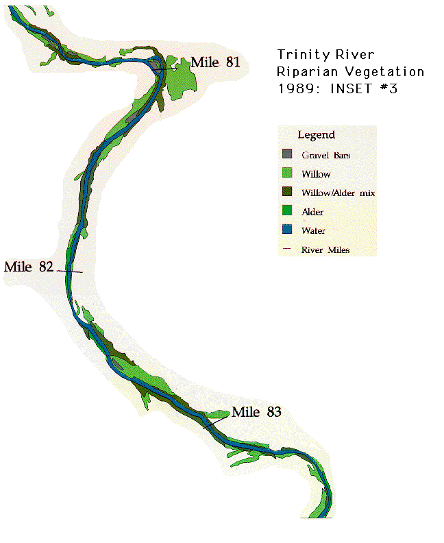 Click on image to enlarge (51K).
To learn more about this topic click Info Links
To view additional information (data source, aquisition date etc.) about this page, click Metadata
| www.krisweb.com |