
| Area | Mainstem Trinity |
| Topic | Tour: Historical Aerial Comparisons 1961/1975/1989 |
Aerial photograph of the Trinity River at Junction City. Note the open nature of the gravel bar. Click on Picture #2 above to see the same site in 1975. Photos provided by the Bureau of Reclamation.
This aerial photograph taken of the Trinity River at Junction City in 1975 shows substantial encroachment on the stream channel by willows and alders because of lack of scouring flows after dam construction. This photo was scanned from a poster board at DWR in Red Bluff. The line in the middle of the photo is where two aerial photos were joined. Photos provided by the Bureau of Reclamation.
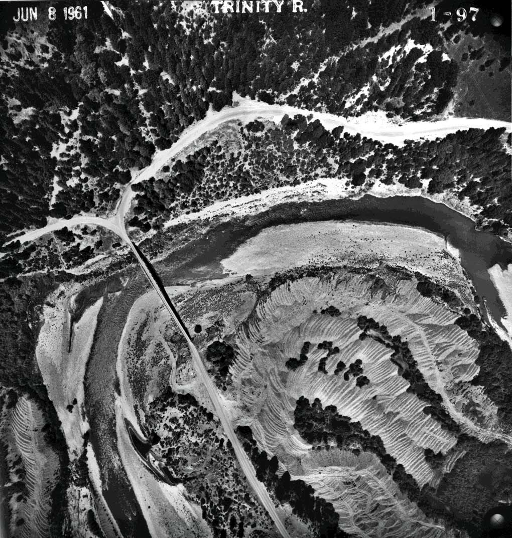
Aerial photo of Canyon Creek joining the Trinity River taken on June 8, 1961. Click on Picture #4 to compare with photos taken in 1975. Photos provided by the Bureau of Reclamation.
Aerial photo mosaic of Canyon Creek joining the Trinity River at Junction City taken in 1975. Only sparse riparian vegetation is encroaching on the river below Canyon Creek. The delta of Canyon Creek. Photos provided by the Bureau of Reclamation.
Aerial photo of Indian Creek joining the Trinity River taken on June 8, 1961. Note the braided channel of Indian Creek itself at the mouth, indicating recent deposition and the unvegetated nature of the Trinity River gravel bar. Click on Picture #6 to compare with a photo taken in 1989. Photos provided by the Bureau of Reclamation.
Aerial photograph of the mouth of Indian Creek and the Trinity River taken in 1989. Note the substantial increase in riparian vegetation along the Trinity mainstem, including the delta of Indian Creek. This photo was taken in the middle of a drought cycle which in part explains the lack of scour or deposition by Indian Creek itself. Photos provided by the Bureau of Reclamation.
This June 8, 1961 aerial photo shows the Trinity River downstream of Lewiston Dam, near the town of Lewiston. Photos provided by the Bureau of Reclamation.
This aerial photo is of the Trinity River at Lewiston in 1989. Photos provided by the Bureau of Reclamation.
 Click on image to enlarge (198K).
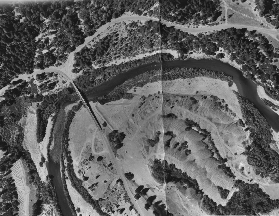 Click on image to enlarge (239K).
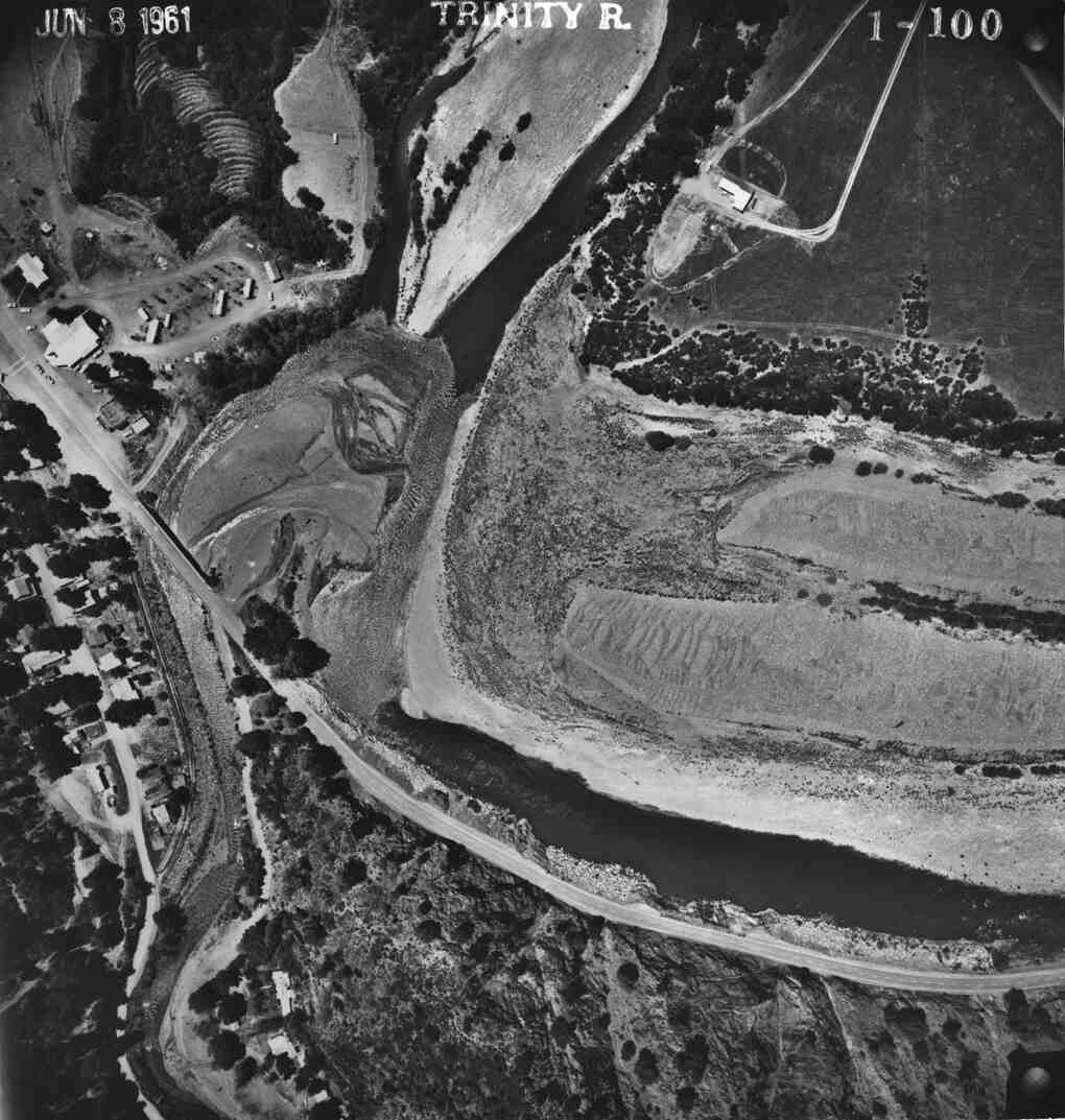 Click on image to enlarge (101K).
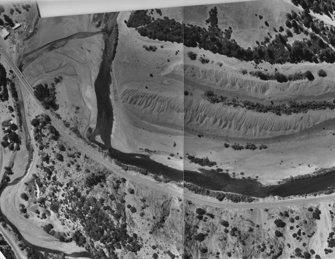 Click on image to enlarge (217K).
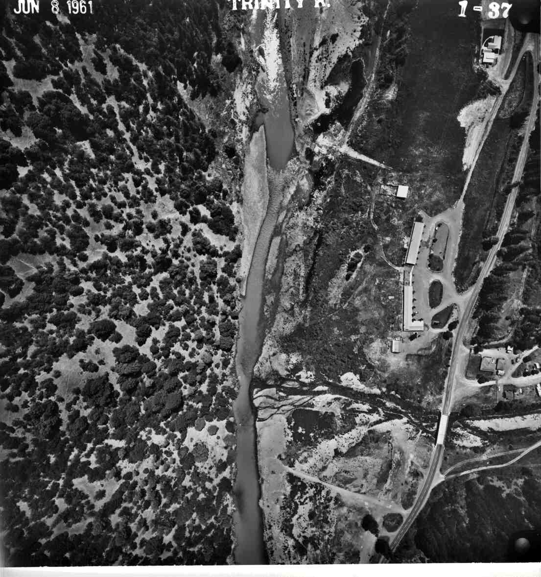 Click on image to enlarge (131K).
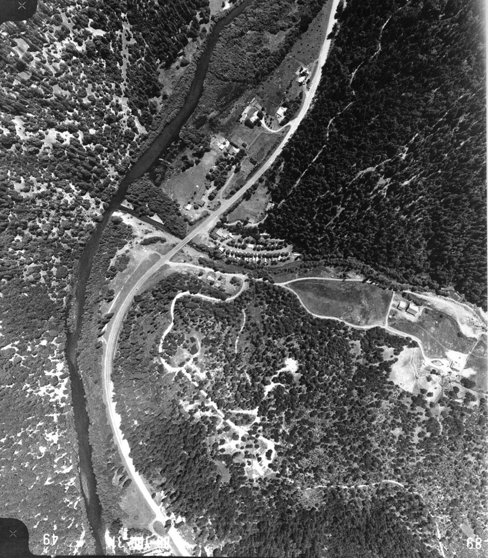 Click on image to enlarge (373K).
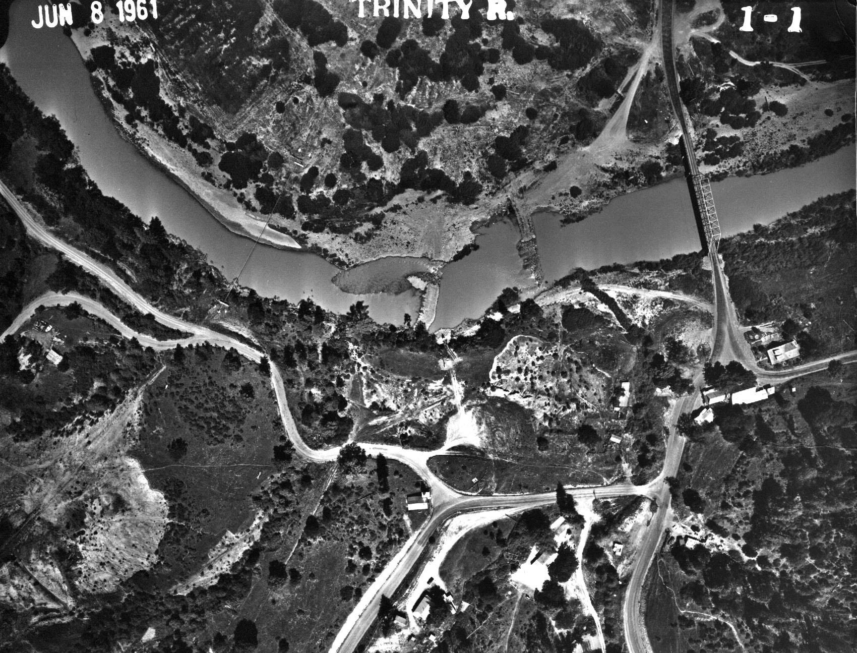 Click on image to enlarge (559K).
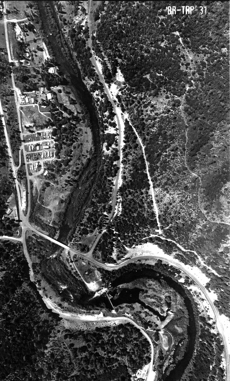 Click on image to enlarge (290K).
To learn more about this topic click Info Links
To view additional information (data source, aquisition date etc.) about this page, click Metadata
| www.krisweb.com |