
| Area | Mainstem Trinity |
| Topic | Tour: Historical Aerial Photos 1961 |
Aerial photo of the Trinity River at Junction City on June 8, 1961 before the construction of Trinity and Lewiston Dams. Note that there is very little riparian vegetation on the flood plain of the Trinity River. Photos provided by the Bureau of Reclamation.
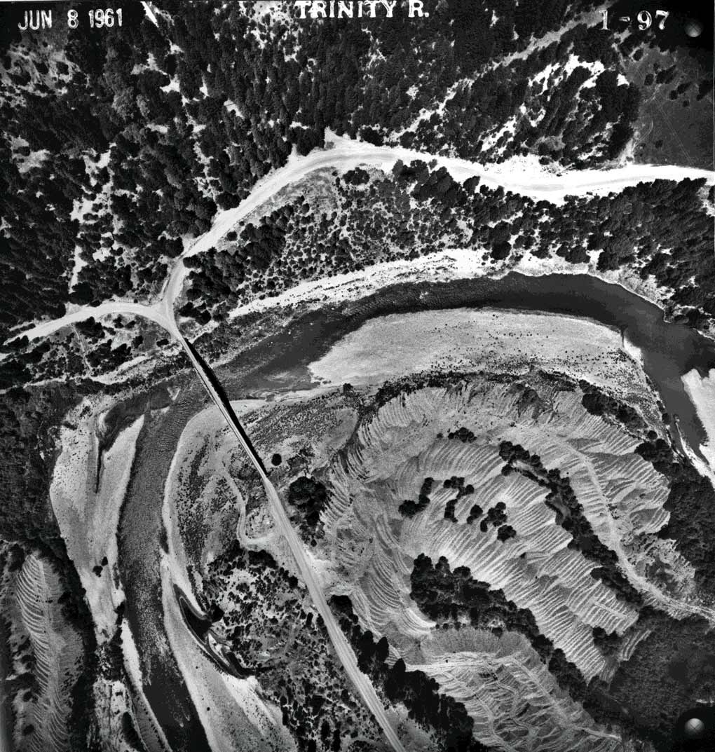
The Trinity River at Lewiston is depicted above with the mouth of Rush Creek at the bottom left in the photo. Note the very open and sparsely vegetated nature of the gravel bar. Photos provided by the Bureau of Reclamation.
Aerial photo of the Trinity River at the mouth of Rush Creek taken on June 8, 1961. Photos provided by the Bureau of Reclamation.
Aerial photo of the Trinity River below Lewiston taken on June 8, 1961 with a natural side channel. Photos provided by the Bureau of Reclamation.
Aerial photograph of the Trinity River and the mouth of Grass Valley Creek taken on June 8, 1961. Note the large delta form at the mouth of Grass Valley Creek, including recent depositions extending into the active channel of the Trinity. Photos provided by the Bureau of Reclamation.
Aerial photo of Indian Creek joining the Trinity River taken on June 8, 1961. Note the braided channel of Indian Creek itself at the mouth, indicating recent deposition and the unvegetated nature of the Trinity River gravel bar. Photos provided by the Bureau of Reclamation.
Aerial photograph of the Trinity River at Douglas City on June 8, 1961 with Weaver Creek entering from the right. Photos provided by the Bureau of Reclamation.
The mainstem Trinity River at Helena as seen from an aerial photograph taken on June 8, 1961 with the North Fork Trinity entering from the left. Note the lack of vegetation on the gravel bar in the upper central part of photo. Photos provided by the Bureau of Reclamation.
 Click on image to enlarge (198K).
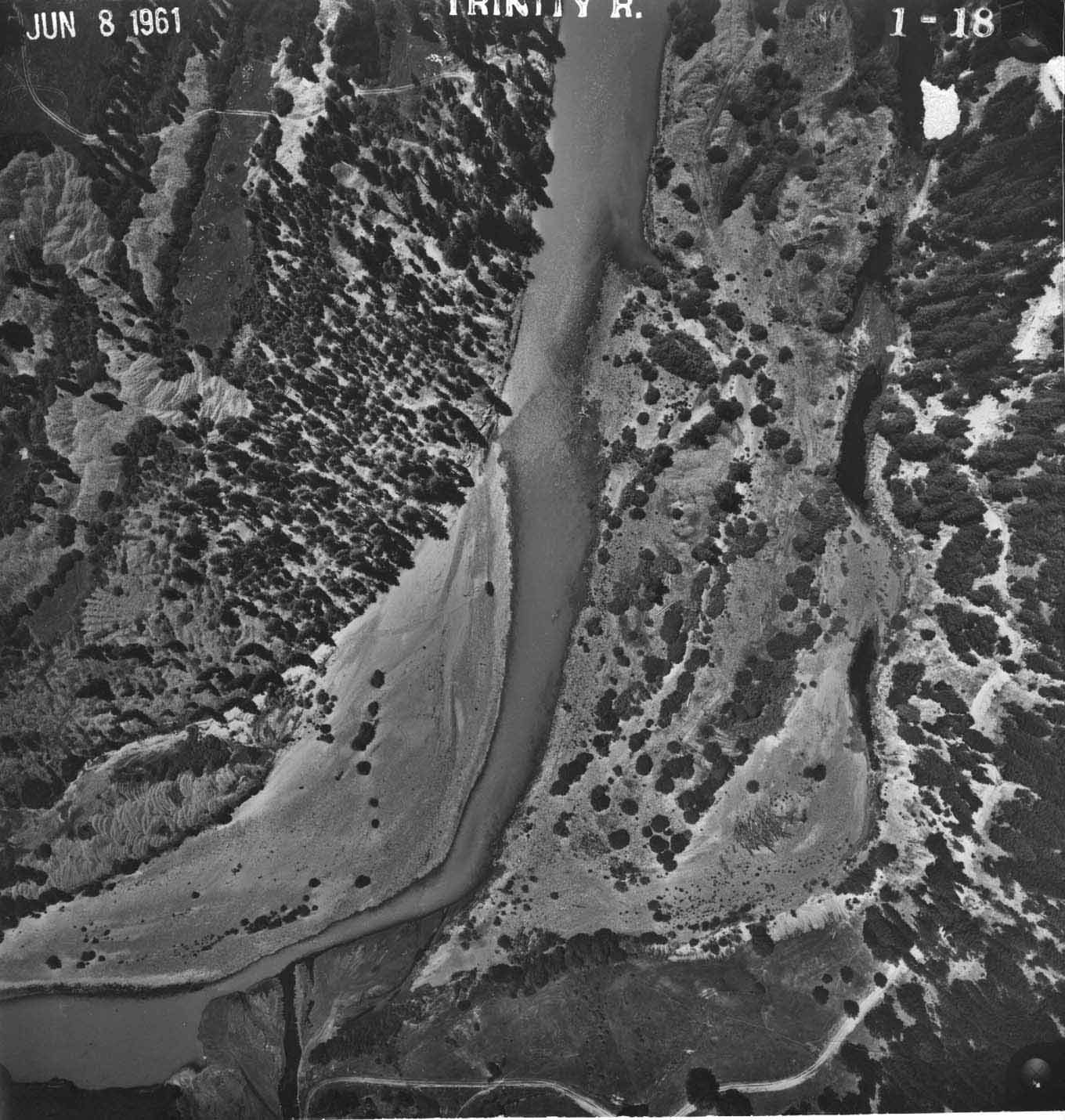 Click on image to enlarge (200K).
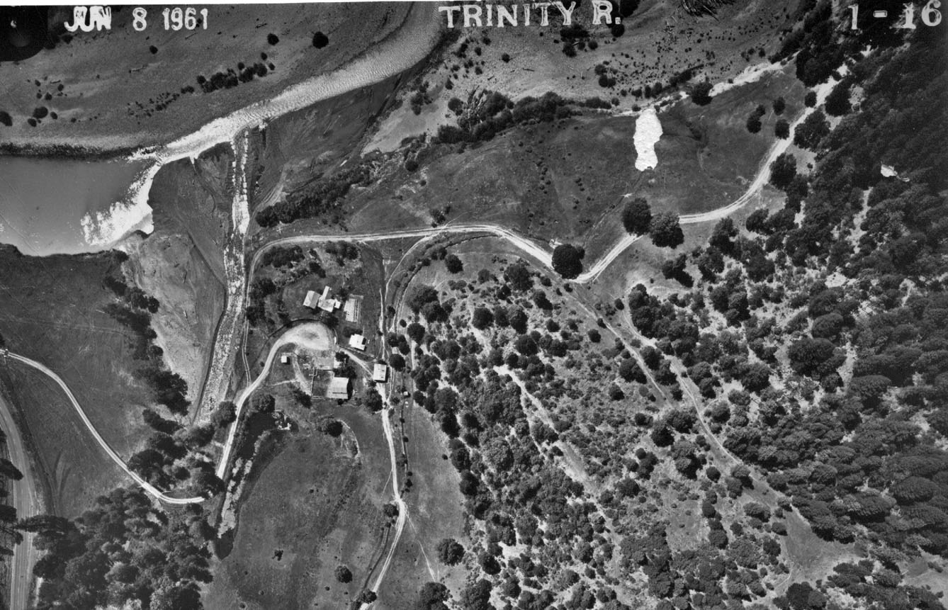 Click on image to enlarge (259K).
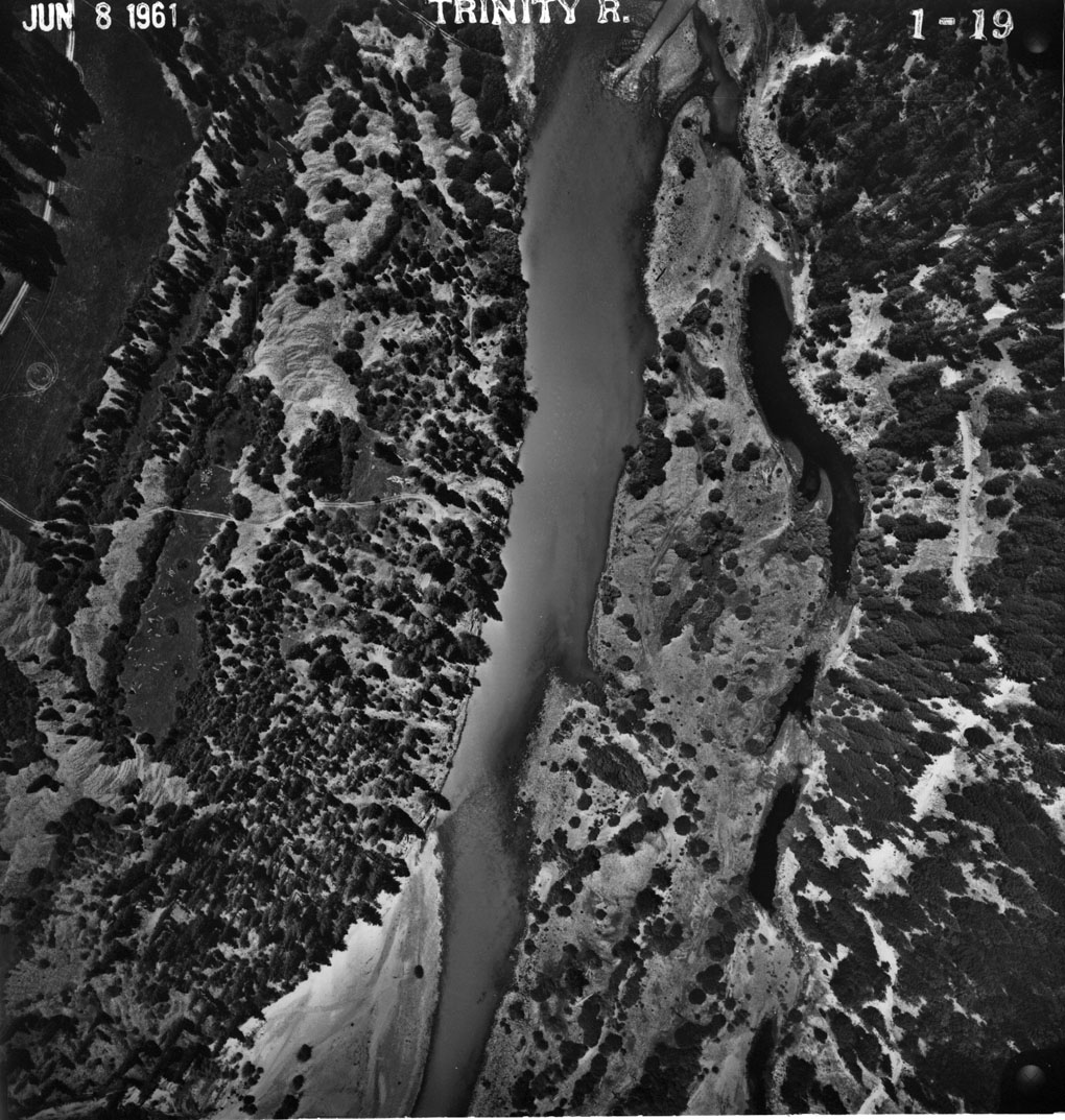 Click on image to enlarge (304K).
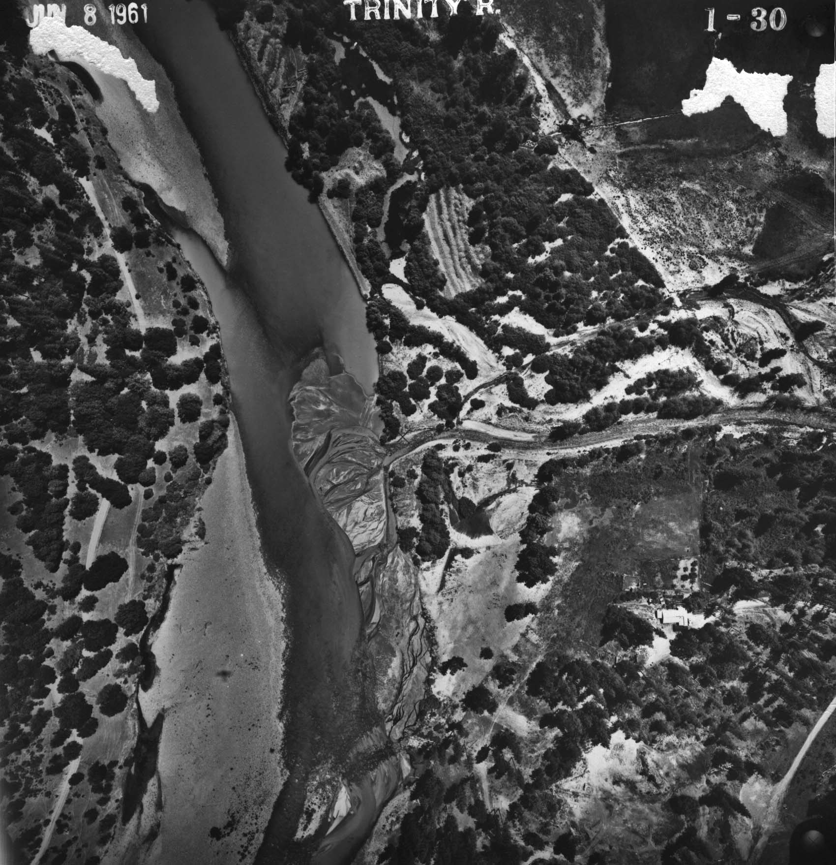 Click on image to enlarge (332K).
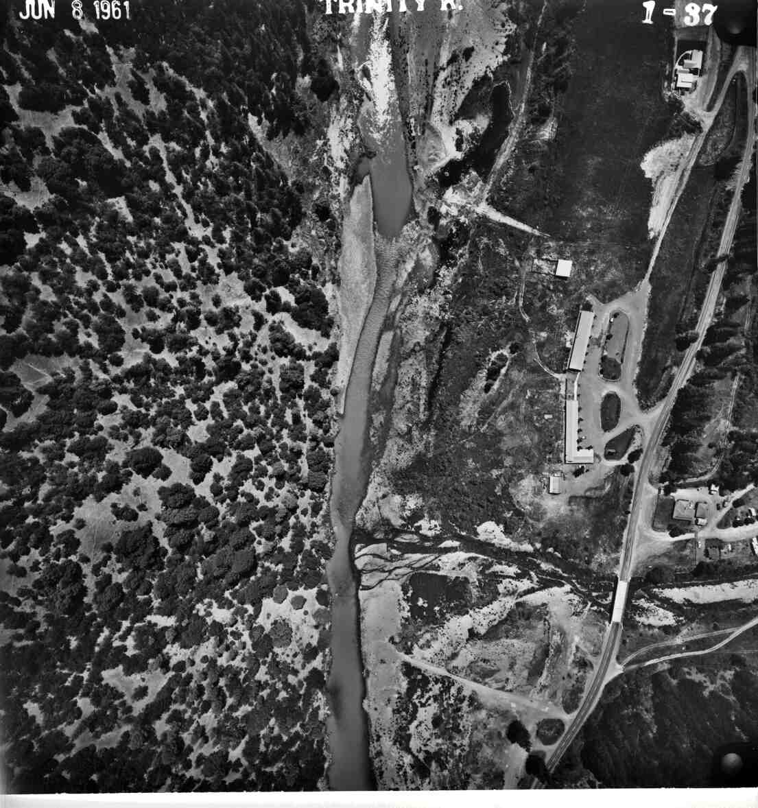 Click on image to enlarge (131K).
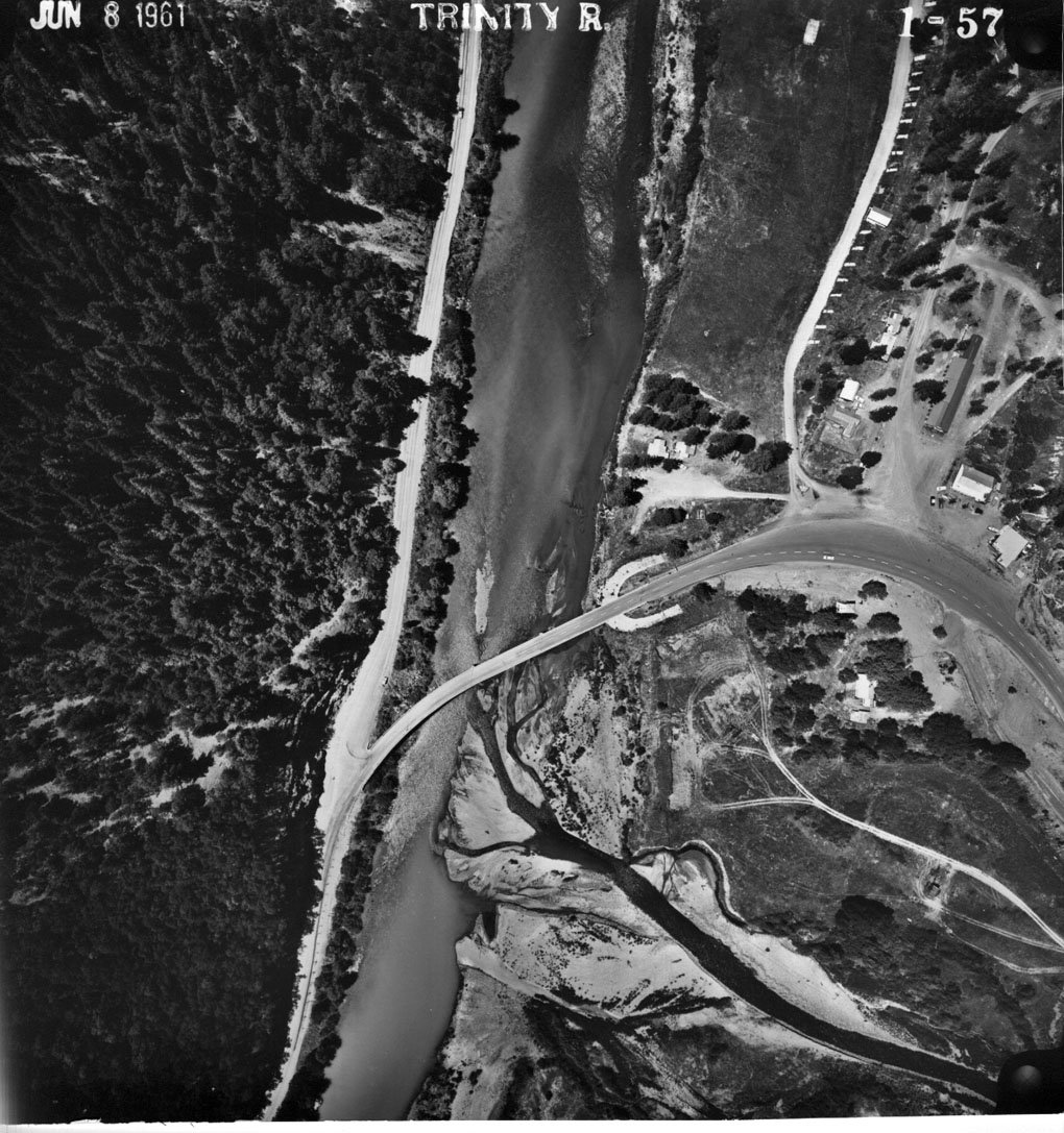 Click on image to enlarge (289K).
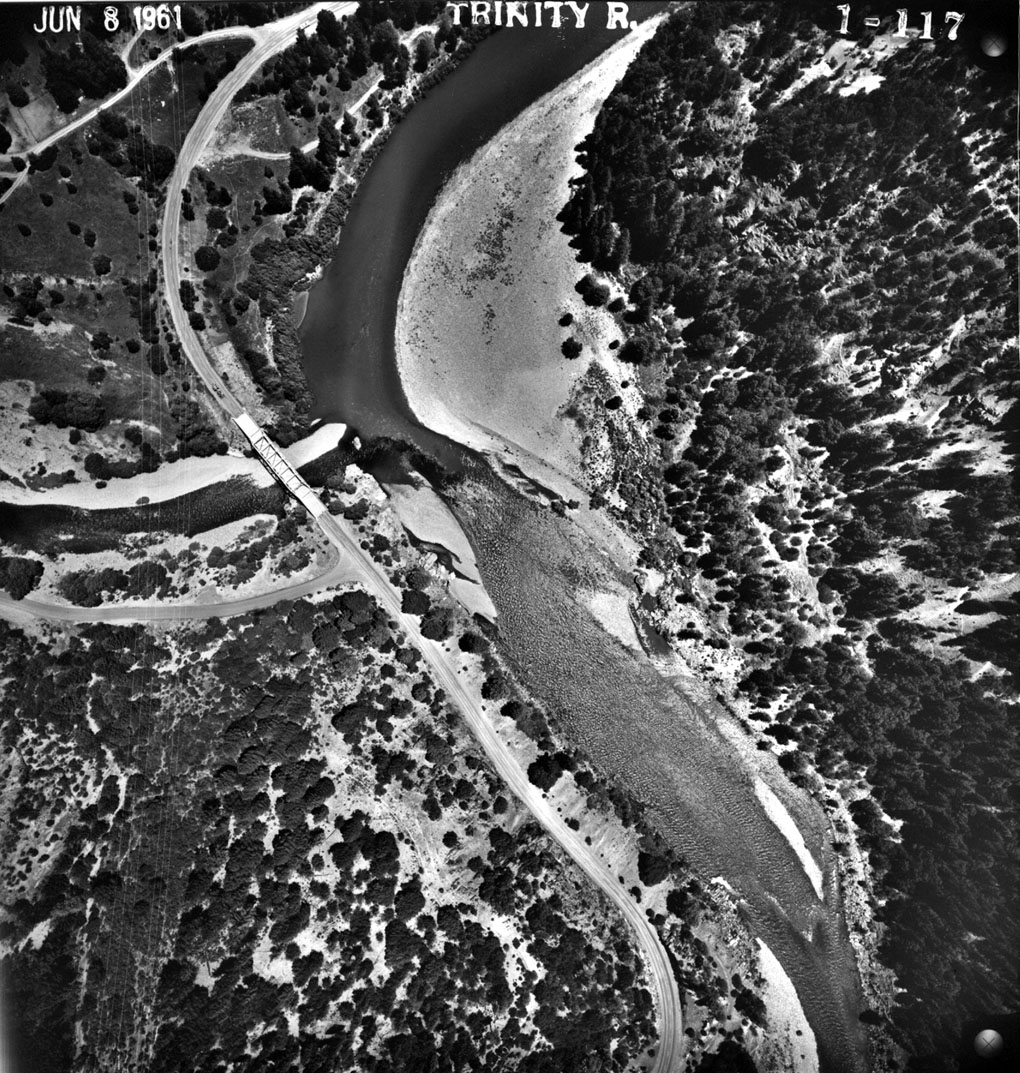 Click on image to enlarge (374K).
To learn more about this topic click Info Links
To view additional information (data source, aquisition date etc.) about this page, click Metadata
| www.krisweb.com |