
| Area | Mainstem Trinity |
| Topic | Tour: Historical Aerial Photos 1974 |
Convergence of Weaver Creek and the Trinity River at Douglas City on January 17, 1974. Photos provided by the Bureau of Reclamation.
The Trinity River near Salt Flat on January 17, 1974 at 14,000 cfs. Note homes on left bank threatened by flood waters. Photos provided by the Bureau of Reclamation.
The convergence of Indian Creek and the Trinity River on January 17, 1974. Photos provided by the Bureau of Reclamation.
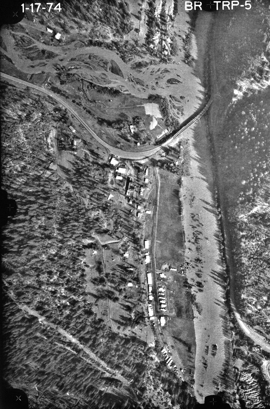 Click on image to enlarge (305K).
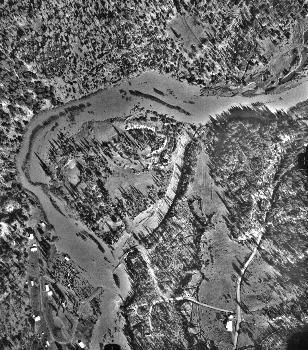 Click on image to enlarge (454K).
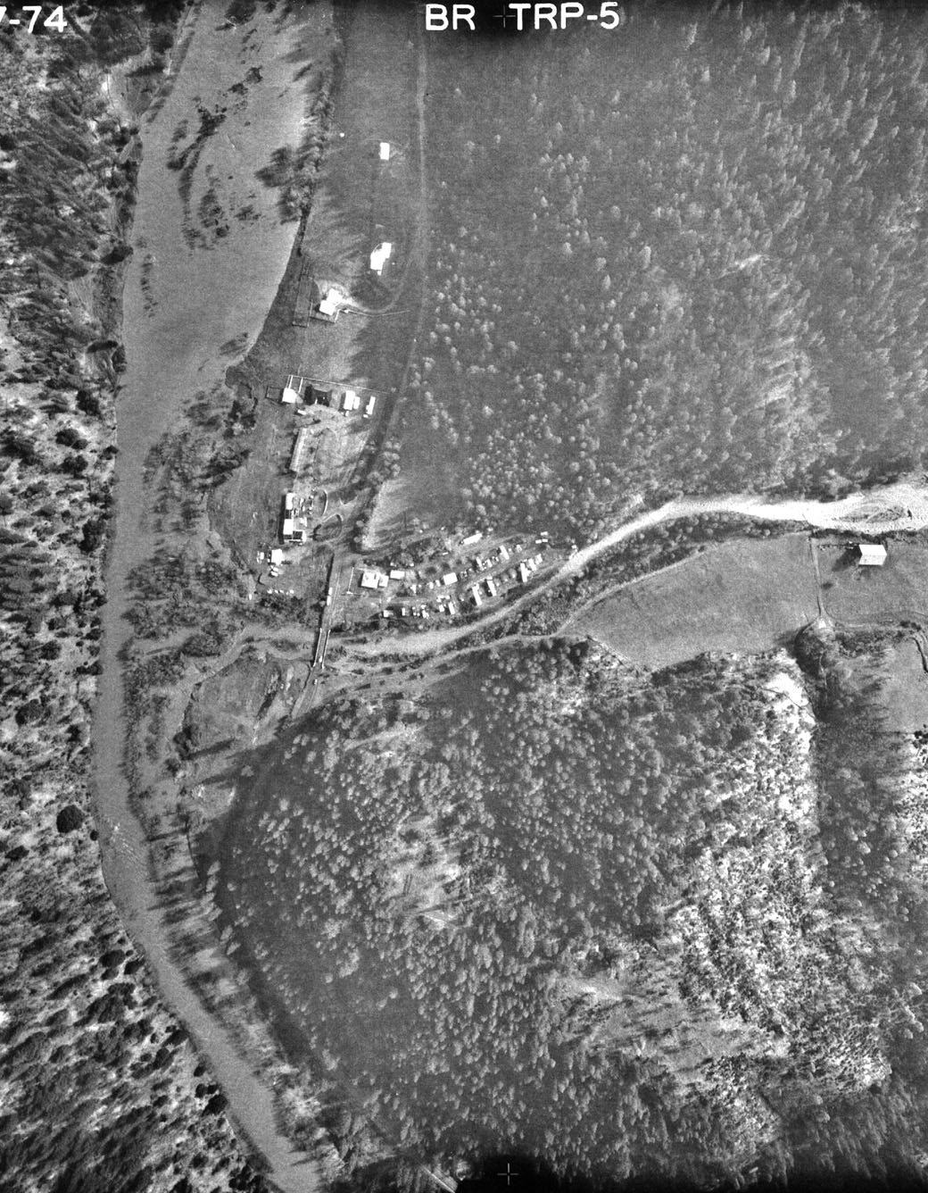 Click on image to enlarge (332K).
To learn more about this topic click Info Links
To view additional information (data source, aquisition date etc.) about this page, click Metadata
| www.krisweb.com |