
| Area | Mainstem Trinity |
| Topic | Tour: Monitoring Gravel Quality |
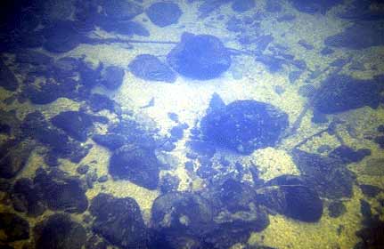
Embedded gravel and cobble just upstream of the Lime Kiln Side Channel in the Trinity River. Note blond colored, decomposed granitic sands clogging interstitial spaces. Such high levels of fine sediment make for very poor salmon and steelhead spawning habitat. Lack of interstitial space reduces habitat for aquatic insects and decreases steelhead juvenile rearing habitat. Juvenile steelhead will burrow into the substrate of a clean cobble bedded stream during periods of severe cold in winter. Photo taken October 14, 1993. Photos provided by the U.S. Fish and Wildlife Service.
Fishery biologists and hydrologists often measure fine sediment in stream bed gravels to gauge suitability for salmon and steelhead. Sampling sites should be areas preferred by salmon and steelhead for spawning such as riffles or pool tail crests. Above a U.S. Fish and Wildlife Service biologist collects gravel with a McNeil sampler in the Rush Creek Side Channel. 9/89. Photos provided by the U.S. Fish and Wildlife Service.
A McNeil sample is taken by driving a cylinder into the gravel bed and extracting a core. Several samples across a riffle area are taken so that the sample taken is truly representative. Photos provided by the U.S. Fish and Wildlife Service.
Sediment inside the McNeil sampler is sacked and taken to the lab where it is sieved for analysis to determine particle size distribution (see Chart in this section on McNeil samples taken on the Trinity River). Photos provided by the U.S. Fish and Wildlife Service.
Fall Chinook spawning off the mouth of the Brown's Mountain II Side Channel, despite high levels of fine sediment as indicated by blonde color of stream bottom. Sept. 1993. Photos provided by the U.S. Fish and Wildlife Service.
An aerial photo of the mouth of Grass Valley Creek shows a large delta of decomposed granitic sands. Sand from Grass Valley Creek is a major contributor to impaired spawning and rearing conditions in the mainstem of the Trinity River below Lewiston Dam. Lack of natural flushing flows annually during spring has also made the river less able to flush fine sediment. Photos provided by the U.S. Fish and Wildlife Service.
This riffle in the Trinity River below the mouth of Grass Valley Creek shows extremely high embeddedness. This area would provide poor habitat for juvenile salmonids and spawning success here would be very low. Photos provided by the U.S. Fish and Wildlife Service.
Buck Horn Dam has been constructed on Grass Valley Creek to help catch sediment that would otherwise enter the Trinity River. Photos provided by the U.S. Fish and Wildlife Service.
 Click on image to enlarge (17K).
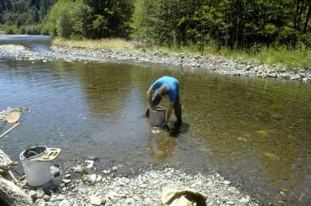 Click on image to enlarge (25K).
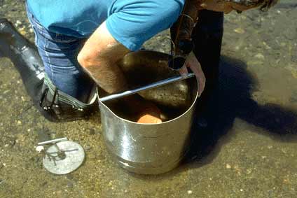 Click on image to enlarge (17K).
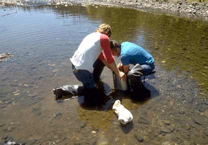 Click on image to enlarge (18K).
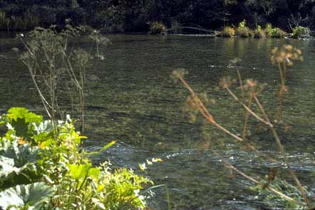 Click on image to enlarge (24K).
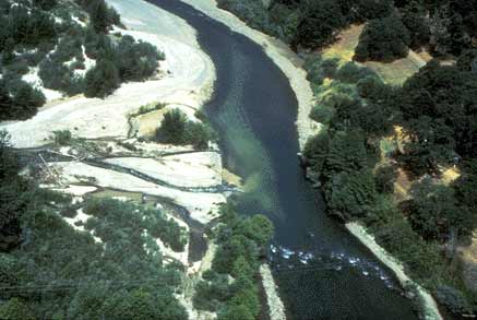 Click on image to enlarge (22K).
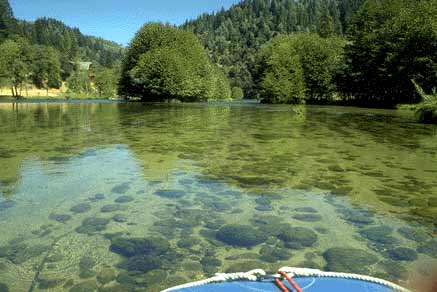 Click on image to enlarge (21K).
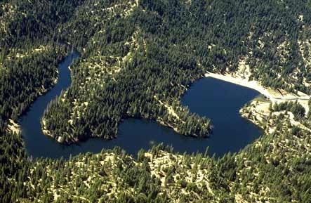 Click on image to enlarge (32K).
To learn more about this topic click Info Links
To view additional information (data source, aquisition date etc.) about this page, click Metadata
| www.krisweb.com |