
| Area | Mainstem Trinity |
| Topic | Tour: Restoration Pool Dredging Projects |
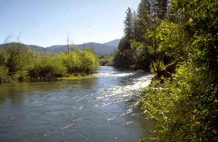
Cemetery Hole on the Trinity River just below Lewiston before dredging (9/89). Restricted depth of pools and lack of pool volume caused serious crowding of spring Chinook adults in the summer of 1988. Dredging helped increase pool holding habitat for adult salmon. High pre-spawn mortality of female Chinook salmon (CDFG, 1990) may have been related to over-crowding. Photos provided by the Bureau of Reclamation.
Dredging taking place at Cemetery Hole to increase pool volume for adult salmon and steelhead.The Trinity Program has since put more emphasis on preventing sediment from entering the main channel of the Trinity River and less emphasis on mechanical manipulation of the channel. 9/89. Photos provided by the Bureau of Reclamation.
Bucktail Pool with dredging just beginning. Berms were augmented for equipment access and then pulled back as dredging activities were completed. 9/89. Photos provided by the Bureau of Reclamation.
Dredging at Bucktail Hole to increase pool volume for adult salmon and steelhead holding areas. 9/89. Photos provided by the Bureau of Reclamation.
Bucktail Hole after dredging. 9/89. Photos provided by the Bureau of Reclamation.
Poker Bar Pool filled up with decomposed granite sands (note blonde sands at depth). 8/90. Photos provided by the Bureau of Reclamation.
Dredging of pool at Poker Bar. 8/90. Photos provided by the Bureau of Reclamation.
Dump truck being loaded by dredger at Poker Bar. All dredge spoils were taken to the upper terraces of the river above flood risk zones. 8/90. Photos provided by the Bureau of Reclamation.
 Click on image to enlarge (22K).
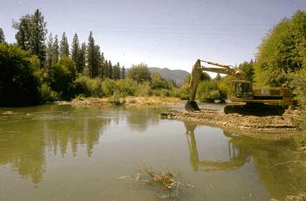 Click on image to enlarge (16K).
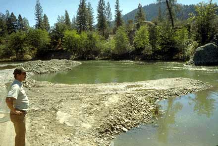 Click on image to enlarge (25K).
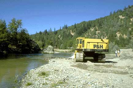 Click on image to enlarge (20K).
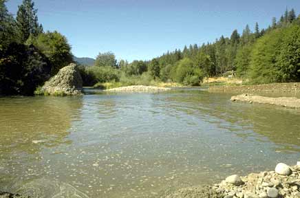 Click on image to enlarge (18K).
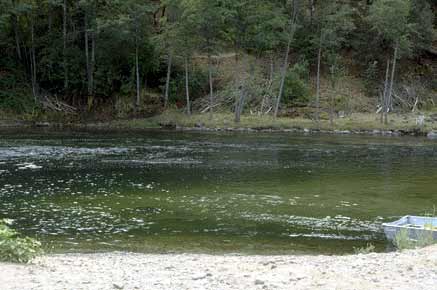 Click on image to enlarge (20K).
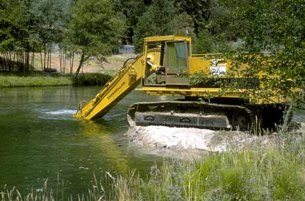 Click on image to enlarge (26K).
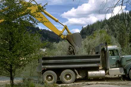 Click on image to enlarge (23K).
To learn more about this topic click Info Links
To view additional information (data source, aquisition date etc.) about this page, click Metadata
| www.krisweb.com |