
| Area | Middle Trinity |
| Topic | Wildfire: Wildfire by Association - Lower Middle Trinity 1910-2000 |
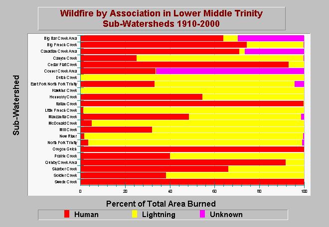
| Caption: This chart shows the ignition source of wildfires as a percent of the total are burned between 1910 and 2000 in each sub-watershed within the Lower Middle Trinity Planning Watershed. A large percentage of wildfires have been started by humans. Data are from Graham Matthews and Associates Trinity River Sediment Source Analysis (2001). See Info Links for more information. | |
 |
To learn more about this topic click Info Links .
To view additional information (data source, aquisition date etc.) about this page, click Metadata .
To view the table with the chart's data, click Chart Table web page.
To download the table with the chart's data, click fire_acres_lowermiddletrinity_gma_1910_2000.dbf (size 4,148 bytes) .
To view the table with the chart's source data, click Source Table web page.
To download the table with the chart's source data, click fire_acres_trinity_gma_1910_2000.dbf (size 11,732 bytes)
| www.krisweb.com |