
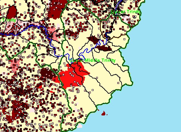
| Area | Middle Trinity |
| Topic | Wildfire: Wildfire by Association - Lower Middle Trinity 1910-2000 |
| This is a map of wildfires from 1910 to 2001 in the sub-watersheds of the Upper Middle Trinity Planning Watershed, displayed with Trinity River and sub-basin outlines. The Trinity County Resource Conservation District used data from Six Rivers and Shasta-Trinity National Forests to produce these layers for the Graham Matthews and Associates Trinity River Sediment Source Analysis (2001). | |||
 |
 |
||
To view metadata about a map layer, click on a link in the table below.
| Name of Layer in Map Legend | Metadata File Name |
|---|---|
| Sub-Watersheds (TCRCD-GMA) | tr_wsbnd.shp.txt |
| Planning Watersheds (TCRCD-GMA) | tr_stdy-areas.shp.txt |
| Subbasins (no labels) | subbasins_trin.shp.txt |
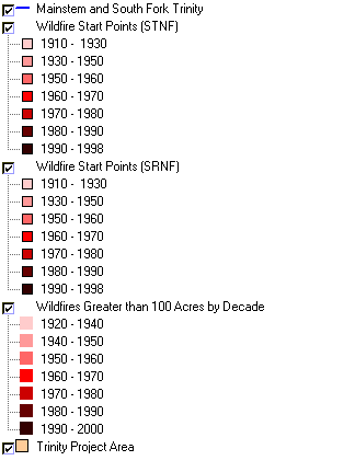
| Mainstem and South Fork Trinity | trin_riv.shp.txt |
| Wildfire Start Points (STNF) | stnf_frpts.shp.txt |
| Wildfire Start Points (SRNF) | srnf_frpts.shp.txt |
| Wildfires Greater than 100 Acres by Decade | tc_fires_100ac.shp.txt |
| Topographic Map (1:24k scale) | trinity.sid.txt |
| Topographic Map (1:24k scale) | trinity.sid.txt |
| Grayscale Hillshade of Elevation | grayscale30.tif.txt |
| Elevation (meters)(USGS)(TIFF) | elev30.tif.txt |
| Trinity Project Area | trin_outl.shp.txt |
| www.krisweb.com |