| Area |
Middle Trinity |
| Topic |
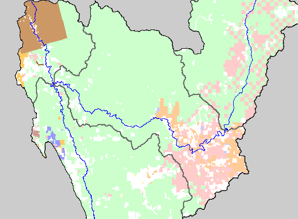
Map: 1F. Land Ownership, Middle Trinity Basin |
|
This is a map of the land ownership in the Middle Trinity sub-basin, displayed with KRIS sub-basins and the mainstem and South
Fork Trinity Rivers. The U.S. Forest Service (pale green) is the largest landowner in the sub-basin. Sierra Pacific Industries
(pale pink) and the U.S. Bureau of Land Management (pale yellow) own large tracks of land in the southeastern corner of the
basin. Data were contributed by the Trinity County Resource Conservation District.
|
|
|
 |
 |
To view metadata about a map layer, click on a link in the table below.
