
| Area | Middle Trinity |
| Topic | Tour: New River China Creek #1 Stream Survey Maps and Photos |
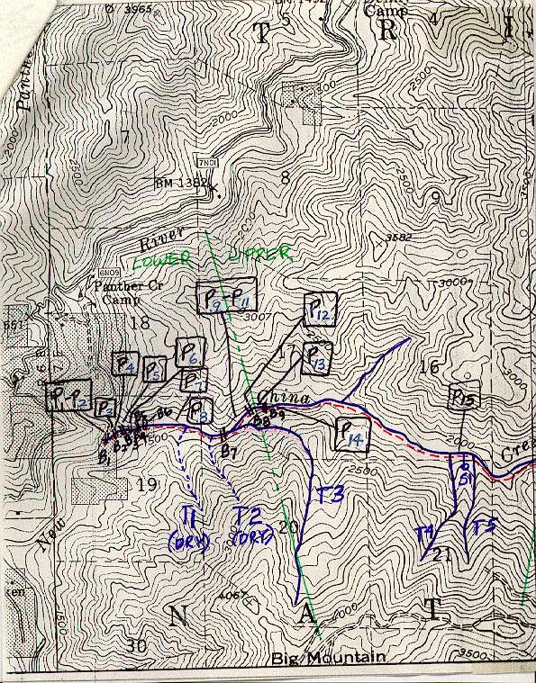
Map#1 from USFS stream survey of China Creek, New River tributary, conducted by Gary Rensink and Paul Renoud on August 27, 1985.
Map#2 from USFS stream survey of China Creek, New River tributary, conducted by Gary Rensink and Paul Renoud on August 27, 1985.
Map#3 shows barriers and is from a USFS stream survey of China Creek, New River tributary, conducted by Gary Rensink and Paul Renoud on August 27, 1985.
Mouth of China Creek at confluence with the New River. August 1985. Photo from the files of the Weaverville Ranger District, Shasta Trinity National Forest.
Barrier falls not far above the mouth of China Creek. Photo from the files of the Weaverville Ranger District, Shasta Trinity National Forest. August 1985.
Complete barrier B1, from just above the mouth of China Creek. B1 is a 20 foot high bedrock cascade/falls. The mouth of China Creek is not a barrier. Photo taken Photo from the files of the Weaverville Ranger District, Shasta Trinity National Forest. August 1985.
Lower China Creek, 1000 ft. above mouth. Dense canopy cover of large alder and oak. Bedrock, boulder and rock channel forming small pools alternating with riffles. Photo from the files of the Weaverville Ranger District, Shasta Trinity National Forest. 1985.
 Click on image to enlarge (190K).
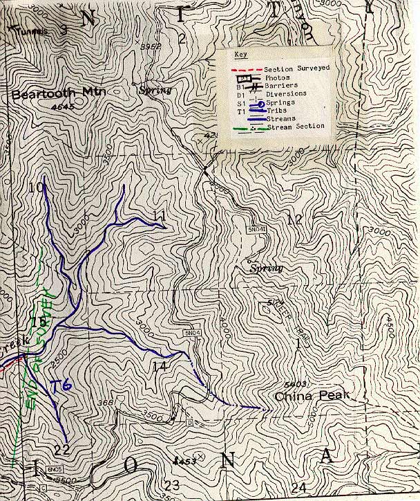 Click on image to enlarge (177K).
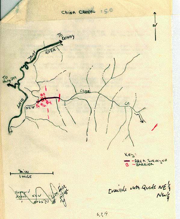 Click on image to enlarge (77K).
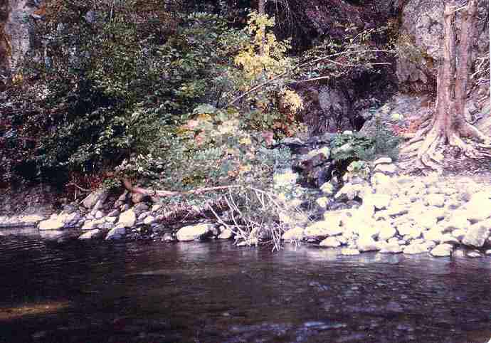 Click on image to enlarge (49K).
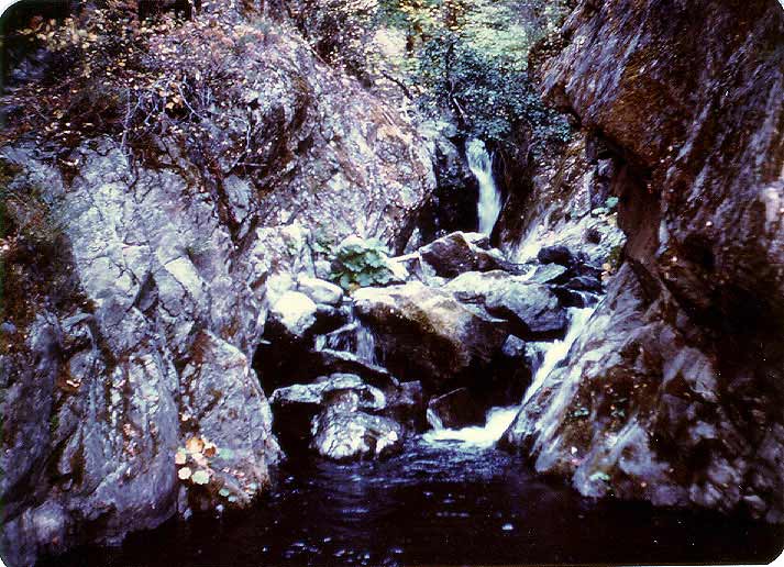 Click on image to enlarge (85K).
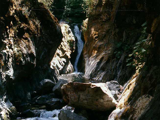 Click on image to enlarge (57K).
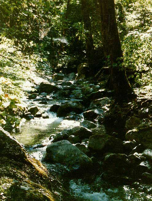 Click on image to enlarge (78K).
To learn more about this topic click Info Links
To view additional information (data source, aquisition date etc.) about this page, click Metadata
| www.krisweb.com |