
| Area | Middle Trinity |
| Topic | Tour: New River Eagle Creek Stream Survey Map and Photos |
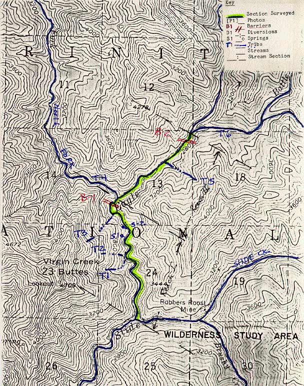
Map#1 from an USFS October 2, 1985 stream survey of the East Fork New River by Rich Feranna, Paul Renoud and Joe Zustak.
The confluence of Eagle Ck. and Slide Ck. (on right). Photo from the files of the Weaverville Ranger District, Shasta Trinity National Forest. October 1985.
Shallow bedrock pool, 300 ft. upstream. Dense vegetation typical of this section. Photo from the files of the Weaverville Ranger District, Shasta Trinity National Forest. 1985.
Large, deep pool located below T-1. Photo from the files of the Weaverville Ranger District, Shasta Trinity National Forest. 1985.
The stream just below T-3 looking downstream. Photo from the files of the Weaverville Ranger District, Shasta Trinity National Forest. 1985.
The downstream, taken from same point as NREC4. Photo from the files of the Weaverville Ranger District, Shasta Trinity National Forest. 1985.
The pool below B-1The pool below B-1. Photo from the files of the Weaverville Ranger District, Shasta Trinity National Forest. 1985.
B-1, a 15 ft. vertical bedrock falls. Photo from the files of the Weaverville Ranger District, Shasta Trinity National Forest. 1985.
 Click on image to enlarge (194K).
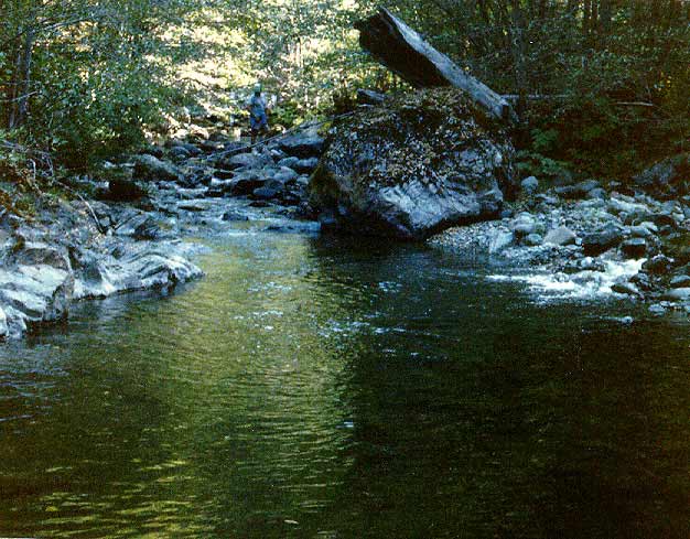 Click on image to enlarge (65K).
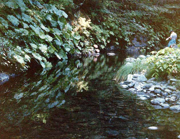 Click on image to enlarge (74K).
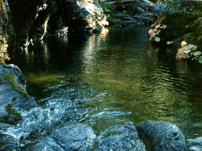 Click on image to enlarge (66K).
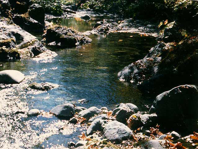 Click on image to enlarge (75K).
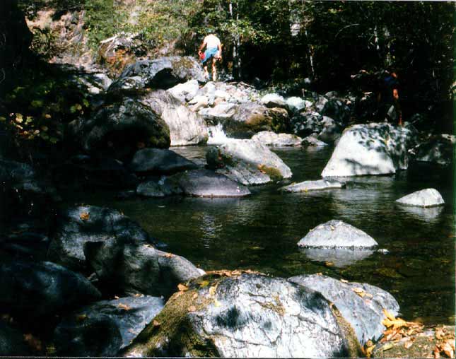 Click on image to enlarge (52K).
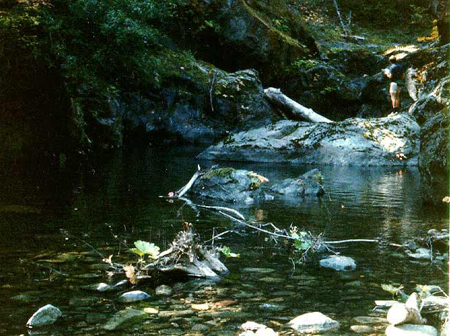 Click on image to enlarge (64K).
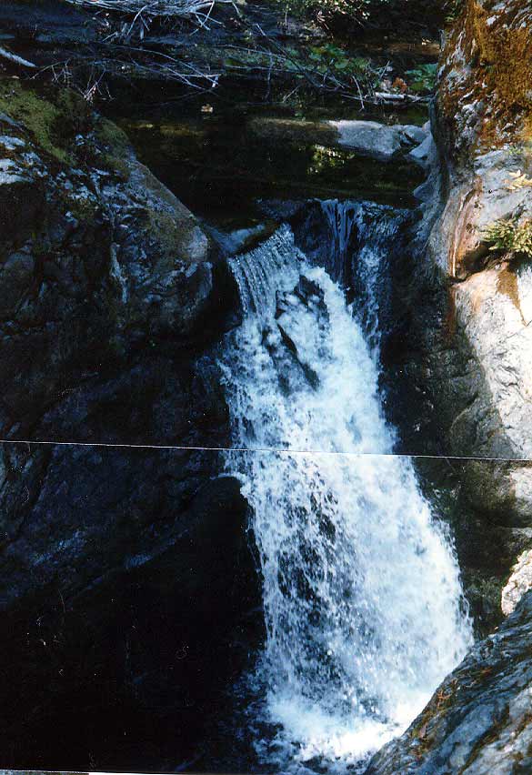 Click on image to enlarge (78K).
To learn more about this topic click Info Links
To view additional information (data source, aquisition date etc.) about this page, click Metadata
| www.krisweb.com |