
| Area | Middle Trinity |
| Topic | Tour: New River Quinby Creek |
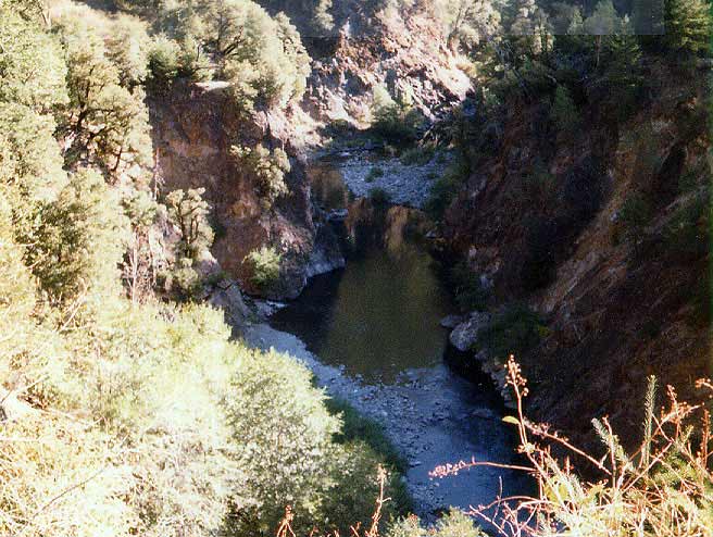
NEW RIVER canyon, looking upstream. Quinby Creek enters river from left (in lower mid photo). Photo taken during stream survey by Gary Rensink and Mark Renoud on August 26-28, 1985. Photo from the files of the Weaverville Ranger District, Shasta Trinity National Forest.
Complete barrier B1 plus plunge pool. B1 is a bedrock chute 35 ft. high and 40 ft. long. Debris is probably old Denny Rd. culvert and was not considered a barrier at the time. Plunge pool was 30 ft. in diameter; 7-8 ft. deep. Photo from August 1985. Photo from the files of the Weaverville Ranger District, Shasta Trinity National Forest.
Bedrock channel. Small, well-shaded pools formed by boulders and rock. Photo from August 1985. Photo from the files of the Weaverville Ranger District, Shasta Trinity National Forest.
"A" pool, 12 feet wide and 45-50 feet long with good spawning gravels and excellent in-stream shelter provided by vegetation and undercut banks. Photo from the files of the Weaverville Ranger District, Shasta Trinity National Forest. 1985.
Complete barrier B5, a 15 ft. high bedrock falls. At the top is a small pool preceded by a 5 ft bedrock chute and debris jam. Photo taken in August 1985. Photo from the files of the Weaverville Ranger District, Shasta Trinity National Forest.
Upper stream. Boulder and rock strewn streambed, at tributary T9. Photo taken in August 1985. Photo from the files of the Weaverville Ranger District, Shasta Trinity National Forest.
Mouth of Quinby Creek. From 1974 survey.Photo from the files of the Weaverville Ranger District, Shasta Trinity National Forest.
Barrier 1 is 200 yards upstream from mouth and has a 75 foot bedrock falls. Pool below is 6 ft. deep. Note trashed culvert from upstream road failure at lower right. Photo taken in 1974. Photo from the files of the Weaverville Ranger District, Shasta Trinity National Forest.
 Click on image to enlarge (70K).
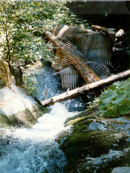 Click on image to enlarge (77K).
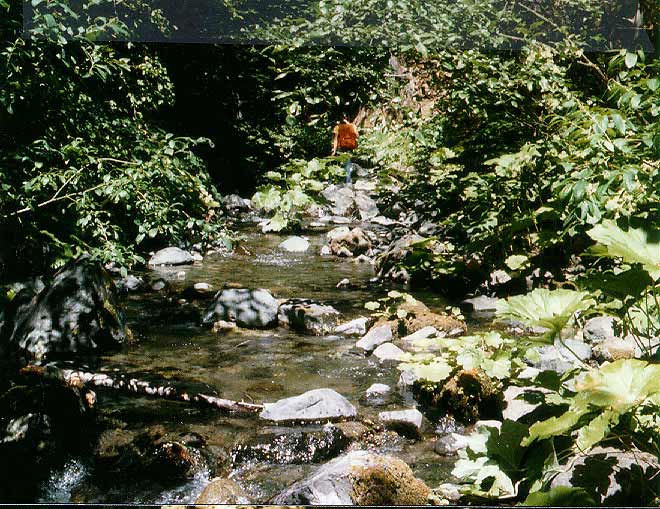 Click on image to enlarge (93K).
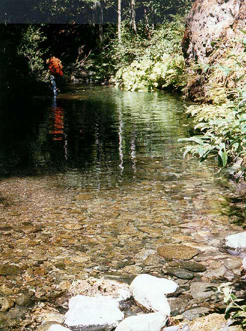 Click on image to enlarge (85K).
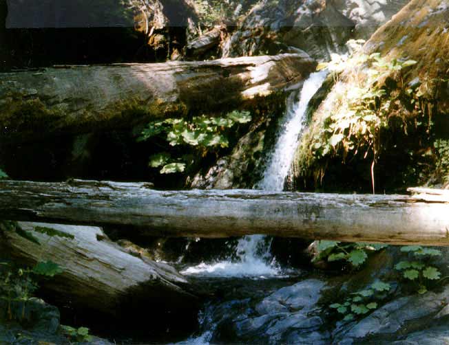 Click on image to enlarge (47K).
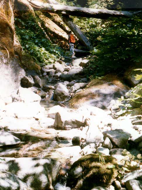 Click on image to enlarge (56K).
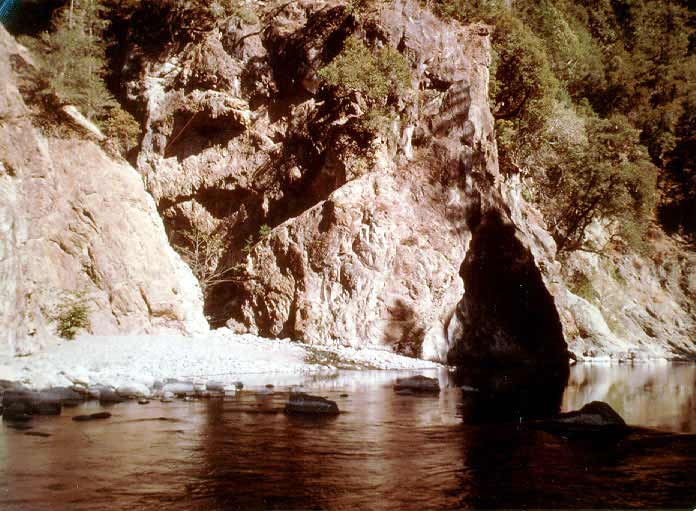 Click on image to enlarge (63K).
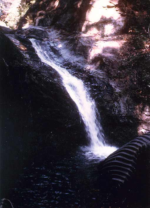 Click on image to enlarge (47K).
To learn more about this topic click Info Links
To view additional information (data source, aquisition date etc.) about this page, click Metadata
| www.krisweb.com |