
| Area | Middle Trinity |
| Topic | Tour: New River Virgin Creek |
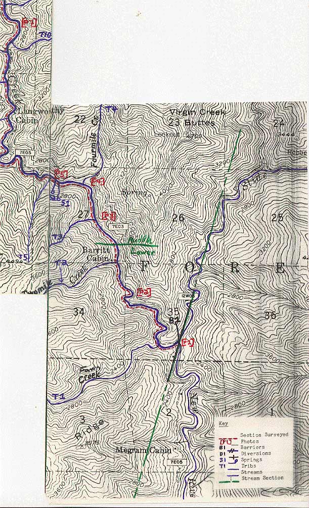
Map #1 from Virgin Creek survey conducted by Gary Rensink and Paul Renoud on August 19-20, 1985. Map above is the lowest reach and Pictures 2,3 and 4 have maps of reaches further upstream.
Map #2 from Virgin Creek survey conducted by Gary Rensink and Paul Renoud on August 19-20, 1985.
Map #3 from Virgin Creek survey conducted by Gary Rensink and Paul Renoud on August 19-20, 1985.
Map #4 from Virgin Creek survey conducted by Gary Rensink and Paul Renoud on August 19-20, 1985.
Large wood and extremely confined bedrock channel in Virgin Creek, tributary of the New River. August 1985. Photo from the files of the Weaverville Ranger District, Shasta Trinity National Forest.
Exposed bedrock and large boulder in the channel of Virgin Creek. August 1985. Photo from the files of the Weaverville Ranger District, Shasta Trinity National Forest.
Large woody debris jam on the flood plain of Virgin Creek in the New River drainage. August 1985. Photo from the files of the Weaverville Ranger District, Shasta Trinity National Forest. 1985.
 Click on image to enlarge (203K).
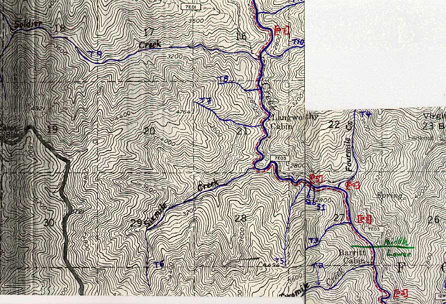 Click on image to enlarge (211K).
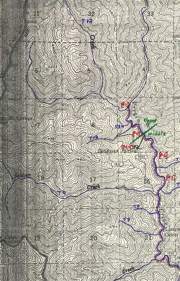 Click on image to enlarge (242K).
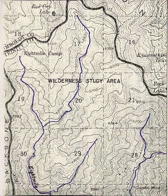 Click on image to enlarge (145K).
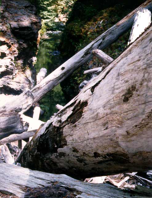 Click on image to enlarge (55K).
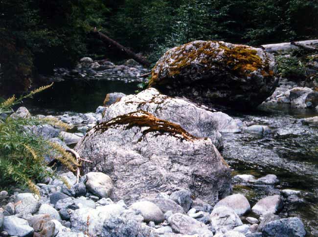 Click on image to enlarge (58K).
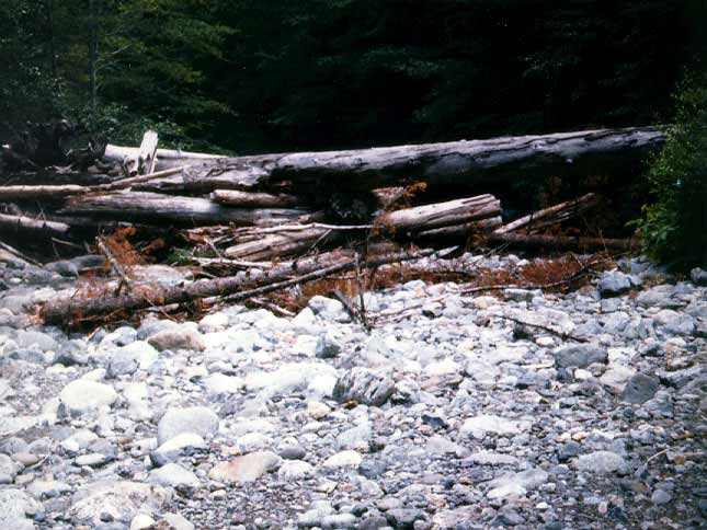 Click on image to enlarge (54K).
To learn more about this topic click Info Links
To view additional information (data source, aquisition date etc.) about this page, click Metadata
| www.krisweb.com |