
| Area | Middle Trinity |
| Topic | Tour: GVC Road Decommissioning |
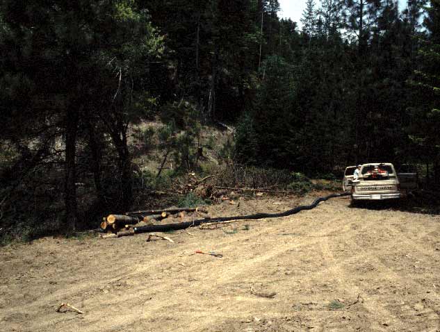
Preparing site 16L1 in Grass Valley Creek sub-watershed 18 for removal of a stream crossing. The elongate, flexible pipe passes the water in the stream around the project during excavation to prevent water pollution. Photo courtesy of the Trinity County Resource Conservation District. June 1995.
Removal of fill material associated with stream crossing at site 18-16L1 in the Grass Valley Creek watershed. Photo courtesy of the Trinity County Resource Conservation District. June 1995.
Note that the completed road crossing removal project at site 16L1 in Grass Valley Creek sub-watershed 18 involved considerably less channel excavation than projects completed in previous years (see Tour: Grass Valley Channel Excavation Pictures #5-8). Photo courtesy of the Trinity County Resource Conservation District. June 1995.
Low sand bag check dams were placed in the active channel below the removal of the road crossing at site 18-16L1 to catch sediment. Note that additional bags are placed below the check dams to armor the bed. Photo courtesy of the Trinity County Resource Conservation District. June 1995.
This photo shows that the road crossing removal and subsequent channel armoring at site 18-16L1 was successful as no gully erosion occurred and side slopes are intact. Photo courtesy of the Trinity County Resource Conservation District.
Grass Valley Creek sub-watershed 27 at site 009 (9 main crossing) before removal of the stream crossing. Photo courtesy of the Trinity County Resource Conservation District. Jan. 1995.
Removal of the stream crossing at site 27-009 showing the old culvert. Stream flow is captured in the black plastic, flexible pipe to avoid water pollution and to keep the site dry enough to work. Excavation amounted to fill material at the crossing only so as not to destabilize a wider channel area or reaches upstream or downstream of the crossing. Photo courtesy of the Trinity County Resource Conservation District. August 1995.
The active channel at site 27-009 was stabilized after stream crossing removal to prevent scour of the stream bed and gully formation similar to that which occurred in streams which had crossings removed in 1993-1994. Photo courtesy of the Trinity County Resource Conservation District. August 1995.
 Click on image to enlarge (50K).
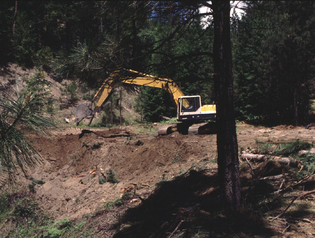 Click on image to enlarge (100K).
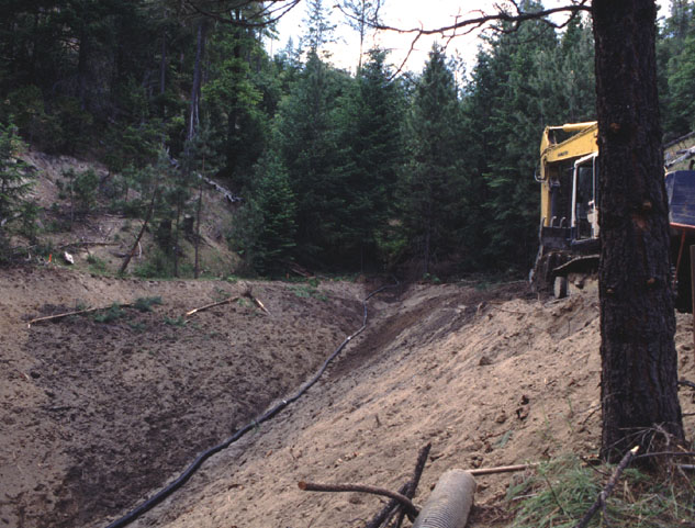 Click on image to enlarge (104K).
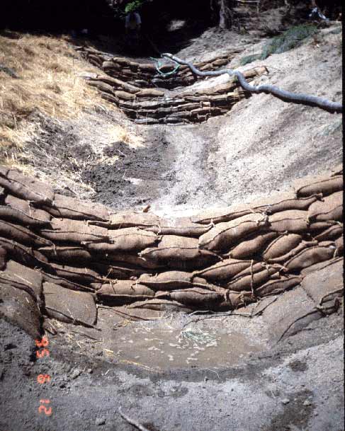 Click on image to enlarge (60K).
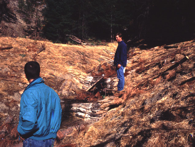 Click on image to enlarge (126K).
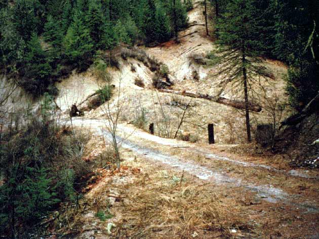 Click on image to enlarge (62K).
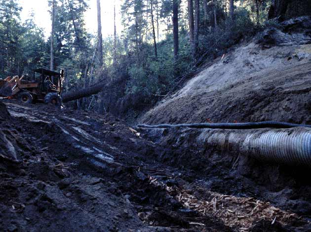 Click on image to enlarge (55K).
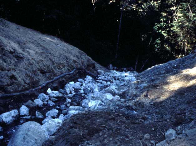 Click on image to enlarge (47K).
To learn more about this topic click Info Links
To view additional information (data source, aquisition date etc.) about this page, click Metadata
| www.krisweb.com |