
| Area | Middle Trinity |
| Topic | Tour: Grass Valley Channel Excavation |
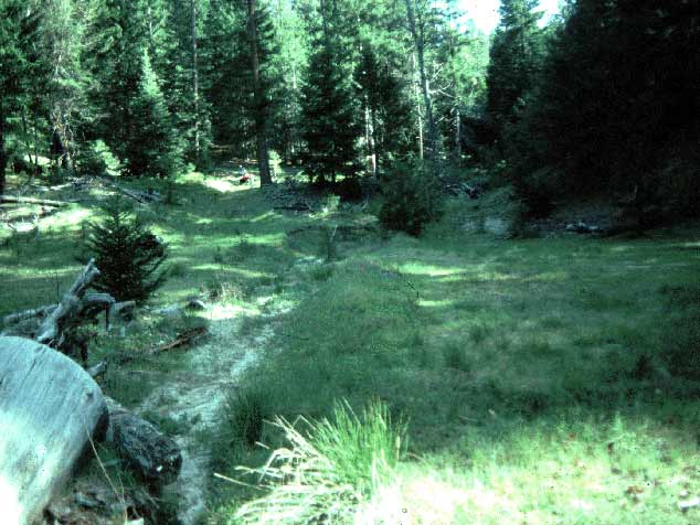
This photo shows a location 36.1 in Grass Valley Creek sub-watershed 29 before treatment. There was concern that the channel was filled in by past logging and that future storm events would cause scour, contributing substantial amounts of sediment to Grass Valley Creek. Gully erosion was in evidence up this draw just out of the photo and some decomposed granite is visible in the ephemeral stream channel. Photo taken by John McCullough and provided courtesy of the Trinity County Resource Conservation District. May 1993.
This photograph shows the same location after channel excavation (note large conifer at center of photo). This method of channel restoration was devised at Redwood National Park in a different geologic setting. Excavating channels at RNP saved large sediment contributions and no channel armoring or mulching was necessary. Photo courtesy of the Trinity County Resource Conservation District. June 1994.
This shows the same location as Picture #1 and #2 but after heavy rains in January 1995 (sub-watershed 29, location 36.1). Decomposed granitic soils proved highly subject to erosion after channel excavations that did not provide channel armoring. Extensive channel excavations were discontinued after 1995 and any disturbed channels were completely armored. Photo courtesy of the Trinity County Resource Conservation District. February. 1995.
This trench was dug to discern whether a remnant stream channel could be discovered. An old armor layer would indicate that logging activities and subsequent erosion had buried the old stream channel and provide a target for excavation to promote stream channel recovery. No armor layer is apparent in the photo and the assumption that channels were buried proved unfounded. Sub-watershed 27a at site 031. October 1993.
This photograph shows an old stream crossing in Grass Valley Creek sub-watershed 27C at site 157 before any project was initiated. The site was thought to have been buried by past logging activity and sediment transport. Photo taken by John McCullough and provided courtesy of the Trinity County Resource Conservation District. July 1993.
Stream crossing removal and channel excavation in sub-watershed 27C at site 157. Photo provided by the Trinity County Resource Conservation District.
Excavated channel (27C-157) after project completion in October 1993. Photo taken by John McCullough and provided courtesy of the Trinity County Resource Conservation District. July 1993.
Severe gully erosion after heavy winter storms in January 1995 at site 27C-157. Lack of channel armor allowed substantial contributions of sediment. Large-scale channel excavations were discontinued as part of adaptive management after monitoring results were assessed. Photo provided by the Trinity County Resource Conservation District. Jan. 1995.
 Click on image to enlarge (50K).
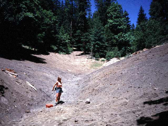 Click on image to enlarge (60K).
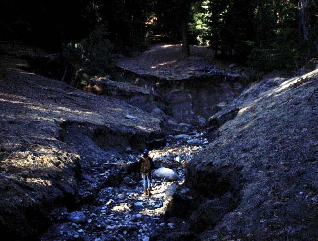 Click on image to enlarge (50K).
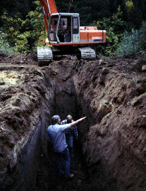 Click on image to enlarge (56K).
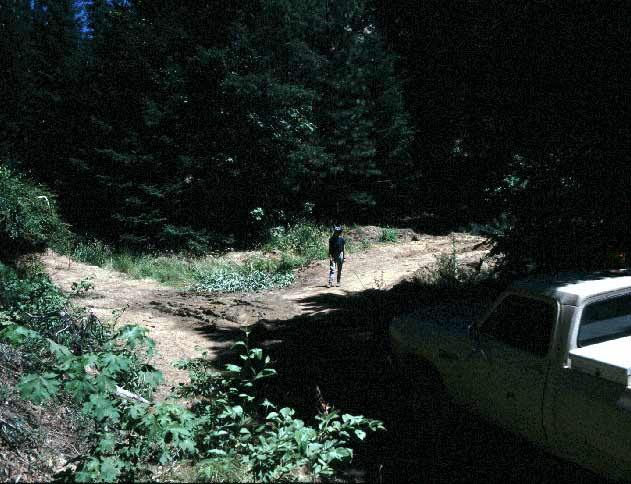 Click on image to enlarge (51K).
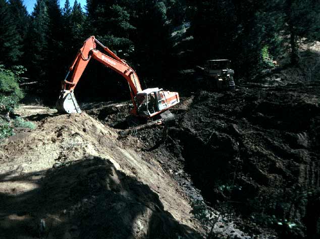 Click on image to enlarge (49K).
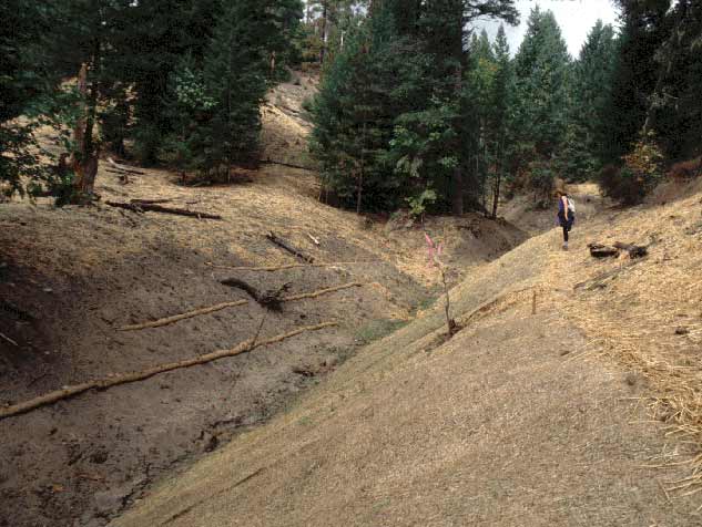 Click on image to enlarge (50K).
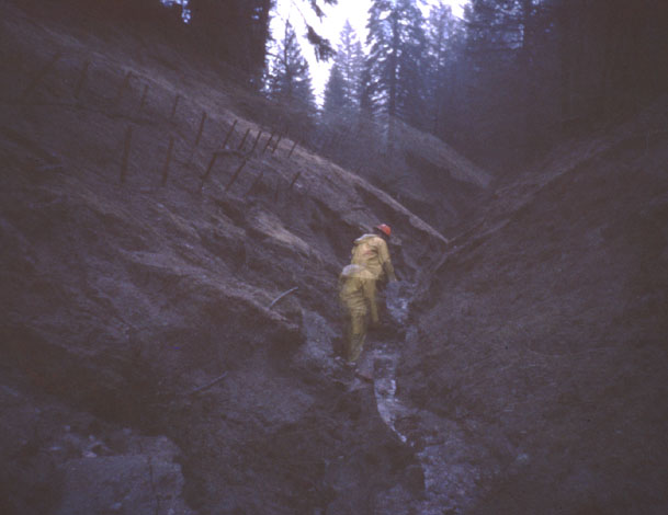 Click on image to enlarge (47K).
To learn more about this topic click Info Links
To view additional information (data source, aquisition date etc.) about this page, click Metadata
| www.krisweb.com |