|
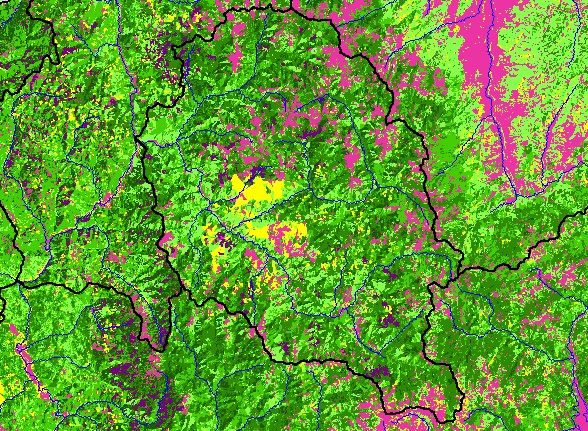
This is a map of 1994 vegetation size data for the Salmon River sub-basin, derived by the U.S. Forest Service from Landsat
satellite images, displayed with 1:500,000 scale streams. Much of the Lower Klamath Basin is early seral stage forest. This could
be bare soil and grasses after timber harvest, such as in Terwer Creek, or natural grasslands on Bald Hills to the west of Tully
Creek. The vegetation and timber types show more mature coniferous forests on USFS land in the east of the basin. The
vegetation classification is accurate at a one-hectare scale and is suitable for stand classification. Data were provided by the U.S.
Forest Service Spatial Analysis Lab in Sacramento, CA, and Humboldt State University.
|
|