
| Area | Salmon River |
| Topic | Map: Salmon River Fish Presence and Water Monitoring |
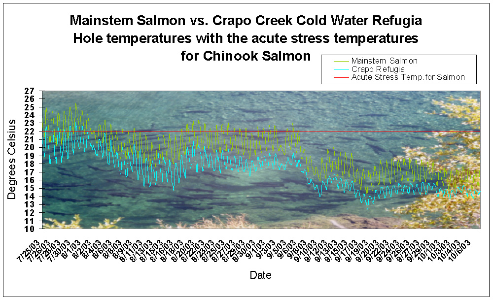
This graph shows the difference in temperature between the Mainstem Salmon River and the bottom of the Crapo Creek Refugia Hole in the summer of 2003. The Crapo hole is significantly colder than the Mainstem below the hole. The graph is overlayed on a photo of Spring Chinook holding in the Crapo hole - a typical sight during the summer months. Click on Map to see a map of Fish Presence and Water Monitoring Sites in the Salmon River Project Area.
 Click on image to enlarge (279K).
To learn more about this topic click Info Links
To view additional information (data source, aquisition date etc.) about this page, click Metadata
| www.krisweb.com |