
| Area | Salmon River |
| Topic | Tour: Salmon River Map Images |
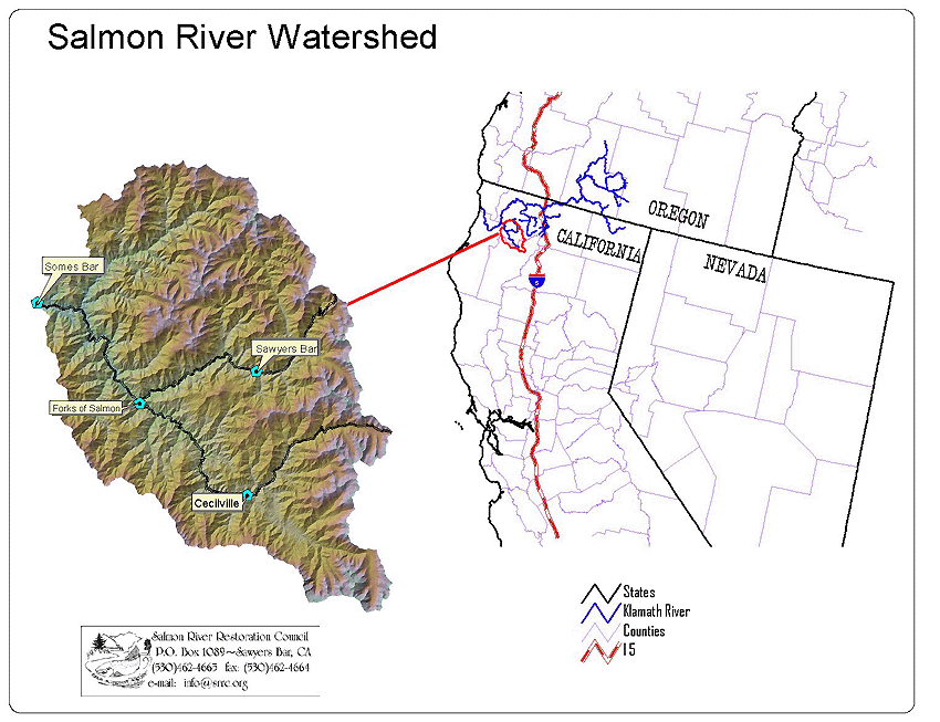
The Salmon River is located in very northern California. The 480,640 acre Basin is home to approximately 250 year round residents.
The 751 square mile Salmon River Basin is 98.7% publicly owned with federal management by the United States Forest Service.
Fire perimeters were obtained from 1:126720 Ranger District Fire Atlases. Polygons were ocularly transferred to 1:62500 manuscripts. District Atlases contain all fires greater than 40 acres in size. The dates covered are from 1911 to present. Since 1911, a total of 44% of the Basin has burned, while 29% of the Basin has burned since the mid 1970s. The risk of catastrophic fire is identified by managers as the number one threat to Salmon River ecosystem health.
This Map shows fire starts in the Salmon basin from 1922 to present.Historic records in the form of Individual Fire Reports (Form 5100-29) were researched from 1922 forward. Fire locations reported were converted to lat/long coordinates using a 1:126720-based lat/long grid. Locations are approximate but adequately represent the number & general spatial distribution of fire ignitions. This information identifies that the Salmon River is prone to a high frequency of lightning-caused fires.
Wilderness areas and Late Successional Reserves (LSRs) take up a large percentage of the area in the Salmon. Forty five percent of the sub-basin is designated as wilderness. LSRs are areas designated for the protection of wildlife and fisheries under the Northwest Forest Plan.
The Salmon River Basin is characterized by steep mountains and deeply incised river canyons. Although most of the Basin is road less, there are over 1000 miles of forest roads which are capable of producing large amounts of sediment during storm events.
Active Landslides, Steep Granitic Slopes and Inner gorge areas are major geomorphic features in the Salmon River Basin. Identifying sensitive geomorphic areas is integral to resource management planning in the Salmon Basin.
 Click on image to enlarge (154K).
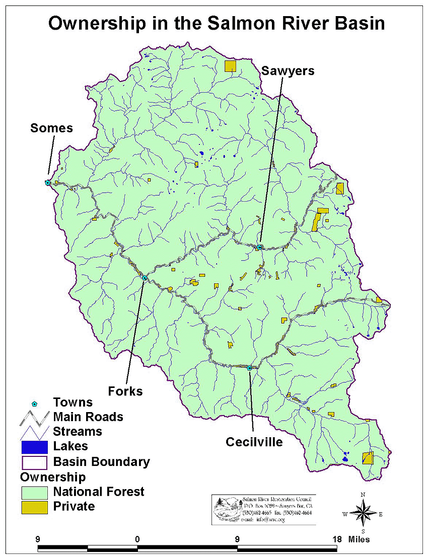 Click on image to enlarge (269K).
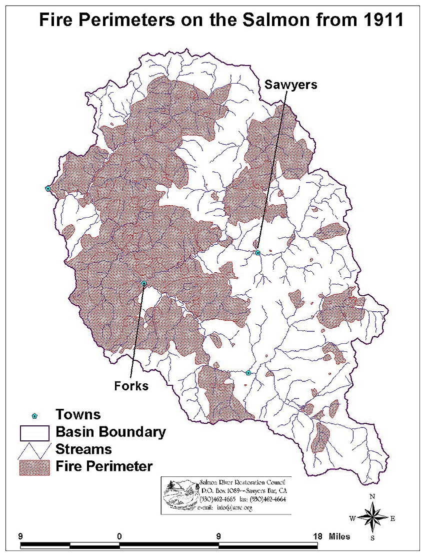 Click on image to enlarge (318K).
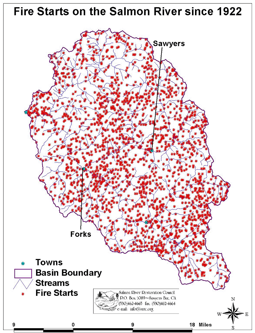 Click on image to enlarge (307K).
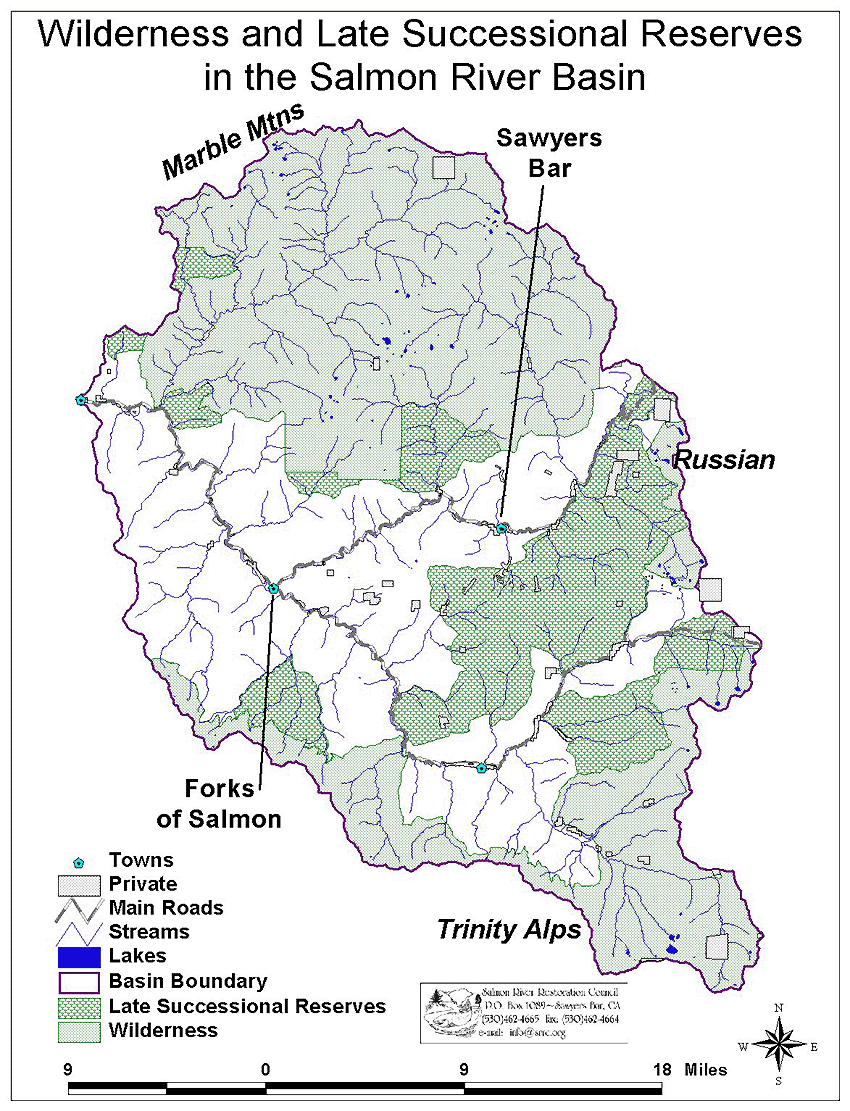 Click on image to enlarge (337K).
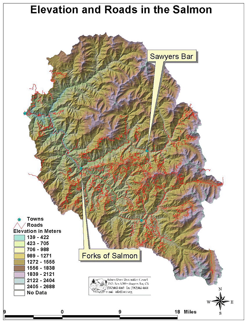 Click on image to enlarge (419K).
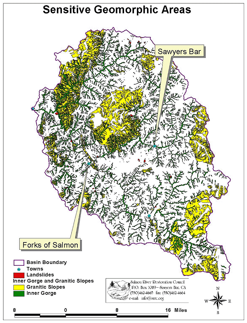 Click on image to enlarge (320K).
To learn more about this topic click Info Links
To view additional information (data source, aquisition date etc.) about this page, click Metadata
| www.krisweb.com |