
| Area | Salmon River |
| Topic | Tour: Roads & Erosion in Steinacher Creek |
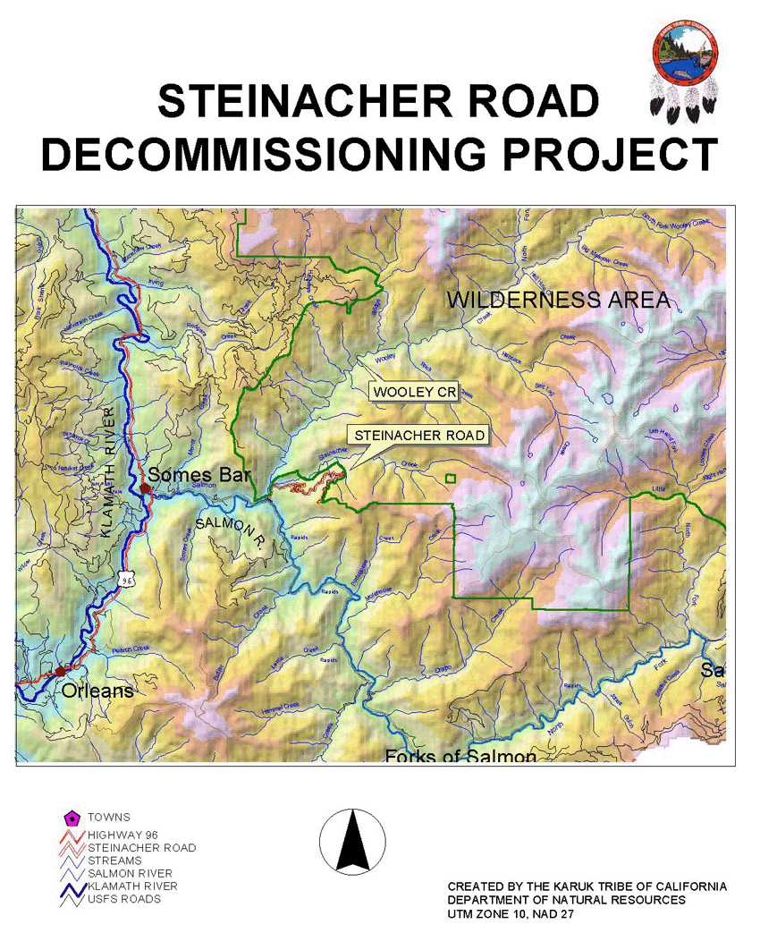
Steinacher Road is located off the Salmon River Road (Forest Hwy. 93), East of Somes Bar and State Highway 96. Both Wooley Creek (which Steinacher drains into) and the Salmon River are Key Watersheds. The Wooley Creek tributary is widely recognized as one of the most pristine and high quality anadromous fish habitats in the state of California. Except for Steinacher Road, the Wooley Creek drainage is located entirely within designated Wilderness area. Maps & photo's courtesy of Scott Quinn, Karuk Tribe Department of Natural Resources.
Steinacher Road was built between 1969 and 1971.The soils in this area are comprised of mostly highly erosive granitics that tend to cause culvert and ditch failure. From 1970 to 1996, it is estimated that 10,650 cubic yards of sediment entered the stream channel from cutbanks and road surfaces. The annual volume of sediment delivery from these sources is more than three times natural background levels. The Steinacher Road is a phased project. In 1998 the Karuk Tribe performed emergency storm proofing before the winter rains began. In 1999 the Karuk Tribe decommissioned approximately one mile of road (Phase II), and storm proofed the remaining segment for the winter. Steinacher road was again winterized in 2000. The Tribe is currently seeking additional funding to complete the project.
This photo shows the Karuk Tribal Restoration Crew getting field experience on how to discommission roads in the Steinacher sub-basin of the Salmon River. This project was funded through the USF&W, BIA, EPA, USFS, CDF&G, Natl. Fish Wildlife Foundation, and the Northern California Indian Development Council.
As part of the winterizing process to reduce the chance of erosion, the road bed was ripped in intervals to install rolling dips. Straw bail fences were also added to further reduce the impact of runoff during major storm events.
This photo shows tribal members removing fill material at the "Big Crossing (excavation (RX10) at CP155+80). There is approximately 36,100 yd3 of fill remaining in RX10.
Excavator pulling stream crossing on tributary to Steinacher Creek. Project carried out by the Karuk Tribe Natural Resource Department.
This is a before picture. Notice the high concentration of granitic's as evidenced by the color and texture of the soil. Also notice the steepness of the terrain in which Steinacher Road was built through.
This after shot depicts the road after decommissioning has occurred. Straw has been broadcast to minimize erosion until natural and planted vegetation becomes established and covers the soil surface.
 Click on image to enlarge (499K).
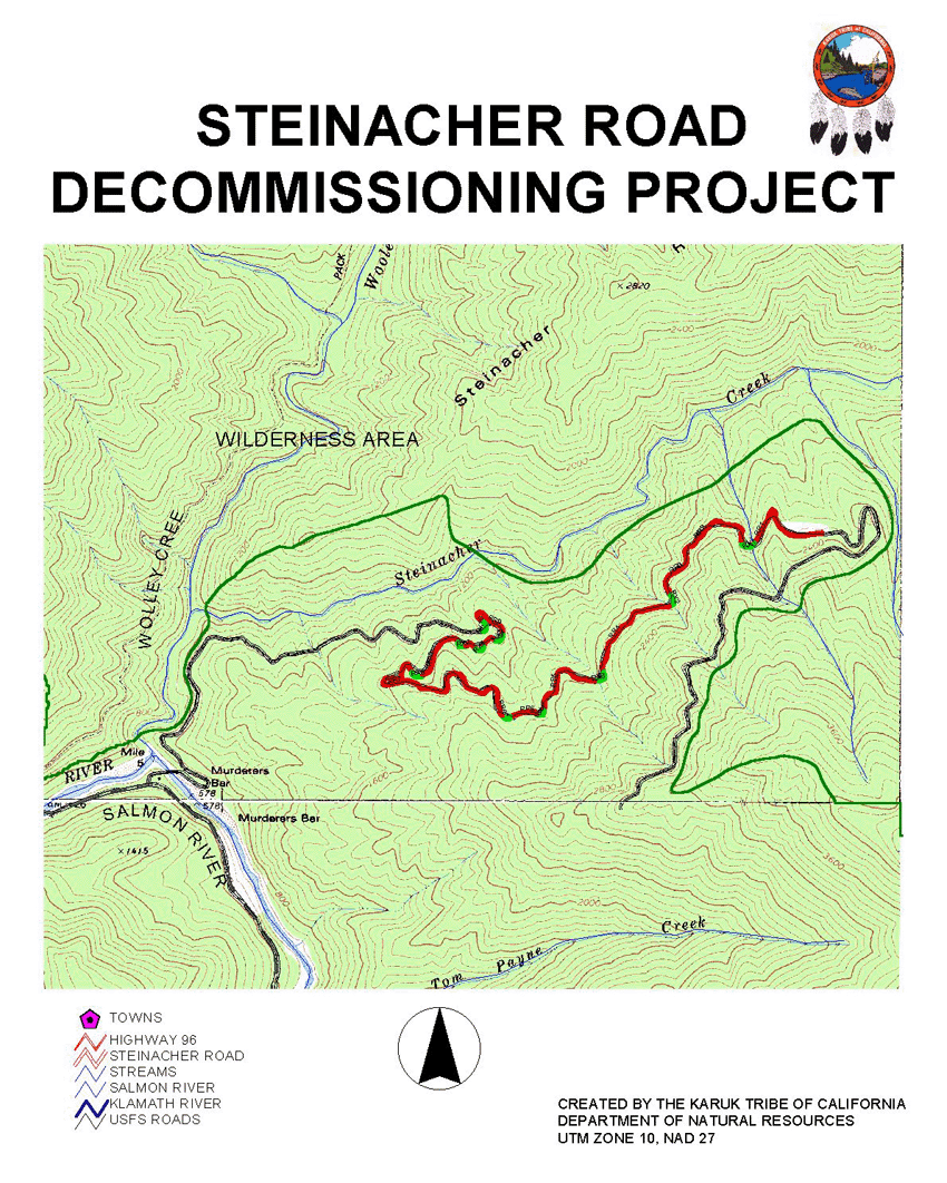 Click on image to enlarge (408K).
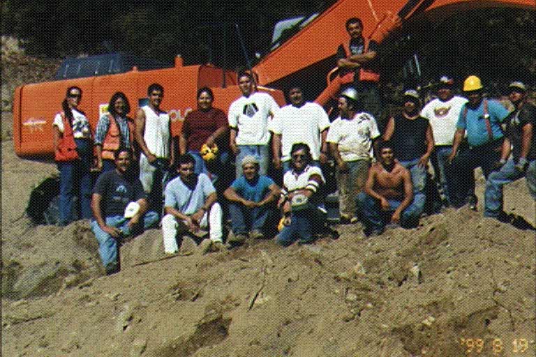 Click on image to enlarge (84K).
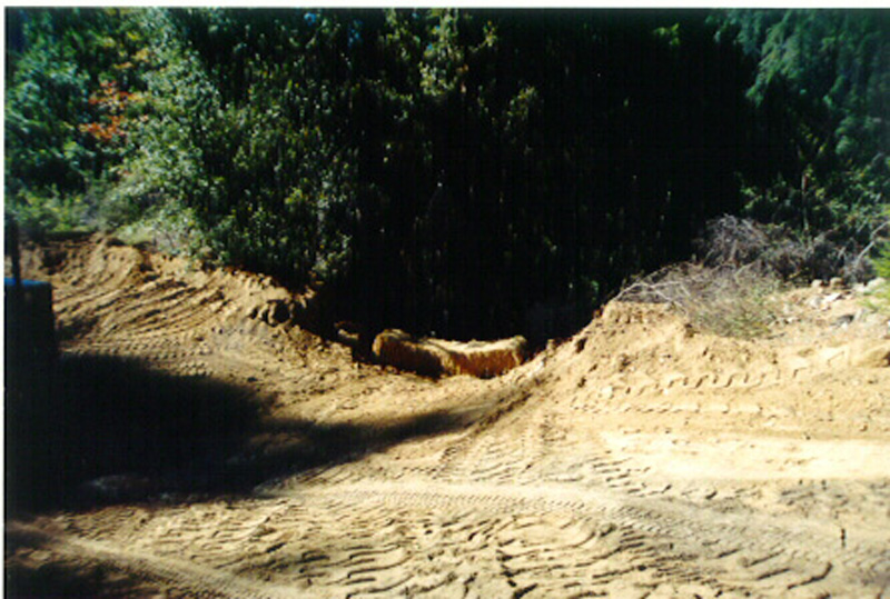 Click on image to enlarge (191K).
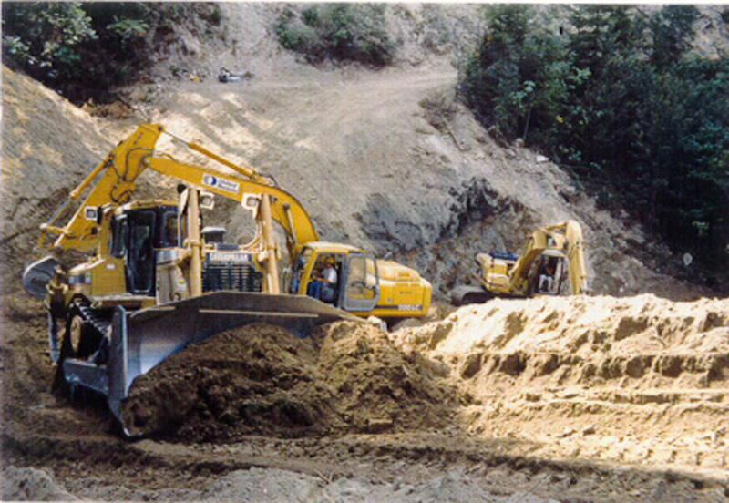 Click on image to enlarge (228K).
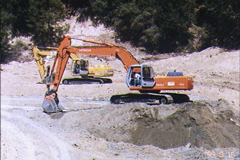 Click on image to enlarge (85K).
 Click on image to enlarge (213K).
 Click on image to enlarge (214K).
To learn more about this topic click Info Links
To view additional information (data source, aquisition date etc.) about this page, click Metadata
| www.krisweb.com |