
| Area | Scott River |
| Topic | Climate: Snow Pack Middle Boulder 1949 to 1999 |
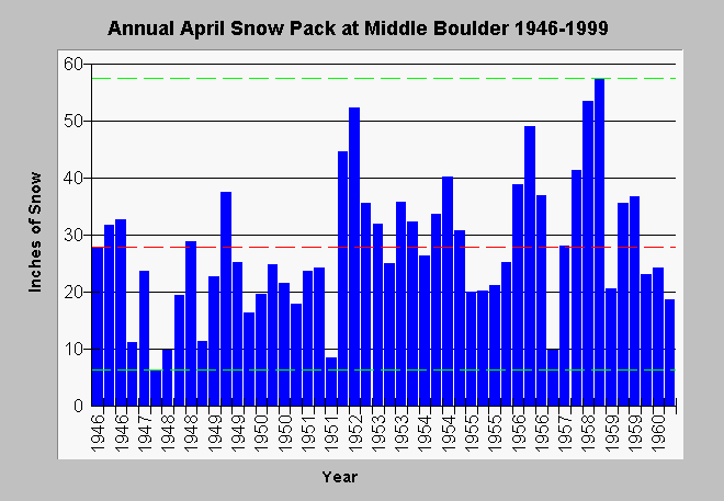
| Caption: This graph shows the water content of the snow pack at the Middle Boulder station for the month of April from 1946 to 1999. The red line is average snow pack water content, whereas, the dashed green lines are the maximum and minimum values for all years measured. Data are from the California Data Exchange Center. Click on Info Links for more information. | |
 |
To learn more about this topic click Info Links .
To view additional information (data source, aquisition date etc.) about this page, click Metadata .
To view the table with the chart's data, click Chart Table web page.
To download the table with the chart's data, click middlebouldersnow.dbf (size 6,754 bytes) .
| www.krisweb.com |