
| Area | Scott River |
| Topic | Temperature: 1996 Maximum Daily SF, EF and Main Scott @ Red Bridge |
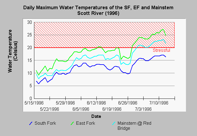
| Caption: The chart above shows a comparison of maximum daily water temperatures of the South Fork, East Fork and mainstem Scott River at Red Bridge below Callahan. The South Fork Scott River did not exceed stressful levels for salmonids from May through September 1996 and it had a buffering effect on water temperatures of the Scott at Red Bridge. Data gaps in the late season at the East Fork and mainstem at Red Bridge are due to the Hobotemp probes being exposed to air at those locations. Data collected using Hobotemp data recorders by Scott Valley High School as part of a Siskiyou County Schools project. See Info Links for more information. | |
 |
To learn more about this topic click Info Links .
To view additional information (data source, aquisition date etc.) about this page, click Metadata .
To view the table with the chart's data, click Chart Table web page.
To download the table with the chart's data, click scotetx.dbf (size 29,642 bytes) .
| www.krisweb.com |