
| Area | Scott River |
| Topic | Temperature: 1998 Min/Max/Ave East Fork Scott @ Masterson Rd |
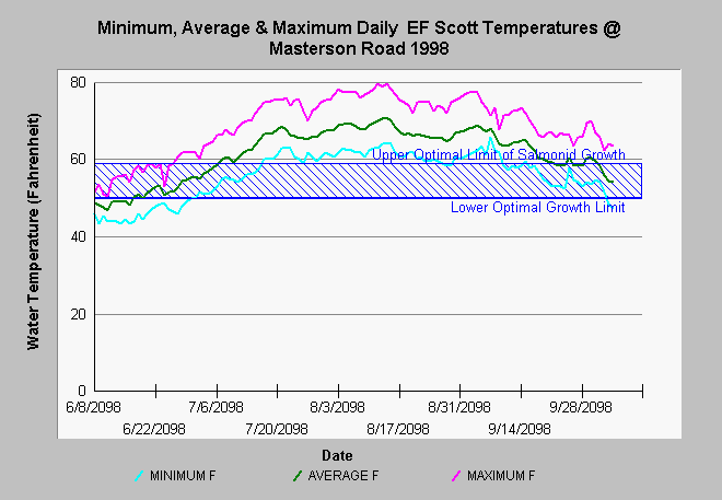
| Caption: This chart shows the daily maximum, average and minimum water temperatures in Fahrenheit of the East Fork of Scott River at Masterson Rd. Water temperatures were highly stressful for salmonids from mid-July through mid-September. The East Fork channel widened substantially as a result of the January 1997 storm (see Tours) and it is likely that these temperatures reflect those channel changes. Data were collected from mid-June to mid-October using Hobotemp data recorders by the Siskiyou Resource Conservation District. See Info Links for more information. | |
 |
To learn more about this topic click Info Links .
To view additional information (data source, aquisition date etc.) about this page, click Metadata .
To view the table with the chart's data, click Chart Table web page.
To download the table with the chart's data, click efms98.dbf (size 8,442 bytes) .
To view the table with the chart's source data, click Source Table web page.
To download the table with the chart's source data, click ref02-08.dbf (size 142,394 bytes)
| www.krisweb.com |