
| Area | Scott River |
| Topic | Tour: Aerials Scott Valley |
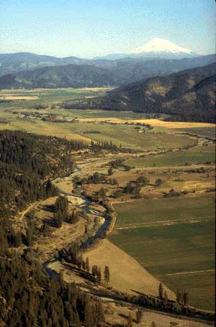
The Scott River winds around Quartz Hill and merges with Shackleford Creek (center of photo). The Scott Valley is a prime agricultural area and fields shown are mostly planted in alfalfa and other feed crops. Mt. Shasta is in the background. Photo courtesy of Dr. Sari Sommerstrom.
The upper Scott River below Callahan was profoundly disturbed by mining that continued until just after World War II. A large barge-like dredge was used to mine gold from the gravel bar. The area presents a major impediment to salmon migration in some years. This photo is highly detailed and suitable for use of the Zoom and Pan functions (click F1 for Help instructions). Photo part of contiguous, geo-referenced monitoring series taken in 1996 by the Siskiyou RCD.Photo by Pat Higgins circa 1990.
Gravel tailings below Callahan with Highway 3 near bottom of photo. Photo part of contiguous, geo-referenced monitoring series taken in 1996 by the Siskiyou RCD (W122-44.85 N41-18.57).
Scott River immediately downstream of gravel tailings showing Highway 3 at right. This photo is highly detailed and suitable for use of the Zoom and Pan functions (click F1 for Help instructions). Photo part of contiguous, geo-referenced monitoring series taken in 1996 by the Siskiyou RCD (W 122-46.35 N41-18.33).
The Scott River riparian zone at the convergence of French Creek (at right). The lighter colored areas of the gravel bar may be largely decomposed granite sands. This photo is highly detailed and suitable for use of the Zoom and Pan functions (click F1 for Help instructions). Photo part of contiguous, geo-referenced monitoring series taken in 1996 by the Siskiyou RCD (W122-47.20 N41-18.27).
Top of photo is diversion point for Scott Valley Irrigation District ditch. This photo is highly detailed and suitable for use of the Zoom and Pan functions (click F1 for Help instructions). Photo part of contiguous, geo-referenced monitoring series taken in 1996 by the Siskiyou RCD (W122-49.13 N41-20.34).
Main stem of the Scott River looking downstream below Ft Jones. The town of Ft. Jones is at the upper left in photo. The Scott River Channel seems to widen at the mouth of Moffett Creek. Photo taken by Pat Higgins in 1990.
The flood plane of lower Kidder Creek is the light colored area in the photograph with the town of Greenview shown just to the left of center on the photo. The riparian zone width of Kidder Creek expanded dramatically during the 1955 flood as a result of high sediment yield. The stream channel is often dry as a result of aggradation and also water extraction for irrigation that continues through fall and winter. Photo taken by Pat Higgins in 1990.
 Click on image to enlarge (22K).
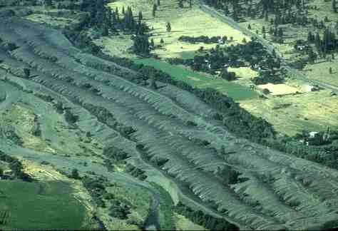 Click on image to enlarge (17K).
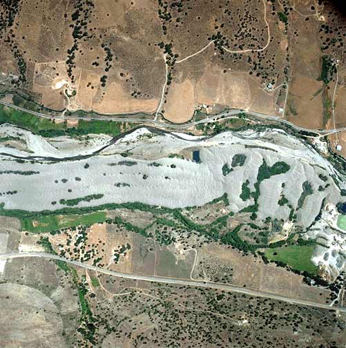 Click on image to enlarge (56K).
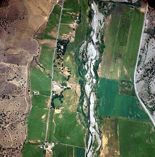 Click on image to enlarge (53K).
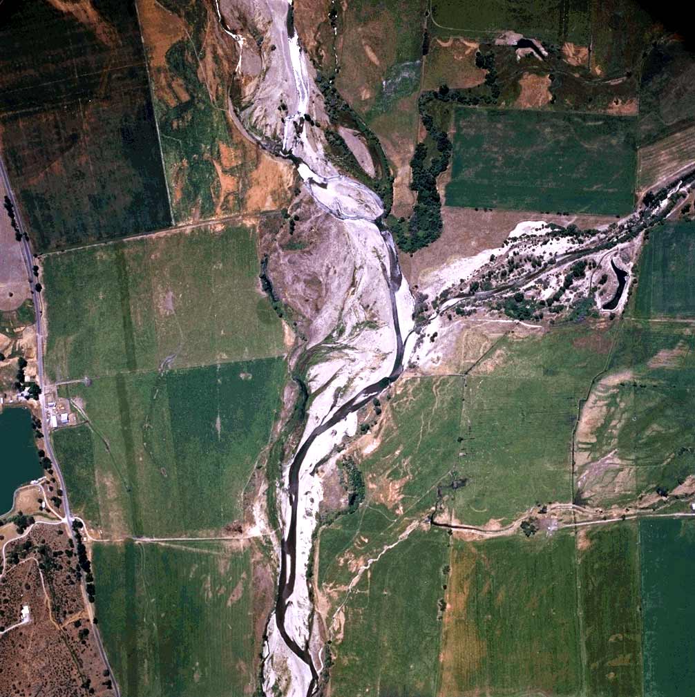 Click on image to enlarge (151K).
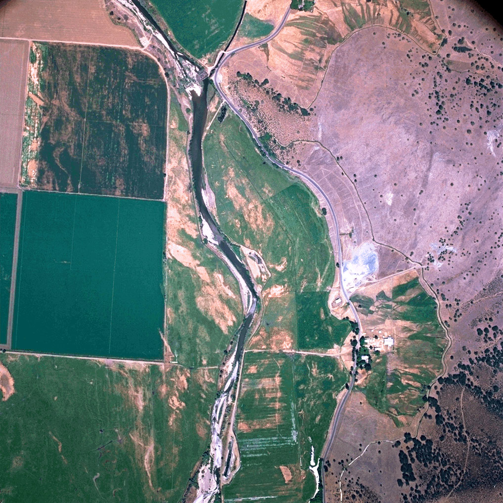 Click on image to enlarge (362K).
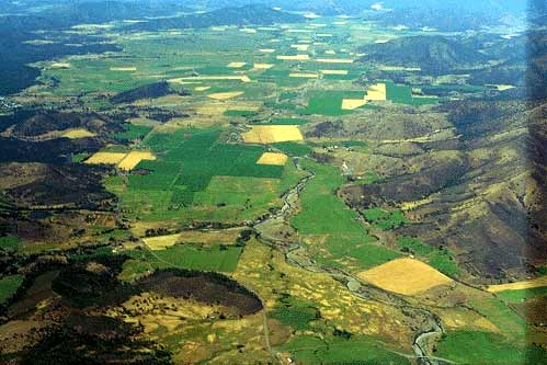 Click on image to enlarge (33K).
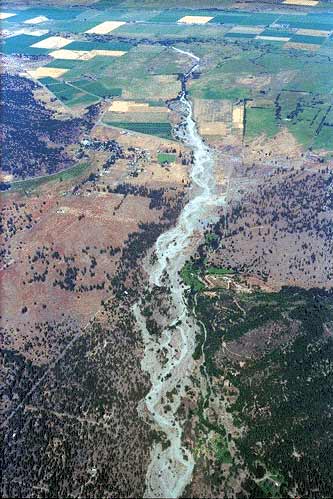 Click on image to enlarge (41K).
To learn more about this topic click Info Links
To view additional information (data source, aquisition date etc.) about this page, click Metadata
| www.krisweb.com |