
| Area | Scott River |
| Topic | Tour: Limiting Factors |
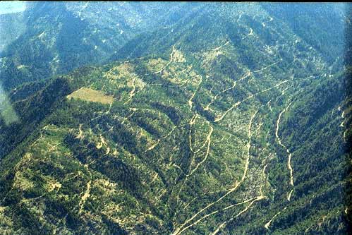
This west side Scott River watershed has a high density of roads related to recent logging and also has weakly consolidated soils. Studies by Dr. Sari Sommerstrom suggest that the largest amount of sediment comes from the road surface, cuts and fill slopes. Select Tour: Restoration French Cr. Erosion to see some solutions that are being implemented.
The road cut in the French Creek watershed illustrates how decomposed granite soils can yield high volumes of sediment. Road related erosion in the French Creek watershed is now being diminished as a result of restoration activities by timber companies, Siskiyou County and the local RCD (Tour: Restoration French Cr. Erosion).
High levels of fine sediment (decomposed granitic sands) are evident in the Scott River below Jones Beach. Note that sand covers most of the bottom of the river which decreases fish spawning success, fish rearing habitat and aquatic insect production. See WQ: Gravel Quality/Reach topic for a quantitative assessment of this problem at various Scott Valley locations.
This photo of the Scott River (foreground) shows the stream channel of Shackleford Creek during August 1997. Shackleford has surface flow even during late summer but the last diversion above its convergence with the Scott River dries the stream up in many years.
This photograph of Kidder Creek upstream of Highway 3 shows a poorly defined channel as a result of lingering 1955 flood damage. (See Tour: Scott Valley Aerials Photo #4). Kidder Creek runs sub-surface in this area for most of summer in part as a result of aggradation but also because of water diversion.
The Scott River upstream of the Highway 3 bridge near Fort Jones drops to very low flows or dries up in drought years during late summer. Loss of surface flow may be in part owing to the large amount of sediment that has been deposited.
This photo shows the upper Kelsey Creek watershed with various age classes of conifers as a result of timber harvest. Ridges at mid-right in the photo were burned during the 1987 Fires. The Kelsey Creek headwaters are in the Marble Mountains and the elevation of the watershed make it subject to rain on snow events. Timber harvest in such areas can elevate peak discharge to levels that are damaging to stream channels. Photo by Pat Higgins.
House teeters over Kelsey Creek channel after January 1997 storm caused severe bank erosion. Elevated peak flows and debris torrents stemming from road failures contributed to major channel changes in Kelsey Creek. The channel widening increased stream warming which may have major effects on Scott River salmonid resources. Kelsey Creek and other Marble Mountain tributaries to the Scott provide vital cold water to buffer the river's high temperatures (see Kier Associates, 1999 in KRIS Bibliography for more information on the 1997 Flood).
 Click on image to enlarge (42K).
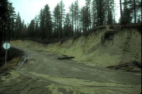 Click on image to enlarge (23K).
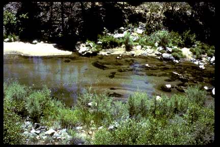 Click on image to enlarge (28K).
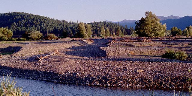 Click on image to enlarge (81K).
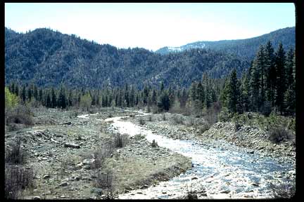 Click on image to enlarge (25K).
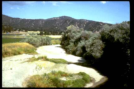 Click on image to enlarge (18K).
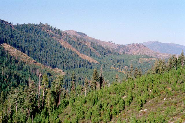 Click on image to enlarge (81K).
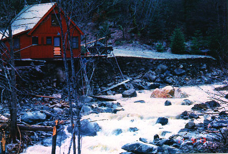 Click on image to enlarge (81K).
To learn more about this topic click Info Links
To view additional information (data source, aquisition date etc.) about this page, click Metadata
| www.krisweb.com |