
| Area | Scott River |
| Topic | Tour: Post 1964 Scott Basin Flood Photos |
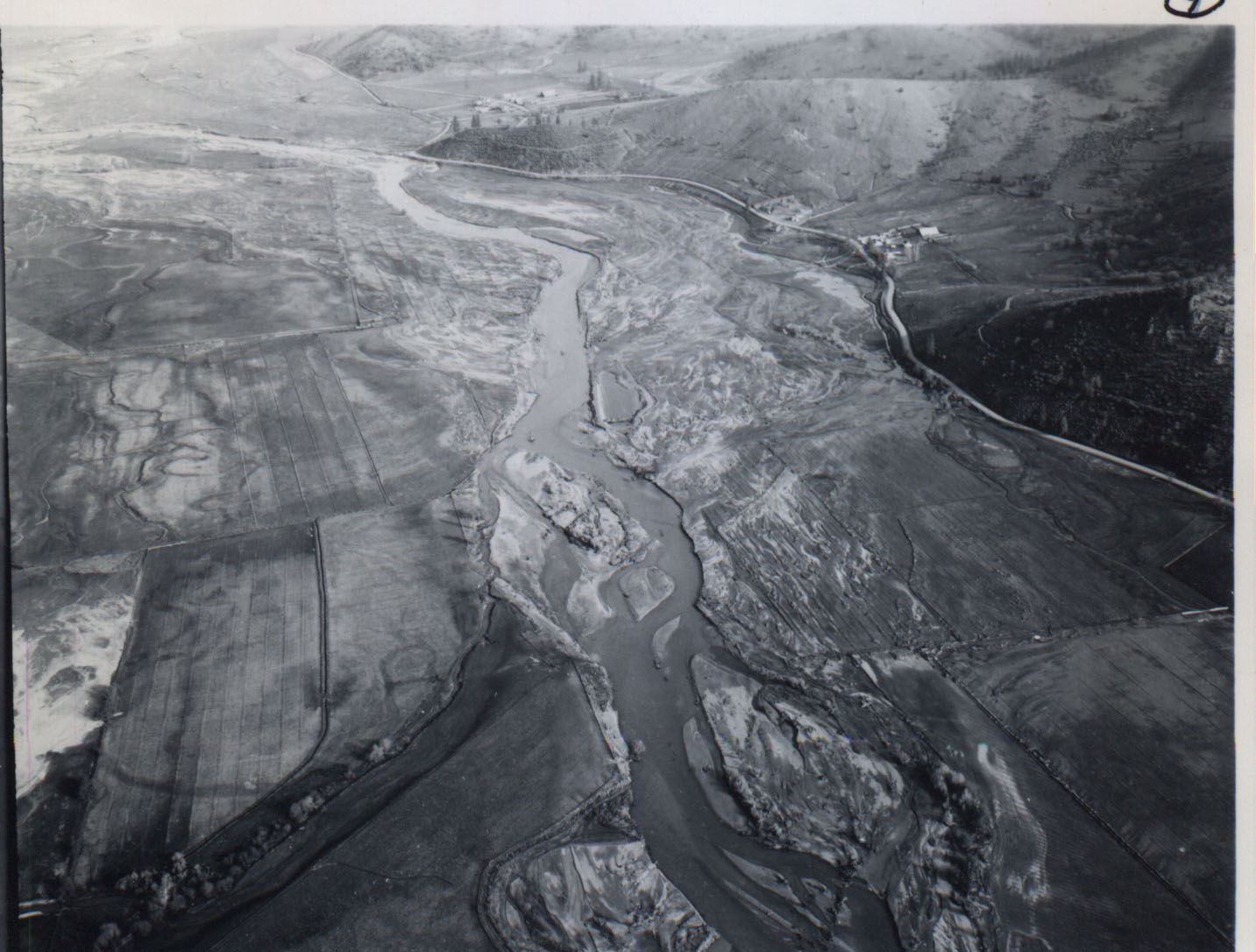
Aerial photo of the Scott River after the 1964 flood showing the Fowle property. The lighter colored soil areas on the flood terrace are decomposed granite sands. Sand deposits in fields may lessen agricultural productivity. Photo courtesy of the Siskiyou RCD.
This aerial photo shows the Faye Lane Bridge after the 1964 flood when the approach to the bridge was washed out. Photo courtesy of the Siskiyou RCD.
Faye Lane Bridge from Faye Lane Road after the 1964 flood had washed out the approach. Photo courtesy of the Siskiyou RCD.
East Side Road where the Scott River eroded away the bank during the 1964 flood. The mine tailings on far side of photo and areas upstream were re-distributed by floodwaters and decreased channel capacity that helped accelerate bank erosion. Photo courtesy of the Siskiyou RCD.
 Click on image to enlarge (216K).
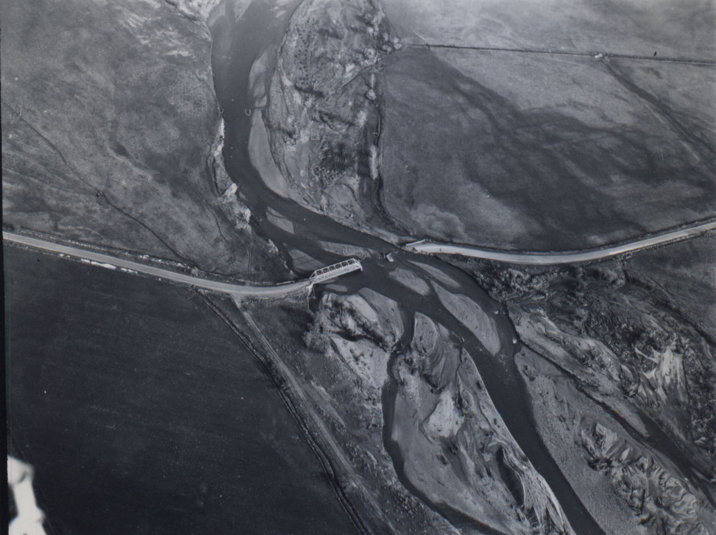 Click on image to enlarge (189K).
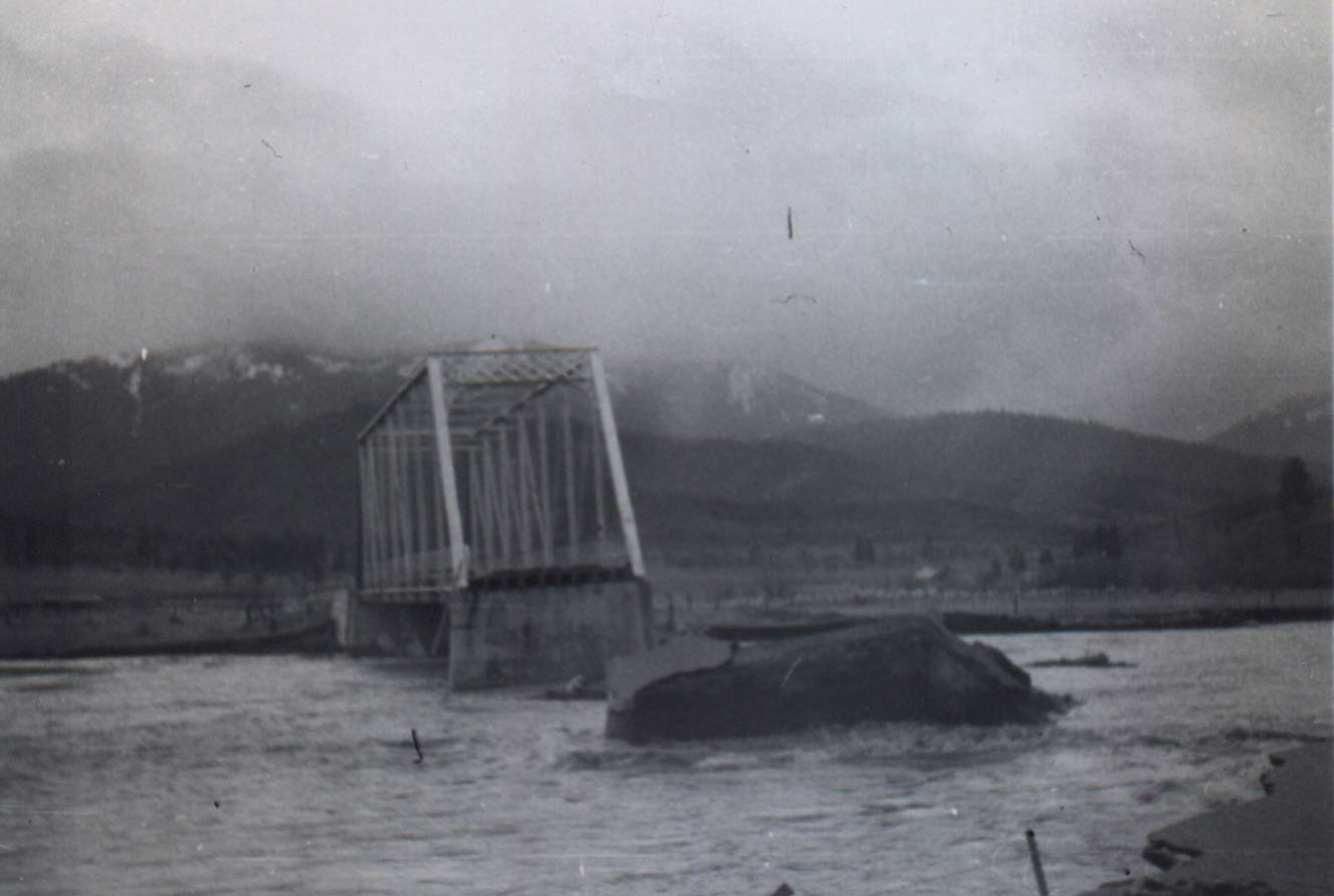 Click on image to enlarge (86K).
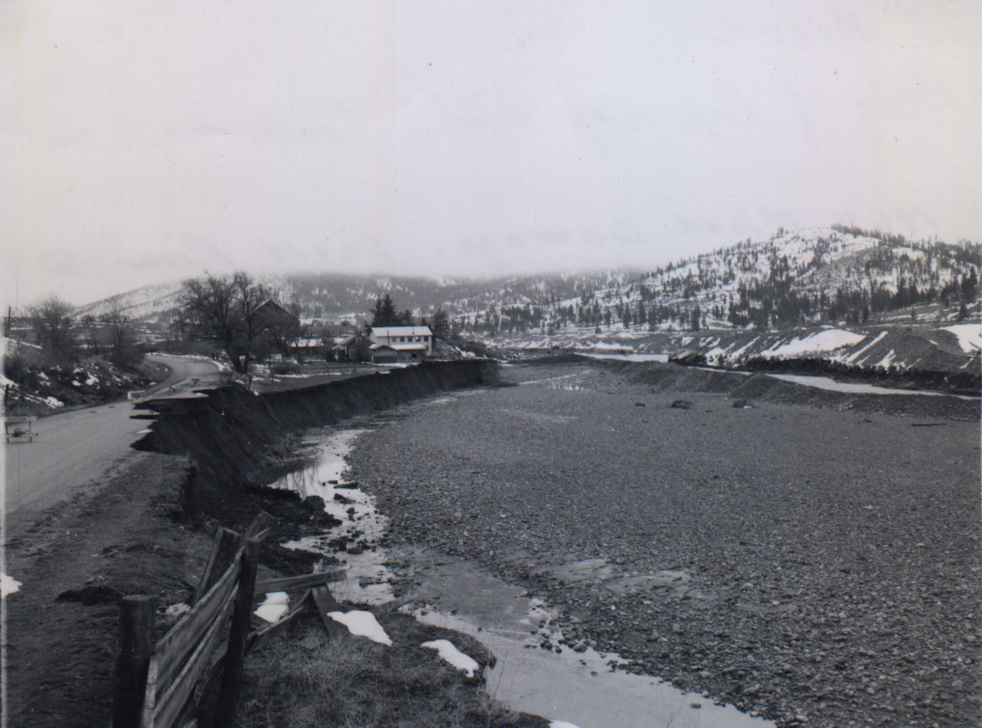 Click on image to enlarge (192K).
To learn more about this topic click Info Links
To view additional information (data source, aquisition date etc.) about this page, click Metadata
| www.krisweb.com |