
| Area | S.F. Trinity |
| Topic | Flow: SF @ Salyer (1951-1952) |
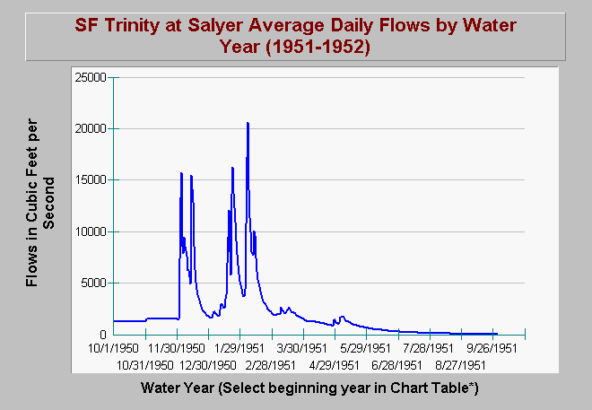
| Caption: The U.S Geological Survey placed a stream gauge at Salyer on the South Fork Trinity River just upstream of its confluence with the main Trinity. The period of record for this gauge is for the water years 1951-1953. The graph above shows average daily flow in cubic feet per second (cfs) for 1951. You may call up any water year by selecting a date (i.e. 10/1/51) in the chart table by selecting the magnifying tool, choosing it as the first record, then returning to the chart and hitting the green recycle button on the right hand menu bar. The X axis of the graph may vary depending on the magnitude of the flows in any given year. Click on Info Links for more information. | |
 |
To learn more about this topic click Info Links .
To view additional information (data source, aquisition date etc.) about this page, click Metadata .
To view the table with the chart's data, click Chart Table web page.
To download the table with the chart's data, click salyercf.dbf (size 17,996 bytes) .
| www.krisweb.com |