
| Area | S.F. Trinity |
| Topic | Sediment: Road Miles by Type - Hayfork Creek, GMA (2003) |
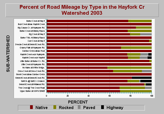
| Caption: The chart above shows percent of road mileage by type broken out by subwatershed within the Hayfork Creek watershed as of 2003. Data compiled by Graham Matthews and Associates for the South Fork Trinity River Water Quality Monitoring Project (2003). Total native road surface (i.e. unpaved) miles compose over 50% of the total roads in all Hayfork Creek sub-basins and are likely related to high fine sediment yields from these watersheds. Click on Info Links for more information. | |
 |
To learn more about this topic click Info Links .
To view additional information (data source, aquisition date etc.) about this page, click Metadata .
To view the table with the chart's data, click Chart Table web page.
To download the table with the chart's data, click road_mi_type_hayfork_cr_wshd_gma.dbf (size 2,342 bytes) .
To view the table with the chart's source data, click Source Table web page.
To download the table with the chart's source data, click sed_roads_densities_sf_trinity_gma_2003.dbf (size 4,930 bytes)
| www.krisweb.com |