| Area |
S.F. Trinity |
| Topic |
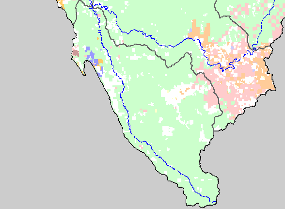
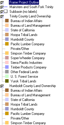
Map: 1F. Land Ownership, SF Trinity Basin |
|
This is a map of the land ownership in the Middle Trinity sub-basin, displayed with KRIS sub-basins and the mainstem and South
Fork Trinity Rivers. The U.S. Forest Service (pale green) is by far the largest landowner in the sub-basin, with the Shasta Trinity
National Forest managing the largest portion. Six Rivers National Forest extends into the northwest corner of the basin as far
upstream as Grouse Creek. The largest tracts of private land are in Hayfork Valley and on South Fork Mountain. Data were
contributed by the Trinity County Resource Conservation District.
|
|
|
 |
 |
To view metadata about a map layer, click on a link in the table below.
