
| Area | S.F. Trinity |
| Topic | Temperature: Min, Max & Avg Hayfork (NRCS Site 02) @ Mercill Br 1995 |
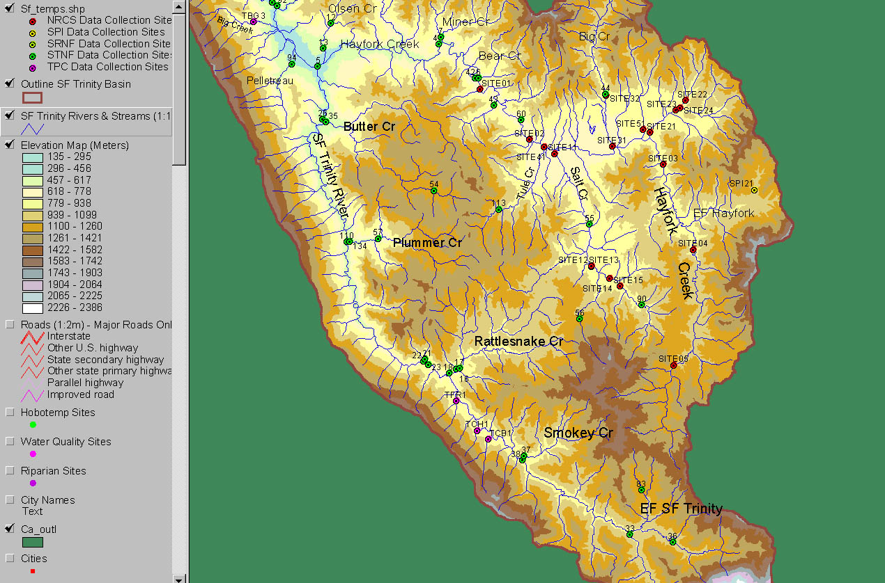
The image above is taken from the KRIS Map SF Trinity ArcView project and shows the location of all temperature stations of the Natural Resources Conservation Service (NRCS), Sierra Pacific Industries (SPI), Six Rivers National Forest (SRNF) and Shasta Trinity National Forest (STNF) and Timber Products Corp (TPC). Site number for the gauge in this Chart is NRCS Site 02.
Mercill Bridge on Hayfork Creek at bottom of Hayfork Valley. Water quality testing and Hobotemp site. Upstream while sampling being done. 6/9/94.
Mercill Bridge on Hayfork Creek at bottom of Hayfork Valley. Water quality testing and Hobotemp NRCS Site 02 looking downstream during low flows. 6/9/94.
 Click on image to enlarge (372K).
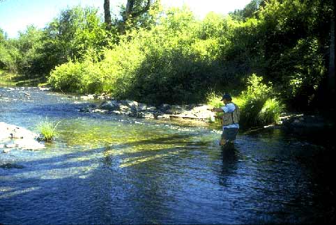 Click on image to enlarge (33K).
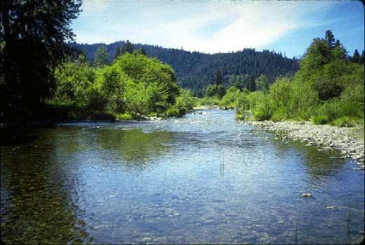 Click on image to enlarge (30K).
To learn more about this topic click Info Links
To view additional information (data source, aquisition date etc.) about this page, click Metadata
| www.krisweb.com |